Robert Heacock
© 2021 by Robert Heacock. Used by permission.
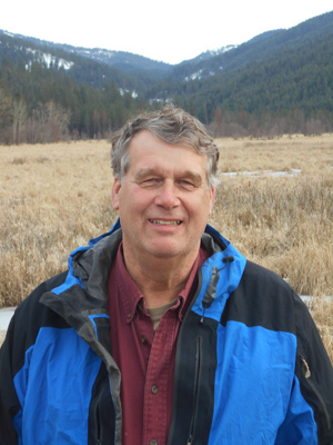
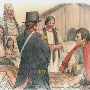
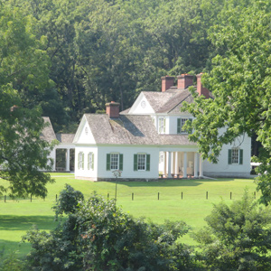
Robert Heacock is an Eastern Washington native, and lives in the Spokane, Washington area. After seeing many Lewis and Clark sites during his years of business travel, he now has a hobby job as Historian on the cruise boats that ply the Columbia and Snake Rivers. This has also provided the opportunity to see and document pertinent sights along the rivers, some not usually accessible. He is the author of ‘Wind hard from the west’: The Lewis and Clark Expedition on the Snake and Columbia Rivers, which has photography by Kris Townsend. The book can be obtained on-line from the Nez Perce County Historical Society and Museum in Lewiston, Idaho at [email protected]
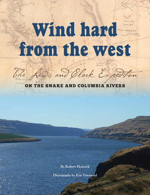
Wind Hard From the West
© 2015 by Robert Heacock. Used by permission.
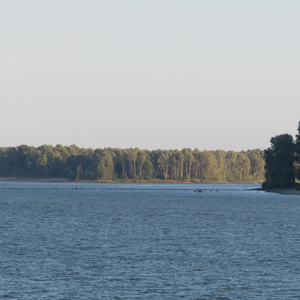
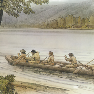
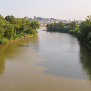
“Wind hard from the west begins and ends where the Lewis and Clark Expedition met what is now known as the Snake River, as it enters the State of Washington. The Snake River then joins the ‘Great River of the West’ or Columbia River and proceeds alongside neighboring present-day Oregon to the Pacific Ocean. In that time, they encountered some of the most spectacular landscapes and endured times as desperate as any on the entire journey.”
Contributions
March 26, 1806
At Fanny's Bottom
After a wet night, they paddle approximately 18 miles up the Columbia River and camp on an island near an area they call “fannys bottom”. Lewis describes eagles and substitutes for tobacco.
November 7, 1805
Ocean in view?
The expedition paddles around Columbia River islands and stops at two Wahkiakum villages. They reach a landmark presently named Pillar Rock where Clark mistakenly exclaims ‘Ocean in view! O! the joy’.
October 29, 1805
Friendly villages
Moving 35 miles down the Columbia, the expedition encounters many Sahaptin and Upper Chinook villages. They pass an island with numerous graves—Memaloose—and camp above the Little White Salmon River.
The Sandy River
The "quicksand river"
by John W. Jengo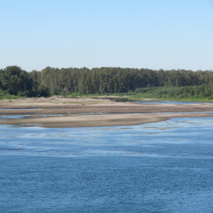
The expedition traveled out from under an ancient river channel frozen in time to a river discharging huge volumes of sediment in real time, the “quicksand river,” now known as the Sandy River.
The Watlalas
by Kristopher K. Townsend
Watlala was the name of a key Upper Chinookan village at the Cascades of the Columbia. The name has been extended by many to mean the tribe more often called the Cascades. The captains called them the Shahala, meaning ‘those upriver.’ The natural constriction of the river provided the people with a fishery and a good measure of control over those who traveled up and down the river. As a result, the Cascade Clahclellah village which the expedition visited on 31 October 1805 and 9 April 1806 was a major trade center before and during white contact.
September 6, 1803
Sailing past Steubenville
Lewis employs horses, sails, and oxen to pass over several gravel bars. He tries sailing, but in the high wind, the sprit sail breaks. They pass Steubenville, Ohio but only make ten miles for the day.
Alcohol Rations
Ardent spirits on the expedition
by Robert R. Hunt
No military commander of the 18th-century would have thought of leading his troops on any mission without planning for liquor. In legislation and military orders of the day, the ration was typically expressed in “gills.”
March 27, 1806
Generous Skilloots
Near present Deer Island, Oregon, some generous Skilloots give away food with hopes that the expedition hunters will hunt with them. Lewis describes the area’s trees and prepares a salmonberry specimen.
November 27, 1805
Sheltering at Tongue Point
Unable to continue due to high winds and waves, they are forced to take shelter on a narrow isthmus—present Tongue Point near Astoria, Oregon. Everyone is wet and disagreeable.
September 18, 1803
Letart Falls
The expedition heads out down the Ohio before sunrise. They safely pass a rapid near the present community of Letart Falls, and Lewis writes his last journal entry until 11 November 1803.
November 23, 1803
Louis Lorimier of Cape Girardeau
After arriving at Cape Girardeau, Lewis takes letters of introduction to Louis Lorimier, whose store was burned to the ground by William Clark’s brother—George Rogers Clark—in 1782.
John Newman
Private
A Pennsylvanian, he had transferred from Fort Massac into the expedition in the fall of 1803, and was a good member of the expedition until October 1804 when he was convicted of “having uttered repeated expressions of a highly criminal and mutinous nature.”
December 7, 1803
Cahokia arrivals
Lewis travels by land and Clark by river to arrive at Cahokia, Illinois. Lewis meets John Hay and Nicholas Jarrot who help him negotiate with the Spanish Lt. governor of Upper Louisiana.
November 3, 1805
The "Quick Sand" River
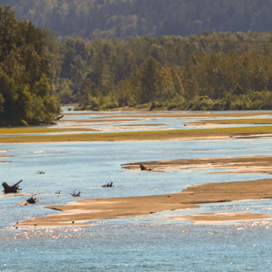
Moving down the Columbia River above present Portland, Oregon, Clark is unable to cross a river full of quicksand—today’s Sandy River. They continue to a large island full of ponds and waterfowl.
September 13, 1803
Marietta, Ohio
At sunrise, the boats move down the Ohio River. They lift the barge over a few riffles and see a flock of passenger pigeons. Anchored opposite Marietta, Ohio, Lewis writes a letter to President Jefferson.
A Solitary Hero
Excerpt from River of Promise
by David L. Nicandri
Lewis had made a habit of abandoning Clark in quests for exploratory triumph. It was no coincidence that Lewis was the first to see the Great Falls or the Continental Divide; he engineered those moments.
February 8, 1806
Bringing in the elk
All three sergeants are dispatched to bring into Fort Clatsop the various elk killed on previous days. By day’s end, they all complete their missions. Lewis describes the salal plant.
January 3, 1806
An agreeable food
Clatsop villagers come to Fort Clatsop to sell whale blubber and dogs. Lewis finds the latter “an agreeable food”. Two men are sent to fetch long-overdue Pvts. Willard and Weiser from the salt works.
April 27, 1806
Yelleppit's village
Moving up the Columbia River, the expedition passes the Umatilla River and then climbs to the high plain above Wallula Gap. Late in the day, they are met by Chief Yelleppit who escorts them to his village opposite the mouth of the Walla Walla. There, the captains learn of a good road to take them back to the Nez Perce.
November 25, 1803
Grand Tower ritual
As the expedition’s flotilla of boats approach the Grand Tower of the Mississippi, Lewis learns of the ritual held the first time a boatman passes it. He also describes coal mines and the Apple River Shawnees living in that area.
In Washington City, the senior Senator from New York state tells his wife about the progress of the Lewis and Clark Expedition.
April 7, 1806
Regulating the firearms
The expedition spends the day hunting and jerking meat at present Shepperds Dell at the lower end of the Columbia River Gorge. The enlisted men are ordered to practice shooting and to adjust their gun sights. Lewis describes the mountain quail, new to science. After the meat was dried and packed, Drouillard returns with some Watlalas in tow.
April 28, 1806
Yelleppit brings a horse
A Shoshone prisoner is found at Yelleppit’s village across from the mouth of the Walla Walla and talks begin with Sacagawea, Charbonneau, and one of the French men acting as interpreters. Yelleppit brings Clark a horse, Clark gives medical aid, and Pvt. Frazer buys ten fat dogs for consumption. The day ends with singing and dancing.
William Clark (1784–1838)
by Joseph A. Mussulman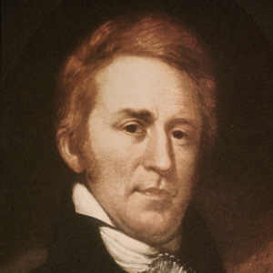
Clark was a highly intelligent man, and in terms of the practical knowledge required to make his way in the wilderness, to lead men, and to succeed in the world of frontier politics, he was highly educated and consummately effective.
April 2, 1806
Exploring the Willamette River
Clackamas visitors tell the captains about the Willamette River, and Clark sets out to find it. At a village at the that rivers’ mouth, Clark resorts to trickery to entice them to trade for food. At Provision Camp at present Washougal, Washington, Lewis says the berries are all gone except for the Oregon grape.
November 25, 1805
Leaving Station Camp
Having decided to winter on the Columbia River’s southern shore, they leave Station Camp. With Mt. St. Helens in view, they paddle upriver and encamp near Pillar Rock where the river narrows.
May 16, 1804
St. Charles arrival
The boats set out early, pass the coal beds of Charbonier Bluff, and reach St. Charles, an early French settlement on the Missouri River. Many citizens come out to see the event and socialization commences.
Still in St. Louis, Lewis authorizes Amos Stoddard, the commandant of Upper Louisiana Territory, to act as his agent concerning any Indian delegations and engagés sent to St. Louis.
From Washington City, the Secretary of War Henry Dearborn asks Capt. Amos Stoddard to continue as Civil Commandant of Upper Louisiana.
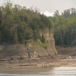
Phoca (Seal) Rock
by John W. Jengo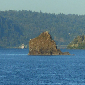
The mid-river island identified as “Phoca” and “Seal rock” on one of William Clark’s route maps is a compact landslide block that detached from the Cape Horn headland.
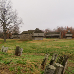
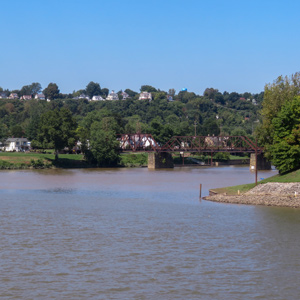
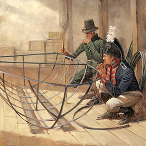
The Falls of the Ohio
The partnership begins
by James J. Holmberg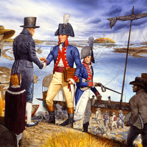
As the days grew shorter and cooler, William Clark must have worn a path to the Louisville landing. The barge (keelboat) could be expected to heave into site at any moment.
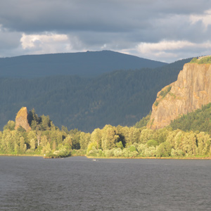
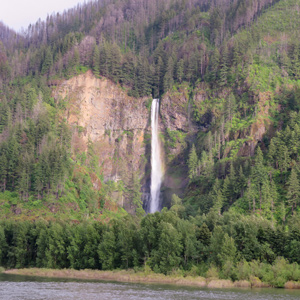
Beacon Rock
A remarkable, high and detached rock
by Joseph A. Mussulman![]()
“a remarkable high detached rock Stands in a bottom on the Stard [starboard, the navigator’s right] Side & about 800 feet high and 400 paces around”
November 13, 1803
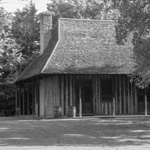
Leaving Fort Massac
The expedition leaves Fort Massac moving about three miles down the Ohio, and Lewis is “siezed with a violent ague”. The Indiana Territorial Governor pens a letter introducing John Hay of Cahokia.
December 30, 1805
Fair morning
At Fort Clatsop, the journalists appear happy to see the sun, and Clark enjoys a sumptuous dinner of fresh elk tongue and marrow bones. With the fort’s pickets and gates completed, overnight guests are banned from the fort. Clark lists the area fauna: slugs, insects, snakes, and waterfowl.
In Washington City, visiting Cherokee and Osage delegates go to the Capitol where Congress is in session.
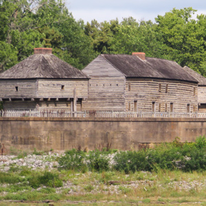
The Salt Works
Making salt from ocean water
by Joseph A. Mussulman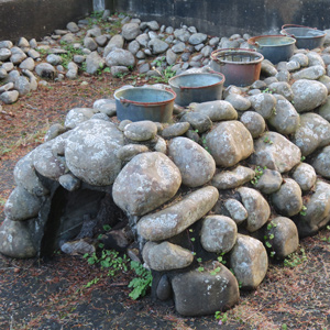
On 28 December 1805, the officers detailed three enlisted men to proceed to the Ocean and “at Some Convenient place form a Camp and Commence makeing Salt with 5 of the largest Kittles . . . .”
September 28, 1803
Cincinnati arrival
Lewis arrives in Cincinnati, Ohio where he rests his crew and writes letters to President Jefferson and William Clark. He tells Jefferson he has come 500 miles and tells Clark that he has two recruits that may be suitable for the expedition.
The Skilloots
by Kristopher K. Townsend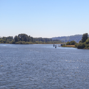
The Skilloot were an Upper Chinookan group that spoke the Clackamas dialect of the Chinookan language. They were located on both sides of the Columbia River above and below the mouth of the Cowlitz. At first, the captains applied the name over a much wider area, perhaps misinterpreting a similar expression meaning ‘look at him!’. Cape Horn, a few miles east of Washougal, was named sqúlips, and could be the origin of the tribe’s name.
Rattlesnakes
Crotalus sp.
by Joseph A. Mussulman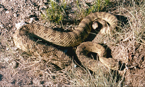
Lewis awoke to find “a large rattlesnake coiled on the leaning trunk of a tree under the shade of which I had been lying.” It certainly wasn’t the first rattlesnake seen on the trip, but he killed this one, and took time to study it.
April 9, 1806
Beautiful waterfalls
The expedition’s flotilla moves sixteen miles up the Columbia River Gorge marveling at its many beautiful waterfalls. In one of the villages, Pvt. Colter confiscates a tomahawk stolen the previous year.
In Washington City, the Secretary of War deals with the death of Arikara Chief Too Né who went there at the request of the captains.
October 21, 1805
Columbia River rapids
Moving down the Columbia above present John Day Dam, the paddlers navigate several rapids while the non-swimmers walk around them. Pvt. Collins shares his camas-brewed beer, and Mt. Hood is in view.
November 19, 1803
Survey and observations
On the expedition’s final day encamped at the mouth of the Ohio, Clark completes his survey of that river’s confluence with the Mississippi, and Lewis makes celestial observations.
September 16, 1803
Very bad riffles
After delaying for fog, Lewis pushes his crew until nearly dark. They pass an area with trees marked by both Indians and settlers. At camp near present Ravenswood, West Virginia, the crew is exhausted.
November 24, 1803
Limestone cliffs
Moving ten miles up the Mississippi, a missing hunter—Sgt. Pryor—is found, and Lewis observes the limestone lining the shores and hills of present Trail of Tears (Missouri) State Park.
September 4, 1803
Leaky boats
As they leave Pennsylvania along the Ohio River, the pirogue springs a serious leak, so they must stop to repair it. Lewis buys a canoe, but it too leaks. Camp is near Newell in present West Virginia.
The Clearwater River
Looking for a canoe camp
by Joseph A. Mussulman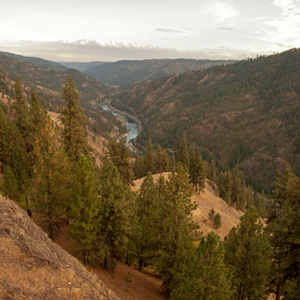
Clark spent the night of 21 September 1805 at Twisted Hair’s camp on an island in the Middle Fork of the Clearwater River. The next morning the chief and his son accompanied him back up to the village on Weippe Prairie where he expected to rendezvous with Lewis.
The Wahkiakums
by Kristopher K. Townsend
The Wahkiakums exemplify the complexities encountered when trying to classify Chinookan peoples. Linguistically, they spoke the Upper Chinookan Clackamas dialect. Culturally, they were related to the Lower Chinookan Clatsops and Chinooks proper. They resided primarily along the north side of the Columbia between Grays Bay and Cathlamet, Washington.
January 8, 1806
A night at Ecola
From Clark’s Point of View above Ecola, Clark’s group enjoys the “grandest and most pleasing prospects”. At Ecola, Tillamook Indians trade a little whale blubber, and Pvt. McNeal’s life is threatened.
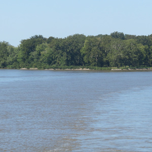
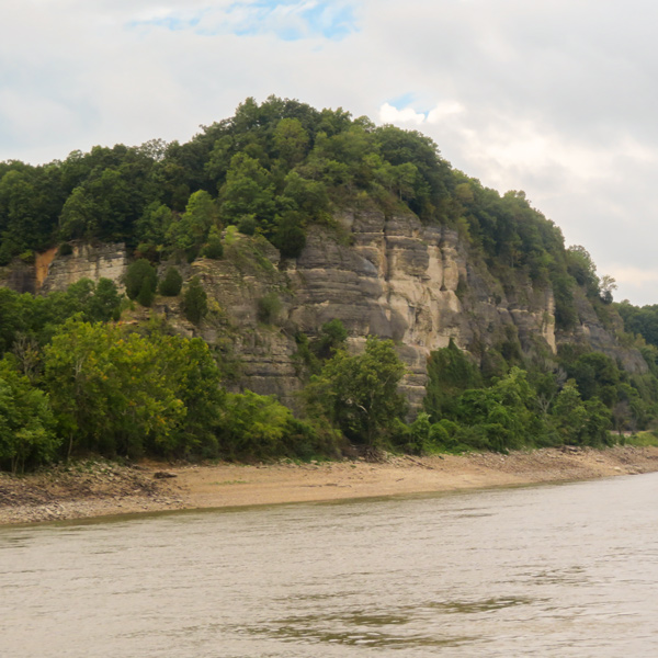
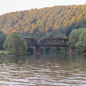
The Columbia River Gorge
Its geologic origin
by John W. Jengo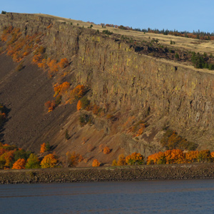
The consolidated rocks that compose the Gorge were formed by a complex interplay of Columbia River Basalt Group flood basalt deposition and basin subsidence, along with contemporaneous folding and faulting—not the Glacial Lake Missoula floods.
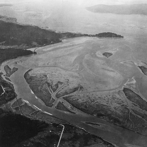
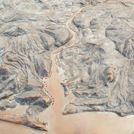
The Deschutes River
by Barbara Fifer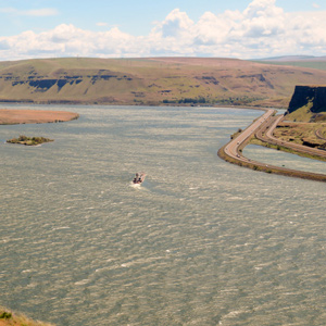
The fall salmon run was ending when the Corps arrived at the Great Falls of the Columbia, several miles below the mouth of Towarnehiooks, with some native people still at the river, fishing with gigs and nets and processing their salmon harvest.
November 17, 1803
Stormy day
The day is stormy at the mouth of the Ohio. Strong winds swamp the smaller boats, which fortunately had been emptied of their cargo. The captains compare the sizes of the Mississippi and Ohio riverbanks.
April 20, 1803
Lewis leaves Harpers Ferry
Meriwether Lewis writes to President Thomas Jefferson explaining a delay at Harpers Ferry Armory due to the design and construction of the iron-framed boat. He also discusses plans to hire interpreter John Conner and a boat builder in Nashville. He leaves for Lancaster, Pennsylvania where Andrew Ellicott will train him in celestial navigation.
September 15, 1803
Passing Belpre
Lewis and his crew head down the Ohio passing present Little Kanawha and Little Hocking rivers. The barge must be lifted over a gravel bar, and they stop for the day near Blennerhassett Island.
April 3, 1806
Mapping the Willamette River
Clark concludes his exploration of the Willamette River. On his way back, he learns that a smallpox epidemic had devastated the local population. The group at Provision Camp at present Washougal, Washington are greatly outnumbered by starving Native People, and Lewis demonstrates the air gun as a defensive measure.
Experience the Lewis and Clark Trail
The Lewis and Clark Trail Experience—our sister site at lewisandclark.travel—connects the world to people and places on the Lewis and Clark Trail.
![]()
Discover More
- The Lewis and Clark Expedition: Day by Day by Gary E. Moulton (University of Nebraska Press, 2018). The story in prose, 14 May 1804–23 September 1806.
- The Lewis and Clark Journals: An American Epic of Discovery (abridged) by Gary E. Moulton (University of Nebraska Press, 2003). Selected journal excerpts, 14 May 1804–23 September 1806.
- The Lewis and Clark Journals. by Gary E. Moulton (University of Nebraska Press, 1983–2001). The complete story in 13 volumes.
This site is provided as a public service by the
![]()
Lewis and Clark Trail Alliance
with additional funding from the following:

