On the Trail
July 31, 1803
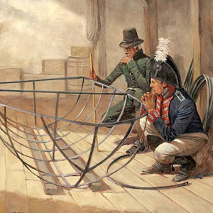
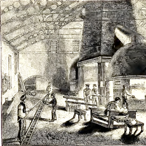
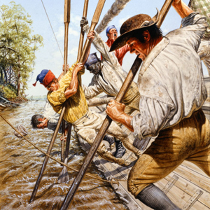
Pittsburgh industry
In Pittsburgh, Lewis oversees construction of the expedition's military-style barge prior to departing down the Ohio River. The area's industry provides many of the items needed to equip this boat, including glass for windows, furniture, tin sheets, and rope.
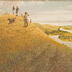
July 31, 1804
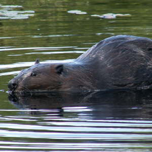
Waiting at Council Bluff
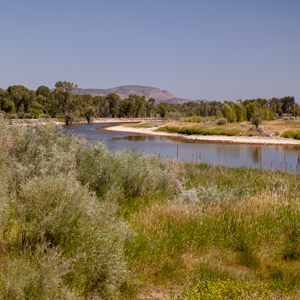
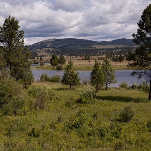
At a camp called Council Bluff—located in present Fort Atkinson, Nebraska—everyone waits for the arrival of the Otoes. Instead of Indians, they are befriended by a young beaver and numerous mosquitoes. Lewis determines latitude and Clark works his courses and distances.
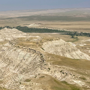
July 31, 1805
A lack of frugality
After spending the night alone, Lewis impatiently waits for Clark and the dugouts. They all breakfast together and then continue up the Jefferson River. Regarding the enlisted men's appetites, Lewis laments their lack of frugality. Evening camp is near present Sappington, Montana.
July 31, 1806
Land of plenty
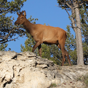
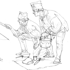
On this cloudy day, the expedition is divided into three groups—one on the Missouri and the other two on the Yellowstone. Lewis and his group paddle down the Missouri River taking fifteen elk and fourteen deer with little effort. Late in the evening, they stay dry by covering some empty lodges with elk hides. Clark and his group paddle through [...]
Eastern Beginnings
10 January–30 August 1803
The Lewis and Clark Expedition ostensibly began in February 1801 when President Thomas Jefferson wrote a letter to Army commander General James Wilkinson requesting that Lieutenant Meriwether Lewis become the President’s personal secretary. Exploration of North America’s western half had long been a goal of the president, and now he had a young protégé who might lead such an expedition.
On 18 January 1803, Lewis hand-delivers to the U.S. Congress the President’s request to fund what would become known as the Lewis and Clark Expedition. The President works in Washington City and Monticello to craft instructions and line up the best talent to assist Lewis. In France, three diplomats negotiate with Napoleon Bonaparte to purchase the Louisiana Territory.
Meriwether receives training, supplies and equipment in Philadelphia and avails himself of armaments and specialized equipment—including a collapsable iron-framed boat—at the Schuylkill and Harpers Ferry arsenals. By July 1803, everything is at Fort Fayette in Pittsburgh. All Lewis needs is a large boat to carry everything down the Ohio. He also needs to know if William Clark will accept his invitation to join him.
Read more ↓
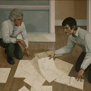
Day-by-Day Pages In-depth Articles
Past the Omahas
21 July–20 August 1804
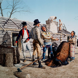
Following the Missouri River north along the present Nebraska-Iowa border, the expedition passes the homelands of the Otoes and Omahas. The captains pay their respects to the late Omaha Chief Blackbird and conduct their first two councils, one with the Otoes and another with the Omaha.
Strong currents, heat, sandbars, sawyers, and masses of driftwood make hard days for the enlisted men and engagés, and Pvt. Moses Reed and an engagé desert.
Shortly after the council with the Omahas, Sgt. Charles Floyd becomes ill, and passes away. He is buried “with all the honors of War” on a bluff overlooking the river in present Sioux City, Iowa.
Read more ↓
Day-by-Day Pages In-depth Articles
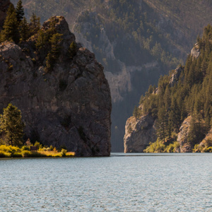
Gates of the Rockies
13 July–17 August 1805
Above the Great Falls of the Missouri, the expedition continues up the Missouri River in eight dugout canoes. There, the river flows along and through the eastern arms of the Rocky Mountains. Clark lists each river constriction as a gate, gap, or narrow.
1 From Clark’s list of “Estimated Distances”.
Below Three Forks, Montana, the Missouri River ends—fed by three forks named by the captains: the Gallatin, Madison, and Jefferson. They continue up the Jefferson until it too forks into three rivers.
The Beaverhead River is only a sixth the size of the Missouri, and the enlisted men must walk the heavy dugouts up the shallow rapids. They are encouraged when Sacagawea sees familiar landmarks such as Beaverhead Rock.
To get to the waters of the Columbia, they would need horses. The captains take turns scouting ahead by land to find the Shoshones who they hope will have horses. While crossing the Continental Divide at Lemhi Pass, Lewis finally meets them.
Clark would continue with most of the party moving the boats up the shallow Beaverhead. By the time they reach the end of the navigable river, Lewis and a group of Shoshones are waiting for them. One journalist would later name the place Fortunate Camp.
Read more ↓
Day-by-Day Pages In-depth Articles
Clark on the Yellowstone
15 July–11 August 1806
Having traveled up the Gallatin River and over Bozeman Pass, Clark, York, the Charbonneau family, and eight enlisted men arrive at the Yellowstone River near present Livingston, Montana.
They travel by horse for several days before finding cottonwood trees large enough to make canoes. By the time they finish two small dugouts, most of their horses are stolen—likely by Crows.
Sgt. Pryor and three privates take the remaining horses across the river and follow an Indian road leading to the Knife River Villages. They would not get far before all their horses are stolen. The small detachment returns to the river where they construct two bull boats from willow and bison hides. Now far behind Clark, they would need to paddle hard if they are to ever rejoin the expedition.
In the two new dugouts, Clark’s party of nine encounter large herds of bison as they paddle down the river. They reach the Missouri River on 3 August with relative safety. Chased by swarms of mosquitoes, they move slowly down the Missouri for several days, but they can find no sign of Lewis and his group.
Read more ↓
Day-by-Day Pages In-depth Articles
Lewis on the Marias
16 July–11 August 1806
Lewis can’t leave finding the source of the Marias River alone. If it comes from the far north, then that region will be considered part of the Louisiana Territory. With only three men, Lewis risks traveling through Blackfeet homelands to find the river’s source.
On 16 July, Lewis directs Sgt. Gass to portage the dugouts around the falls. Those boats are coming down the Missouri—paddled by a detachment lead by Sgt. Ordway. Lewis and his small group then leave the Great Falls of the Missouri bound for the Marias.
On Cutbank Creek, a small tributary, Lewis determines the headwaters will not extend America’s reach into present Canada. Attempts to take celestial observations are obscured by clouds, and the entire junket becomes a big disappointment.
Now in the heart of Blackfeet country, Lewis meets a group of young men, and when the latter attempt to steal rifles, a fatal encounter ensues. Both groups flee.
Riding all day and through the night, Lewis can only hope that he will find the relative safety of Gass and Ordway’s detachments and that together, they can paddle down the Missouri to reunite with William Clark at the mouth of the Yellowstone.
Read more ↓
Day-by-Day Pages In-depth Articles
Featured Members
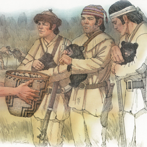
Windsor helped recover three orphaned grizzly bear cubs of a sow they killed on a hunt in early April of 1806. According to Lewis, they traded the cubs to some coastal Indians, who, “fancyed these petts and gave us wappetoe in exchange for them.”
More...
Ordway’s journal is the only one carries an entry for every one of the trek’s 863 days. Just after the expedition ended, Ordway had purchased the land warrants issued to Jean-Baptiste Lepage and William Werner.
More...
He went with Clark to Ecola Creek on the January 1806 blubber-trading expedition, afterwards being dropped off to take a turn at Salt Camp. He returned to his home state to become a well-established Virginian farmer.
More...
Quick Links
Meriwether Lewis
William Clark
Sacagawea
York
Jean Baptiste Charbonneau
Seaman
All Members
Native Nations Encountered
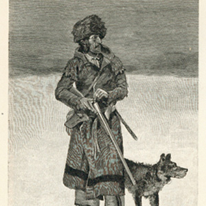
Featured Artist: Alfred Jacob Miller
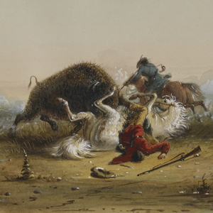
Pierre and the Buffalo in Jean Baptiste, Mountain Man.
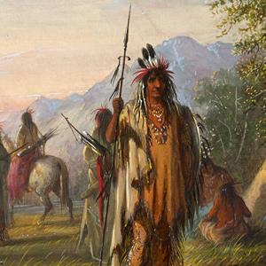
Snake Indian Camp in August 19, 1805.
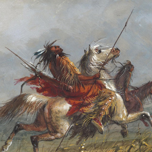
Blackfeet on the Warpath in The Blackfeet Confederacy
Miller’s reputation rests on his single Green River Rendezvous trip from which he transformed his original sketches and notes into a lifetime of images. His work preserves details of clothing, equipment, camps, transport, and performance. At the same time, his images were made for patrons who valued romance and spectacle. For that reason, Miller should be read carefully.
More…
More
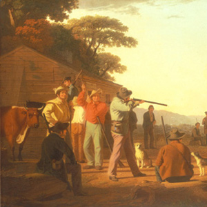
Although hunting and fishing were often considered a ‘gentleman’s sport’ especially in Europe, hunting and fishing for Native Americans and Americans alike were a matter of survival. The success of the Lewis and Clark Expedition depended on the success of its hunters.
OPEN
Given President Jefferson’s directive to establish commerce, the captains worked extensively within a long-established network of North American fur trade. Part of their mission was to help establish the United States of America’s position within that industry.
OPEN
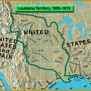
The President’s representatives in Paris had bargained successfully with Napoleon’s bureaucrats not only to buy the port of New Orleans, then the keystone of the continent, but also to acquire, at three cents an acre, an area extending from the Mississippi River to . . . where? No one knew until Meriwether Lewis stood at the crest of the Rocky Mountains at a place known today as Lemhi Pass, on 12 August 1805.
OPEN
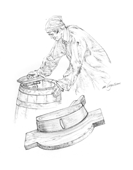
Explore the methods they used to get stuff done—from building canoes to making rope.
OPEN
Learn about the people—and one dog—who were members of the Lewis and Clark Expedition.
OPEN
From major crisis such as the death of Sgt. Floyd, Lewis’s gunshot wound, and the illness of Sacagawea to minor events such as sexually transmitted diseases, mosquito-born illnesses, and deep cuts, the medical aspects of the Lewis and Clark Expedition provide an interesting topic of study.
OPEN
Lewis and Clark were among several significant explorers of North America both before and after the expedition.
OPEN
The success of the Lewis and Clark Expedition was due to its many members and the people they met, including politicians, Eastern gentleman scientists, traders, and the many people already living in the American west.
OPEN
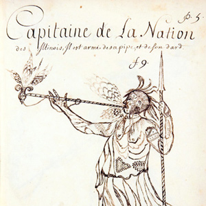
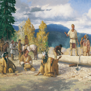
The Lewis and Clark Expedition benefited from the Indians’ knowledge and support. Maps, route information, food, horses, open-handed friendship—all gave the Corps of Discovery the edge that spelled the difference between success and failure.
OPEN
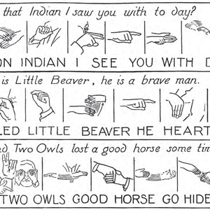
From clichés and colorful sayings of the time to Native American languages, these pages feature the art of language.
OPEN
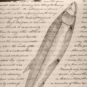
Their work in the emerging fields of botany, ethnography, geography, geology, and zoology are now considered classics of early American scientific literature.
OPEN
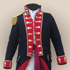
Throughout the expedition the soldiers were expected to conform to the rules and routines of the frontier soldier of 1803.
OPEN
The entire story is told in these five webpages.
OPEN
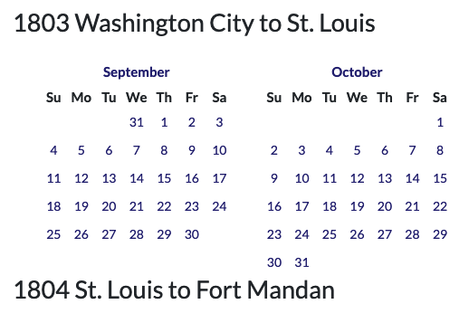
Links to every day-by-day page in a calendar format spanning 31 August 1803 to 26 September 1806. A page every day!
OPEN
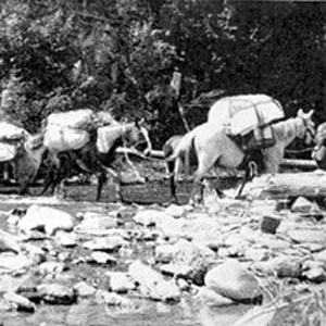
To cross the Rocky Mountains, the Lewis and Clark Expedition needed horses and the skills to manage them. Despite their seemingly constant struggle to find missing and stolen horses, as a kind of calvary unit, they left hoof prints on approximately 1,500 miles of western terrain.
OPEN
Because of the literate journalists, historians and visual artists can tell the Expedition’s story. When they celebrated with song and dance, we too can share in the experience.
OPEN
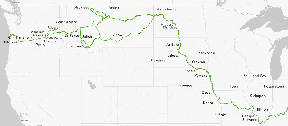
Starting with its genesis in Jefferson’s Monticello, Lewis’s training and preparations in Philadelphia, and the barge’s excursion down the Ohio River, the route they took, often called the Lewis and Clark Trail, crosses the continent weaving an epic tale of western exploration treasured by many today.
OPEN
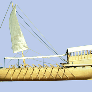
Starting at Pittsburgh, traveling to the Pacific Ocean, and then returning to St. Louis, the Lewis and Clark Expedition traveled approximately 10,600 miles. Of that, 85%—over 9,000 miles—was by boat. To understand travel in the early 1800 American West is to understand the boats and challenges of river navigation.
OPEN
Other topics include music, holidays, High Potential Historic Sites, and an index of articles from We Proceeded On.
OPEN
Lewis and Clark left behind among many Indians a legacy of nonviolent contact. Those who came later enjoyed that legacy and too often betrayed it.
OPEN
Legacy is a very slippery sort of term. If we could erase our myth concepts of Lewis and Clark … it might reawaken something really extraordinary in our national consciousness.
OPEN
Discover More
- The Lewis and Clark Expedition: Day by Day by Gary E. Moulton (University of Nebraska Press, 2018). The story in prose, 14 May 1804–23 September 1806.
- The Lewis and Clark Journals: An American Epic of Discovery (abridged) by Gary E. Moulton (University of Nebraska Press, 2003). Selected journal excerpts, 14 May 1804–23 September 1806.
- The Lewis and Clark Journals. by Gary E. Moulton (University of Nebraska Press, 1983–2001). The complete story in 13 volumes.