Clackamas visitors tell the captains about the Willamette River, and Clark sets out to find it. At a village at the that rivers’ mouth, Clark resorts to trickery to entice them to trade for food. At Provision Camp at present Washougal, Washington, Lewis says the berries are all gone except for the Oregon grape.
Provision Camp
Drying Meat
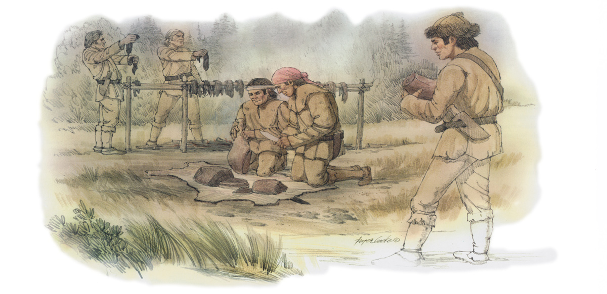
those who remained in camp were employed in collecting wood making a scaffoald and cuting up the meat in order to dry it.
—Meriwether Lewis
Clackamas Visitors
several canoes of the natives arrived at our camp . . . . these men informed us that 2 young men whom they pointed out were Cash-hooks [Clackamases] and resided at the falls of a large river which discharges itself into the Columbia on it’s South side some miles below us. we readily prevailed on them to give us a sketch of this river which they drew on a mat with a coal. it appeared that this river which they called Mult-no-mâh discharged itself behind the Island
—William Clark
Berries Disappear
the huckleburry, shallon, and the several evergreen shrubs of that speceis which bear burries have seased to appear except that speceis which has the leaf with a prickly margin.
—Meriwether Lewis
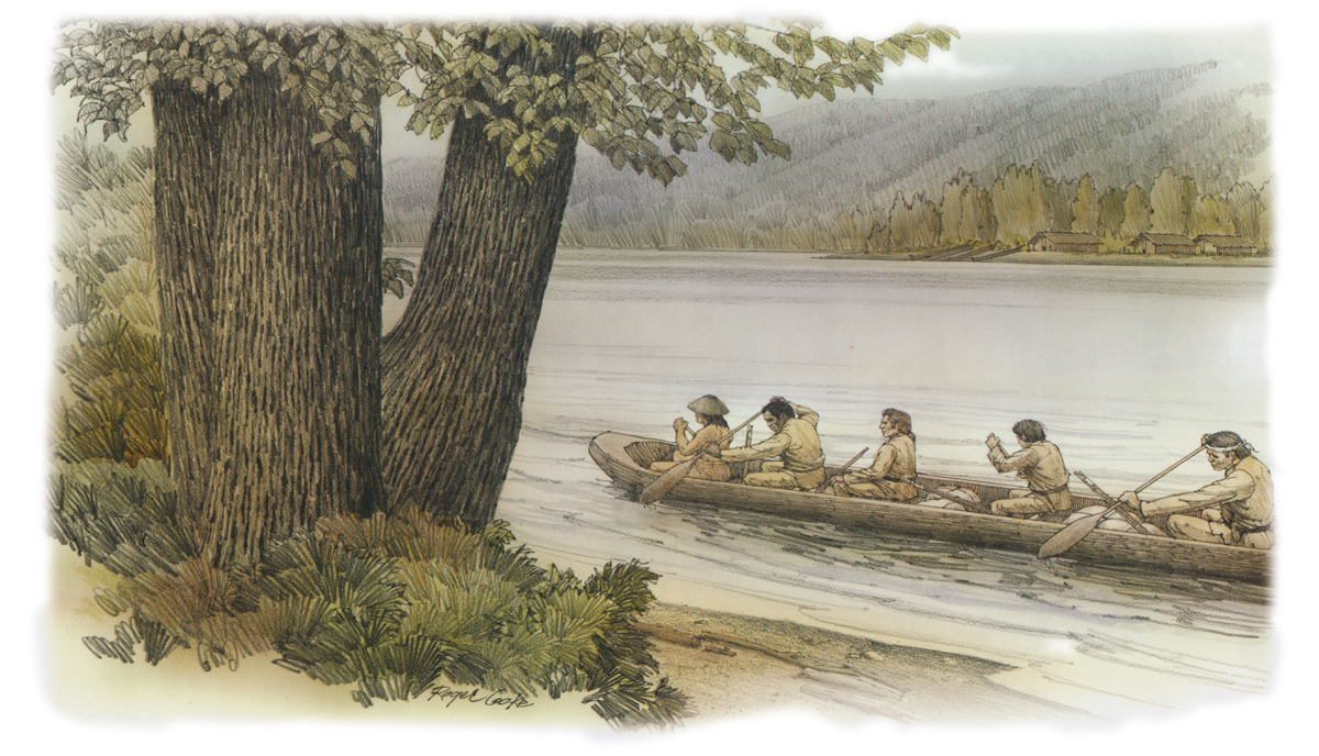
Willamette River
Clark on the Willamette River
© 30 March 2009 by Kristopher K. Townsend. Permission to use granted under the Creative Commons Attribution-Share Alike 4.0 International license.
Most of the Multnomah villages were on Sauvie Island on the right shore of the Willamette River.
Missed Multnomah Village
at 8 miles passed a village on the South side at this place my Pilot informed me he resided and that the name of his tribe is Ne-cha-co-lee, this village is back or to the South of Dimond island, and as we passed on the North Side of the island both decending & assending did not See or know of this Village. I proceeded on without landing at this village.
—William Clark
Clark’s Bad Fire
I entered one of the rooms of this house and offered Several articles to the nativs in exchange for Wappato. they were Sulkey and they positively refused to Sell any. I had a Small pece of port fire match in my pocket, off of which I cut a pece one inch in length & put it into the fire and took out my pocket Compas and Set myself doun on a mat on one Side of the fire, and a magnet which was in the top of my ink Stand the port fire cought and burned vehemently, which changed the Colour of the fire; with the Magnit I turned the Needle of the Compas about very briskly; which astonished and alarmed these nativs and they laid Several parsels of Wappato at my feet, & begged of me to take out the bad fire;
—William Clark
Exploring the Willamette
The Current of the Multnomar is as jentle as that of the Columbia glides Smoothly with an eavin surface, and appears to be Sufficiently deep for the largest Ship. I attempted fathom it with a Cord of 5 fathom which was the only Cord I had, could not find bottom 1/3 of the distance across.
—William Clark
Mt. Hood from the Willamette
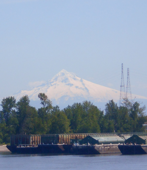
© 3 May 2019 by Robert Heacock. Used by permission.
The four barges above confirm Clark’s opinion of the Willamette River being “Sufficiently deep for the largest Ship.” Mt. Jefferson is to the right of Mt. Hood (south) and out of frame. The other peaks he mentions on this day are all north of Mt. Hood.
Prominent Peaks
from the enterance of this river, I can plainly See Mt. Jefferson which is high and Covered with snow S. E. Mt. Hood East, Mt St. Helians a high humped Mountain to the East of Mt St. Helians. I also Saw the Mt. Raneer Nearly North.
—William Clark
Weather Diary
State of weather at rise
Wind at State of the weather at 4 P.M. Wind at 4 P.M. River cloudy S E cloudy after fair S E fallen 1/8 in. heavy dew last night. cloudy all night.
—Meriwether Lewis[1]To assist the reader of this web page, the date column is omitted, the “State of the Columbia River” columns have been merged, and some abbreviations have been spelled out.
Experience the Lewis and Clark Trail
The Lewis and Clark Trail Experience—our sister site at lewisandclark.travel—connects the world to people and places on the Lewis and Clark Trail.
Plan a trip related to April 2, 1806:


Willamette River Confluence is a High Potential Historic Site along the Lewis and Clark National Historic Trail managed by the U.S. National Park Service. The confluence is best viewed from Kelly Point Park, managed by the City of Portland.
Notes
| ↑1 | To assist the reader of this web page, the date column is omitted, the “State of the Columbia River” columns have been merged, and some abbreviations have been spelled out. |
|---|

