Joseph Mussulman

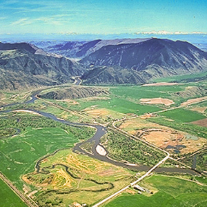
Marc A. Hefty photo.
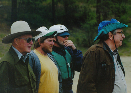
Photo by Bill Bevis.
Left to right: Two concerned dugout canoe owners, one concerned expert paddler, and Joe grinning with delight
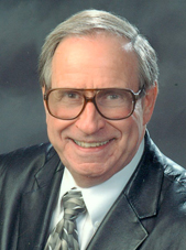
Joseph A. Mussulman (1928–2017) was the founding producer, editor and writer for Discovering Lewis & Clark. After five years of preparation and experimentation the website went online in 1998, under the auspices of a non-profit entity called VIAs Inc., and funded by grants from various sources, especially–throughout the bicentennial observance from 2003 to 2006–the Challenge Cost Share Program of the National Park Service. In 2009 the site was taken over by the Lewis & Clark Fort Mandan Foundation of Washburn, North Dakota.
Dr. Mussulman earned his bachelor’s and master’s degrees in music history and literature at Northwestern University in 1950 and 1951. As a Danforth Scholar he earned a doctorate in humanities from Syracuse University in 1967.
He has written and produced a number of interpretive programs in collaboration with audio specialist Richard H. Kuschel, also of Missoula Montana. In 1986, he wrote, narrated, and co-produced a multimedia presentation for the Blaine County Museum (MT) titled Forty Miles from Freedom, about the Non-Treaty Nez Perce Indians’ final battle with the U.S. Army, at the Bear Paw Mountains in 1877. In 2012-13 Mussulman and Kuschel revised the 20-minute onsite production and updated it in High Definition video. In 1994 their interactive self-guided audio-CD tour of Yellowstone National Park, a five-hour program produced for Tour Technologies, Inc., received first prize in the category of media productions from the National Association for Interpretation. Their Two Days to Destiny, an audio interpretive tour of the Little Bighorn Battlefield, won first place from the NAI in 1995.
Mussulman is the author of five articles on Lewis and Clark that appeared in We Proceeded On, the official journal of the Lewis and Clark Trail Heritage Foundation, Inc.: “My Boy Pomp’: About That Name,” Vol. 21, No. 2 (May 1995); “Soundscapes: The Sonic Dimensions of the Lewis and Clark Expedition,” Vol. 21, No. 4 (November 1995); “Men in High Spirits: Humor on the Lewis and Clark Trail,” Vol.22, No. 2 (May 1996); “‘In Greatest Harmoney’: ‘Meddicine Songs’ on the Lewis and Clark Trail,” Vol. 23, No. 4 (November 1997); and “Pomp’s bier was a bar,” Vol. 27, No. 1 (February 2001).
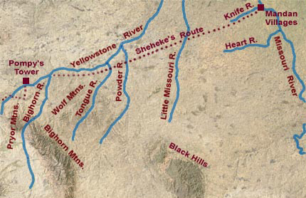
Dr. Mussulman has designed and produced maps for various books, brochures and study guides about Lewis and Clark, including 58 full-color maps illustrating the expedition’s entire route from coast to coast for the travelers’ guide, Along the Trail with Lewis and Clark, by Barbara Fifer and Vicky Soderberg (2nd ed., Helena: Montana Magazine, 2001). Those maps also appeared in the same publisher’s annual Lewis and Clark Travel Planner and Guide. They may be seen in Discovering Lewis & Clark at Discovering Lewis & Clark from the Air. In 1998, he created a poster illustrating the trail from Washington, D.C. to the Pacific, for Farcountry Press.
His other publications include a biography, Dear People . . . Robert Shaw (Indiana University Press,1979; reprint, Chapel Hill, NC: Hinshaw Music, 1996), and Music in the Cultured Generation (Evanston: Northwestern University Press, 1974). From 1987 through 1998 he was the interpretive writer and designer of Montana Afloat, a series of sixteen maps of Montana’s major floatable rivers.
Dr. Mussulman was a 1999 recipient of a Montana Governor’s Arts Award. Several years later he received an award of meritorious achievement from the Lewis and Clark Trail Heritage Foundation “for outstanding contributions in bring to this nation a greater awareness and appreciation of the Lewis and Clark expedition.” In 2005, he received the Montana Governor’s Humanities Award.
Contributions to this Site
The Dearborn River Crossing
Along the Old North Trail
by Joseph A. Mussulman
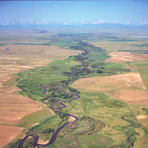
Shortly after crossing the Dearborn River, Lewis saw that the Indian road “continued along the foot of the mountain to the West of north” so he and his men cut northeast across the “tolerably level” plain toward the Sun River.
Clark’s Nutcracker
Nucifraga columbiana
by Joseph A. Mussulman
On the Salmon River, Clark “saw to day [a] Bird of the woodpecker kind which fed on Pine burs it’s Bill and tale white the wings black every other part.” Later, Meriwether Lewis had time to study and describe it with his usual thoroughness.
Camp Disappointment by Air
by Joseph A. Mussulman
On 19 July 1806 Lewis intersected the Marias River six miles above the point where he had ended his exploration of its lower reaches the previous spring. He and his party now continued northwest along the Marias reaching its most northern point.
The Osage Delegations
by Joseph A. Mussulman
They were “certainly the most gigantic men we have ever seen,” Jefferson wrote on 12 July 1804. A dozen Osage men and two boys had arrived in Washington City the previous day, escorted by Pierre Chouteau.
Edible Valerian
Valeriana edulis
by Joseph A. Mussulman
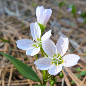
One of the roots obtained by George Drouillard on 21 August 1805 may have been a species of valerian (vuh-LEHR-ee-an), such as Valeriana edulis (vuh-leh-ree-AYE-nuh ed-YOU-lis), or edible valerian.
Crane Fly
Tipula abdominalis
by Joseph A. Mussulman
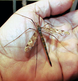
On 27 December 1805, Clark wrote: “Musquetors to day, or an insect So much the Size Shape and appearance of a Musquetor that we Could observe no kind of difference.”
Smoking
Smoking on the expedition
by Joseph A. Mussulman, Kristopher K. Townsend
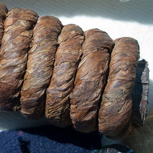
The captains would have to ration their dwindling supplies, and the smokers would have to extend their tobacco with leaves and inner bark from local plants and trees. The captains would also learn the endless variety of ceremonies practiced when sharing a pipe the People they met.
The Marias River by Air
Narrow escape
by Joseph A. Mussulman
“I sliped at a narrow pass of about 30 yards in length and but for a quick and fortunate recovery by means of my espontoon I should have been precipitated into the river down a craggy pricipice of about ninety feet.”
Fort Clatsop Elk
Cervus canadensis roosevelti
by Greg Tollefson, Joseph A. Mussulman
Fort Clatsop’s location was chosen in part because, as some Clatsop Indians had advised the captains, there were more elk on the south side of the river than on the north. The subspecies found there was named in 1898 to honor Theodore Roosevelt.
Yellowstone Canoe Camp by Air
Horse thieves
by Joseph A. Mussulman
Clark’s party made camp at today’s Park City, Montana, and settled in to build the new canoes and attend to other business. While a few of the men took turns with the three axes they had along, some of the rest, being nearly naked, made elk- and deer-skin clothing.
Mountain Beavers
Aplodontia rufa (Sewelel)
by Joseph A. Mussulman
This secretive, primitive little rodent, which somewhat resembles the woodchuck and the muskrat, belongs to the same mammalian order, Rodentia, as the beaver, Castor canadensis, but otherwise they have nothing in common.
The Pirogues
by Joseph A. Mussulman
The two pirogues served as supplementary cargo carriers accompanying the barge from the mouth of the Missouri to the Mandan villages, one of which became the command boat on the return trip from the Marias River to St. Louis.
Pittsburgh by Air
Golden triangle
by Joseph A. Mussulman
The Monongahela River joins the Allegheny River at the apex of Pittsburgh’s “golden triangle” to form the river called Ohio—an Iroquois word meaning “big and beautiful.” After the Revolutionary War, Pittsburgh quickly grew into a gathering-place and jumping-off point.
The Columbia River Estuary
"Great joy"
by Joseph A. Mussulman
When the sky cleared briefly at about noon on 7 November 1805, a rising cheer may have startled the myriad waterfowl in the area, for Clark wrote, “we are in view of the opening of the Ocian, which Creates great joy.”
A Flash Flood
A narrow escape
by Joseph A. Mussulman
Of all the near-calamities the Corps of Discovery experienced, none was more dire than the one that occurred on 29 June 1805 in a normally dry ravine a short distance above the Great Fall. The principals were Charbonneau, Sacagawea, Jean Baptiste, York, and William Clark.
Apsáalooke (Crow) Signs
Smoke signals a discovery
by Joseph A. Mussulman
“This smoke must be raisd. by the Crow Indians in that direction as a Signal for us, or other bands. I think it most probable that they have discovered our trail.”
Jerking Meat
Preserving meat without refrigeration
by Joseph A. Mussulman, Kristopher K. Townsend
What did the captains mean when they say they stopped to jerk their meat? At the time of the expedition “jerk” simply stood for “dried meat.” This article includes a recipe.
The Lewis and Clark River
Coast Range winter
by Joseph A. Mussulman
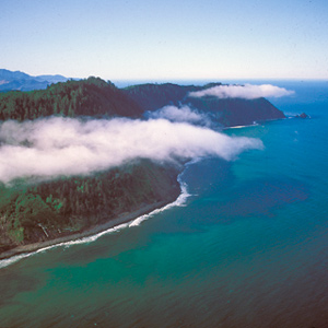
During their time at the coast, the Corps saw only six sunny days; the rest brought clouds, fog, rain, and a little snow. Fifty-three were partly clear. That’s a normal winter on the west slopes of the Coast Range.
Mapping the Rockies
Expectation v. reality
by Joseph A. Mussulman, Robert N. Bergantino
Clark evidently began compiling a map of the Northern Rockies after meeting with Hugh Heney at Fort Mandan on 18 December 1804, and continued adding information acquired from other traders, as well as from Indians. The reality, he would find, was much different.
The Lochsa River
Packer Meadows to Colt Killed Creek
by Joseph A. Mussulman
Snow was falling in the high country above them on the morning of 14 September 1805 when, after striking camp two miles downstream from Packer Meadows, the Corps slogged down the Glade Creek canyon through rain and sleet.
The Sun River by Air
"Curious adventures"
by Joseph A. Mussulman
The day’s “succession of curious adventures wore the impression on my mind of inchantment,” he mused. “It now seemed to me that all the beasts of the neighbourhood had made a league to distroy me.”
Lady’s Slipper
Cypripedium montanum
by Joseph A. Mussulman
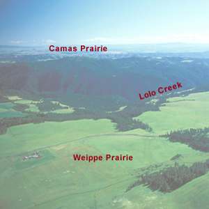
Above Montana’s Lolo Creek, Lewis noticed a flower: “in shape and appearance like ours”—in Virginia, of course—”only that the corolla is white, marked with small veigns of pale red longitudinally on the inner side.”
Mapping the Yellowstone
by Joseph A. Mussulman
Clark’s map of 1814 shows his post-expeditionary conclusions regarding the lay of the land from just west of the Three Forks of the Missouri River, roughly 230 air miles eastward along the Yellowstone to the Tongue River.
Dugout Canoes
by Joseph A. Mussulman
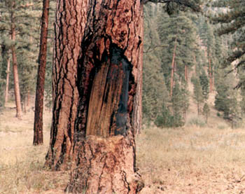
Altogether, the men carved 15 dugout canoes. At Fort Mandan they hewed 6 from cottonwood logs. West of the Rockies they used ponderosa pine logs to craft five new canoes. On the Yellowstone, Clark made two small dugouts a few miles above today’s Billings.
Guard Duty
by Joseph A. Mussulman
During their journey up the Missouri to the Mandan villages, security procedures were outlined in the detachment orders of 26 May 1804. The detachment orders setting forth procedures for the security of Fort Clatsop, were issued on 1 January 1806.
The Shoshone Fish Weirs
by Joseph A. Mussulman, Steve F. Russell
Clark visits a Shoshone camp on the west bank of the Lemhi River near today’s Salmon City, where he and his men are fed on “Sammon boiled, and dried Choke Cher[rie]s,” and taken on a sight-seeing trip to the nearby permanent fishing weirs.
Sharp-tailed Grouse
Tympanuchus phasianellus
by Joseph A. Mussulman
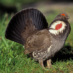
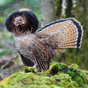
Elliott Coues, whose scientific interest centered on ornithology, in 1893 declared Lewis’s “Grouse or Prarie hen” to be the Oregon ruffed grouse, at that time classified as Bonasa umbellus sabinei (Ord) Coues.
The Articles of War
Rules for soldiers
by Joseph A. MussulmanThe expedition’s enlisted men were obliged to comply with the basic military rules and regulations contained in two distinct official documents that had been written in the initial heat of the Revolutionary War.
Sulphur Springs
A cure for Sacagawea?
by David J. Peck, Joseph A. Mussulman
On his return to the mouth of the Marias, Lewis found Sacagawea gravely ill. He had his men cross the river “to procure the water of the Sulpher spring,” “the virtues of which,” Lewis asserted, “I now resolved to try on the Indian woman.”
Clark’s Umbrella
A matter of melanins?
by David J. Peck, Joseph A. Mussulman
There may have been one good personal reason why Clark carried an umbrella. Beneath our skins we’re all supposed to be pretty much alike, but at the epidermal level there are some conspicuous differences that we owe to melanin.
Columbia River near Blalock
Greatest chief
by Joseph A. Mussulman
This scene’s most arresting feature is still the “high mountain of emence hight covered with Snow” on the photo’s horizon. Clark mistook it for Mount St. Helens. The Indians called the mountain Pahtoe. Since 1838 it has been known as Mount Adams.
Wheeler’s Lolo Crossing
On the Northern Nez Perce Trail
by Barbara Fifer, Joseph A. Mussulman
One of Wheeler’s most successful efforts to amplify any part of Lewis and Clark’s route was his exploration of the Lolo Trail. For that he relied heavily on Elliott Coues’ 1893 annotations to the expedition’s narrative.
The Bitterroot Plant
Lewisia rediviva
by Joseph A. Mussulman
Flathead Salish, Kutenai, Shoshoni, and Nez Perce people all regard the bitterroot with solemn reverence. No other root may be harvested until the elder women of the tribe have conducted the annual First Roots ceremony.
Yokes
Instruments and metaphors
by Joseph A. Mussulman
In 1806, Noah Webster defined the noun yoke as “a bandage on the neck, chain, bond, bondage, mark of servitude, couple, pair.” The word yoke can also denote a type of wooden device to harness animals that have been bred and trained to pull heavy loads.
Lewis’s Birthday Meditation
A "sadly interesting passage"
by Joseph A. Mussulman
It has been remembered as “the most gloomy self-examination of the entire journal,” and “a passage of unreasonable melancholy,” of poignant sadness and self-doubt.
York in the Journals
A comprehensive listing
by Joseph A. MussulmanThe Osages
by Joseph A. Mussulman, Kristopher K. Townsend
The Osage were experienced traders, exchanging horses and Indian slaves for French guns, knives, axes, kettles, and other metal objects. After the 1760s, the Osage adopted a new economic system of planting gardens in permanent villages, summer hunts in the plains, and fur-trapping in the winter.
Long-tailed Weasels
Mustela frenata
by Joseph A. Mussulman
The captains saw their first white weasel at Fort Mandan on 9 November 1804. At Fort Clatsop on Christmas Day, 1805, Sacagawea gave Clark “2 Doz wesels tales.”
Fort Clatsop
Looking for a winter camp
by Joseph A. Mussulman
They had sketched out a plan for their fort, but it seemed that finding a level spot at least fifty feet square would be next to impossible.
John Evans
Mapping the way
by Joseph A. Mussulman, Kristopher K. Townsend
John Evans provided maps of the Missouri River and Rocky Mountains, the most significant outcome of the Mackay-Evans Expedition.
Ebenezer Tuttle
Private
by Barbara Fifer, Joseph A. Mussulman
His name appears only one time, when he is listed as a member of Corporal Warfington’s detachment bringing the keelboat back from Fort Mandan. He may not have even made it that far.
Pierre by Air
Standoff
by Joseph A. Mussulman
Lewis and Clark first met the Teton Sioux on 25 September 1804. One of Jefferson’s primary political objectives for the expedition was to create a peace treaty and trade agreement them, the most potent military and economic force on the lower Missouri.
Sweet Grass
Hierochloe odorata
by Joseph A. Mussulman
For thousands of years sweet grass has been used as incense in spiritual and religious ceremonies, as a personal perfume, and braided into necklaces and bracelets for wearing as amulets to ward off illness and injury.
Gates of the Mountains by Air
"Gloomy aspect"
by Joseph A. Mussulman
“The river appears to have forced it’s way through this immence body of solid rock for the distance of 5-3/4 miles,” Lewis observed.
Grizzly Bear Encounters
Thirteen significant encounters
by Joseph A. Mussulman
“the Indians give a very formidable account of the strength and ferocity of this anamal, which they never dare to attack but in parties of six, eight or ten persons; and are even then frequently defeated with the loss of one or more of their party.”
Portable Inkwell
Their most important tool
by Joseph A. Mussulman
None of their tons of supplies, not even the guns, powder, and bullets with which they fed themselves, were ultimately as important as the pens, ink, and paper they carried, and protected from the elements.
Deists in the ‘Wilderness’
by Joseph A. Mussulman
As deists in the ‘wilderness,’ Lewis and Clark simply wanted to observe and admire the surrounding world and learn to understand the relationships that held it together.
Caching Supplies
by Joseph A. Mussulman
Lewis records the method for hiding and storing goods, which he learned from the French members of the Corps.
Shoshone Travel Advice
Leaving Withington Creek Village
by Joseph A. Mussulman
Lewis was still at Camp Fortunate directing the digging of a cache and the making of packs and pack-saddles for the portage across the divide. Meanwhile, Clark and his contingent left to see whether the Salmon River was as bad as Cameahwait had said.
Coal Mines
Brilliant blaze
by Joseph A. Mussulman
Lewis and Clark could never have imagined a pit like the one in this photograph. Opened in 1997, it is about twelve miles east of the Missouri River and sixty miles north of Bismarck, North Dakota. In the background is a postglacial tarn called Coal Lake.
Blowflies
Calliphora sp.
by Joseph A. Mussulman
On 20 May 1805, the captains named a certain watercourse Blowing Fly Creek, “from the immence quantities of those insects found in this neighbourhood.” As Lewis explained, “they infest our meat while roasting or boiling, and we are obliged to brush them off our provision as we eat.”
John Colter
Private
by Barbara Fifer, Joseph A. Mussulman
Colter left a legacy of western lore, not the least of which was his famous run from the Blackfeet Indians and his exploration of “Colter’s Hell.” Yet his contributions to the expedition were also many.
Floyd’s Monument by Air
"Much Lamented"
by Joseph A. Mussulman
On 20 August 1804, the Corps proceeded thirteen miles, while young Floyd quickly grew worse. A little past noon they landed, and presently Floyd said, “I am going away.”
The Great Fall by Air
"Sublimely Grand"
by Joseph A. Mussulman
Shortly before noon on the 13 June 1805, Lewis’s ears “were saluted with the agreeable sound of a fall of water,” which “soon began to make a roaring too tremendious to be mistaken for any cause short of the great falls of the Missouri.”
Buffalo: Native Uses
An Indian commisary
by Joseph A. MussulmanSpirit Mound
An elevation of devilish spirits
by Joseph A. Mussulman
The visit to this prairie hill was among the more bizarre sidelights of the whole expedition, but evidently it was not entirely unexpected. Seventy-six years earlier, explorer Pierre La Véndrye called the place the “Dwelling of the Spirits.”
Bearberry
Kinnikinnick, Arctostaphylos uva-ursi
by James L. Reveal, Joseph A. Mussulman
Lewis and Clark sometimes called it kinnikinnick, sometimes sacacommis. At Fort Clatsop on 29 January 1806, he described this useful plant.
Wild Roses
Rosa woodsii
by Joseph A. Mussulman
Meriwether Lewis was sufficiently familiar with the genus back home to recognize the new species he termed the “small rose of the prairies,” which he found on 5 September 1804, in present-day Nebraska near the mouth of the Niobrara River.
Big Bend of the Missouri by Air
Around the bend
by Joseph A. Mussulman
They paced off the distance across “the gouge,” wrote Clark, and found it to be about a mile and a quarter; he estimated the distance around the oxbow to be thirty miles.
Naming the Marias
"in honour of Miss Maria"
by Joseph A. Mussulman
“The whole of my party to a man except myself were fully perswaided that this river was the Missouri, but being fully of opinion that it was neither . . . I determined to give it a name and in honour of Miss Maria W____d.”
An Offer to Raise Jean Baptiste
Clark's promises
by Joseph A. Mussulman
Clark’s affection for Sacagawea’s little boy, Jean Baptiste, becomes evident while canoeing down the Yellowstone River. This article analyzes Clark’s offer to his father, Toussaint Charbonneau, to raise the child.
Jefferson the Violinist
by Joseph A. Mussulman
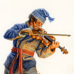
One of Thomas Jefferson’s favorite compositions was the Sonata for Violin and Continuo, Opus 5, written by Corelli. Using a violin such as Jefferson owned, violinist Samuel Taylor plays the theme and two of the variations.
Louisiana’s Political Geography
by Joseph A. Mussulman, Pierce Mullen
On 9 April 1682, René La Salle, claimed “possession of this country of Louisiana.” Thus, without any belligerent confrontations began the decline of one already ancient meta-culture, and the rise of a succession of new empires.
Clark’s Columbia River Maps
by Joseph A. MussulmanThe Freeman-Custis Expedition
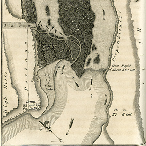
The "Grand Excursion"
by Dan Flores, Joseph A. Mussulman
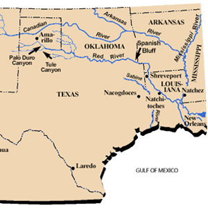
Narrated in both English and Spanish, Daniel Flores tells the story of a parallel, southern exploration now nearly forgotten.
F. Jay Haynes
by Joseph A. Mussulman
Many of the first photos in present Montana were by F. Jay Haynes. His story reflects the emergence of photography itself.
Long Camp
Five weeks with the "Chopunnish"
by Joseph A. Mussulman
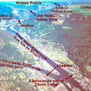
Upon its return from the Pacific coast in the spring of 1806, the expedition camped on the Clearwater River near present-day Kamiah from 14 May 1806 until 10 June 1806, waiting for the snow to melt on the crest of the Bitterroot Mountains.
Lewis & Clark by Air
by Jim Wark, Joseph A. Mussulman
Aerial photographer Jim Wark and scholar Joseph A. Mussulman offer a fascinating new perspective on the Corps of Discovery’s historic journey. From Monticello in the east to Fort Clatsop on the Pacific Ocean, the entire 2004 book is provided online with updates by Mussulman.
Bugs
Worthy of notice
by Joseph A. Mussulman
President Jefferson directed Lewis to observe seasonal transitions as they are marked by the “times of appearance of particular birds, reptiles or insects.”
Fort Clatsop Today
Reconstructing the fort
by Joseph A. Mussulman
Today’s Fort Clatsop stands at or near the site of the Corps’ winter encampment of 1805-06 was built on the same floor plan that Clark drew on the cover of the Elkskin-covered Journal. The rest of the present structure resembles the original only in a remote sense.
Chief Blackbird
Late Omaha chief
by Joseph A. Mussulman
The two captains and ten of the enlisted men climbed the hill to visit the grave of one of the most notorious and controversial leaders of the Omaha Nation, whose name was Washinga Sahba—Blackbird.
Lewis’s Shoshone Tippet
Cameahwait's gift
by Joseph A. Mussulman
Cameahwait and some of his people agreed to help the Corps of Discovery carry its baggage over the divide. In the early afternoon. “We now dismounted,” wrote Lewis, “and the Chief with much cerimony put tippets about our necks such as they temselves woar.”
Square Butte
Lewis's Fort Mountain
by Joseph A. Mussulman
“This mountain has a singular appearance. it is situated in a level plain, it’s sides stand nearly at right angles with each other and are each about a mile in extent … from it’s figure we gave it the name of fort mountain.”
Flag Presentations
by Joseph A. Mussulman
Lewis and Clark usually distributed flags at councils with the chiefs and headmen of the tribes they encountered—one flag for each tribe or independent band.
Local Recollections
Wheeler's inquiries
by Joseph A. Mussulman
Around 1900, Olin D. Wheeler, initiated an inquiry into the source and meaning of the name Lolo. He secured the aid of Judge Frank Woody of Missoula, who in turn discussed the matter with some other “old-timers.”
Order of Encampment
Lay out of the nightly camps
by Joseph A. Mussulman
Spacing between tents, as well as lines of tents, was strictly measured. Privates’ tents, accommodating 6 men each, were between the sergeants’ tents; all were two feet apart. The “sink,” or latrine, was to be 60 paces (300 feet) in front of the first line of tents.
George Drouillard
Hunter and interpreter
by Barbara Fifer, Joseph A. Mussulman
Drouillard was one of the captains’ three most valuable hands. He was also the highest paid member after the captains, he shared the Charbonneaus’ tent with the family and the captains, and he was the only man Clark seemed to call by first name in the journals.
Mapping the Lolo Trail
by Joseph A. Mussulman
Clark did not randomly insert wiggly lines merely to hint at the topography around K’useyneiskit. By comparing his sketches with a modern USGS map we can make reasonably good guesses as to what drainages he actually saw.
La Véndrye’s Golden Sands
His visit to Spirit Mound
by Joseph A. Mussulman, Kristopher K. Townsend
La Vérendrye’s 1728 name for Spirit Mound contains several puzzling statements. Pako’s reference to that “very fine gold-coloured sand,” suggests the “little mountain” was located in a fabulous land, an Eldorado, of precious natural riches.
Fort Clatsop Detachment Orders
by Joseph A. Mussulman
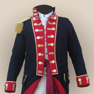
The captains issued Detachment Orders showing the degree to which Lewis and Clark consistently maintained the spirit of Baron von Steuben’s Regulations for the Order and Discipline of the Troops of the United States.
La Freeman-Custis Expedición
La Gran Excursión
by Dan Flores, Joseph A. Mussulman
Narrado tanto en inglés como en español, Daniel Flores narra la historia de una exploración paralela y sureña ahora casi olvidada.
Defining ‘Discover’
Shades of meaning
by Joseph A. MussulmanThe Dictionary of Bias-Free Usage remonstrated that “only by a strange twist of white ethnocentrism can one be considered to ‘discover’ a continent inhabited by millions of people.” Political correctitude might suggest that we simply drop the word discovery from our Lewis and Clark lexicon, and just speak of the captains as explorers.
Meriwether Lewis (1774–1809)
The life of Captain Lewis
by Joseph A. Mussulman
Born on 18 August 1774, he was exactly eight months old when Paul Revere made the legendary ride that signaled the beginning of the War of Independence, and the birth of the new United States of America, which Lewis was to serve with distinction.
Pompeys Pillar by Air
Remarkable rock
by Joseph A. Mussulman
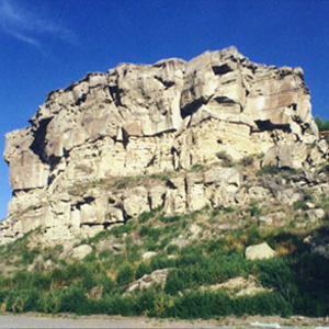
For countless generations this conspicuous sandstone formation had been a distinctive feature in the homeland of the Crows.
The Milk River by Air
Milky blend
by Joseph A. Mussulman
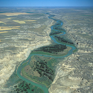
“from the colour of it’s water we called it Milk river.” He wondered whether this might be the river the Hidatsas had called “the river which scoalds at all others.”
Malta Bend
"butifull prarie"
by Joseph A. Mussulman
On 16 June 1804, Clark took a long walk through a “butifull extensive Prarie” to look for an old fort on Evans’s map, built by the French thereabouts more than eighty years earlier. The party spent three days here making new oars and ropes, and hunting.
Lewis’s Branding Iron
by Joseph A. Mussulman
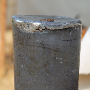
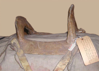
Lewis may have had this branding iron custom-made before he left the East, perhaps at Harpers Ferry, although there is no mention of it in existing records. Such tools commonly were used for marking wooden packing crates and barrels, and on leather bags, until the early 20th century.
Finding the Willamette
Filling in the blank
by Joseph A. Mussulman
Islands had hidden it from view on the westbound trip, but early on 2 April 1806 some Indians visiting their camp happened to mention it. Clark picked six of his soldiers, hired an Indian guide, and went back to see it.
Lewis and Clark Pass
A shorter way
by Joseph A. Mussulman
Sergeant Gass recorded that on 7 July 1806, Lewis’s detachment took a three-hour lunch break and then proceeded four miles, “when we came to the dividing ridge between the waters of the Missouri and Columbia.”
Elk Point
Names
by Joseph A. Mussulman
In the vicinity of Elk Point, South Dakota, the captains found a variety of unfamiliar minerals, including what Clark believed were arsenic and cobalt. “Capt. Lewis in proveing the quality of those minerals was near poisoning himself by the fumes & taste.”
The Marias Massacre
My Lai on the Marias
by Joseph A. Mussulman
Some blame the ruin of the Blackfeet people on the Lewis and Clark Expedition. The story is far too complicated to be told fully in a few hundred words. Many foul deeds on both sides led up to the “the greatest slaughter of Indians ever made by U.S. troops.”
The Judith River
by Joseph A. Mussulman
“at the distance of 2½ miles passed a handsome river which discharged itself on the Lard. side, I walked on shore and acended this river about a mile and a half in order to examine it”
Louisville
Kentucky recruits
by Joseph A. Mussulman
Clark was waiting with seven more recruits who would become permanent members of the contingent soon to be known as the Corps of Volunteers for North Western Discovery.
Spirit Mound by Air
"Unusual spirits"
by Joseph A. Mussulman
On 25 August 1804, obedient to Jefferson’s instruction to observe Indians traditions, monuments and landmarks, Lewis and Clark went inland to visit a “conic form” rising from the plain.
Measuring Heights and Distances
From Owen's Dictionary
by Joseph A. Mussulman
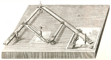
This article shows methods for measuring heights and distances as described by Owen’s Dictionary of Arts and Sciences (1754), a book in the expedition’s traveling library.
The Marias River Risk
"Of highest national importance"
by Joseph A. Mussulman
Why was it so important that Meriwether Lewis was willing to risk his life in a region occupied by the “Pahkees” or Minnetares, the Assiniboines, and other people whom he had been led—by their enemies, of course—to believe were “vicious and illy disposed”?
Wheeler on the Yellowstone
Bozeman Pass and Pompeys Pillar
by Barbara Fifer, Joseph A. Mussulman
In 1902, Wheeler followed the Northern Pacific’s course over Bozeman Pass and the Yellowstone River promoting both the railroad and the Lewis and Clark Centennial.
Pronghorn
Antelope, Antilocapra americana
by Joseph A. Mussulman
The men of the Corps of Discovery must have been electrified by their first sighting of the pronghorn antelope at the northeast corner of today’s state of Nebraska. Naturalists were eager to find the answers to some basic questions about them.
Clark’s Portage Route Survey
Measuring the falls and portage
by Joseph A. Mussulman
On 17 June 1805, Clark and five men set out to determine the best portage route around the Great Falls of the Missouri. On the way up the river, he stopped to also measure the fall of the river and to map the falls.
Early American Flags
by Joseph A. Mussulman
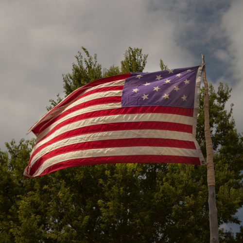
Lewis’s long list of needs for the journey would have been a large supply of American flags, to be flown on their boats, over their camps, and at their council sites. Leading up to the Lewis and Clark expedition, what did the young country’s flags look like?
The Portage Route
Around the Falls of the Missouri
by Joseph A. Mussulman
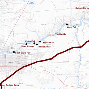
The shuttling of all the baggage and six canoes across the prairie to the upper portage camp opposite White Bear Islands began on 21 June 1805 and was completed on 2 July 1805. All in all, it was one of the most grueling undertakings on the entire expedition.
Lignite
'Strater of carbonated wood'
by Joseph A. Mussulman, Robert N. Bergantino
Lewis and Clark sometimes called this coal “carbonated wood” because sometimes they could see the outlines of woody stems and other plant remains. Coal geologists call it lignite, but Lewis and Clark were essentially correct in their description.
John Mullan’s Lolo
Naming Lo Lo's Fork
by Joseph A. Mussulman
Lt. John Mullan surveyed the Northern Nez Perce road across the Bitterroot Range in 1853-54 to assess its suitability as a railroad route. He never met anyone named Lolo, but was told by an Iroquois guide and interpreter that the creek was called the “Lo Lo Fork,” or “Lo Lo’s Fork.”
Shipping the Supplies
Quartermaster Lewis
by Frank Muhly, Joseph A. Mussulman
Considering all he had to do to prepare for the expedition, Lewis was fortunate in that he could rely on a small cadre of Army personnel to help him assemble, pack, and ship his supplies.
Early American Entomology
by Joseph A. Mussulman
There were only four notable 18th century naturalists who showed much interest in America’s insects: a young Englishman named Mark Catesby, Finnish botanist Peter Kalm, Philadelphian William Bartram, and Reverend Frederick Melsheimer of New Hampshire.
Center Square Pump House
City gathering spot
by Charles F. Reed, Joseph A. Mussulman
Although it would be many years before the entire city had access to pure water, the completion of the Water Works in 1800 helped to reduce the threat of epidemics and provided a foundation for continued urban growth.
Outfitting the Expedition
Buying supplies in Philadelphia and St. Louis
by Frank Muhly, Joseph A. Mussulman
The original shopping list contained more than 180 items, including various “Mathematical Instruments”, arms and accouterments, ammunition, clothing, camp equipage, provisions, Indian presents, medicine, and packing materials.
Up the Columbia
Heading home
by Barbara Fifer, Joseph A. Mussulman
Homeward bound in April 1806, the Lewis and Clark Expedition traveled through the Columbia Gorge and pitched camps on its north side. Their passage was tense and unpleasant, with Indians taking small goods regularly.
Missouri River Fur Trade
by Joseph A. Mussulman, W. Raymond Wood
The Corps of Discovery had been, as James Ronda phrased it, “only the latest in a long series of traders and travelers” to visit the tribes living along the Missouri. The Mandans had been visited in 1738 by la Vérendrye from his base on the Assiniboine River.
Rainbow Falls by Air
"Pleasingly beautifull"
by Joseph A. Mussulman
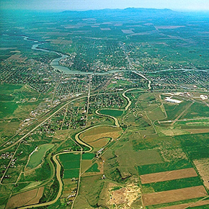
After briefly contemplating the Crooked Falls on 14 June 1805, Lewis followed the sound of “a tremendious roaring” to “one of the most beautifull objects in nature,” a fifty-foot-high cascade “with an edge as regular and as straight as if formed by art.”
Columbian Ground Squirrel
Spermophilus columbianus
by Joseph A. Mussulman
Labiche brought a specimen into Long Camp on the Clearwater River and four days later, Meriwether Lewis penned one of his longest and most meticulous descriptions of any small mammal.
Cous
Lomatium cous
by Joseph A. Mussulman
William Clark first mentioned the root cous on 1 November 1805, saying that native people living near the future Bonneville Dam site traded beads to obtain it from people up the Columbia River. To Clark, it was “cha-pel-el bread.”
The Lost Trail Divide
Leaving the Indian road
by Joseph A. Mussulman
Continuing north up the North Fork Salmon River, they leave a good Indian road and must cut their own trail. Were they lost? Sergeant Gass’s laconic remark gives us a hint: “This was not the creek our guide wished to have come upon.”
Flea Country
A multitude of fleas
by Joseph A. Mussulman
During the portage around the Falls of the Columbia River, as Biddle paraphrased it, “we found that the Indians had camped there not long since, and had left behind them multitudes of fleas.”
Bighorn Sheep Encounters
by Joseph A. Mussulman
During a reconnaissance assignment eight miles up the Yellowstone River on 26 April 1805, Joseph Field became the first member of the Corps to glimpse a live bighorn sheep.
John James Audubon
(1785–1851)
by Doug Erickson, Joseph A. Mussulman
America’s greatest ornithologist, John James Audubon, was just starting his career when Lewis and Clark returned, and there is ample evidence that he drew inspiration from Lewis and Clark’s writings.
Salt-curing Meat
Preserving without refrigeration
by Joseph A. Mussulman
Salt served functions that were equally as important as dietary needs: drying meat—namely, and tanning hides for clothing and moccasins.
Concomly
Prominent Chinook leader
by Joseph A. Mussulman
Concomly was a prominent Chinook citizen and leader whose people lived on the north side of the Columbia estuary, on the shore of Haley’s Bay. On November 17, 1805, he introduced himself to Lewis and Clark at Station Camp.
Lolo Stories
Endless possibilities
by Joseph A. Mussulman
One amateur historian averred that it was “a corruption of the French name Le Louis, given to the stream and pass by early French trappers” in honor of Meriwether Lewis. Another claimed that the mystery [wo]man was named after “Lolo [i.e., Lola] Montez, a noted Spanish beauty.”
White-tailed Deer
Odocoileus virginianus
by Joseph A. Mussulman
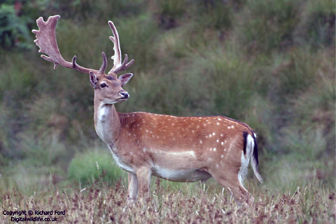
Lewis had no reason to write about the common or fallow deer of the East Coast, although in using it for the purpose of comparison, he gave quite a clear picture of it. John Godman’s 1828 description relied partly on Lewis and Clark’s journals.
Charbonneau’s Prayer
Accident in the white pirogue
by Joseph A. Mussulman
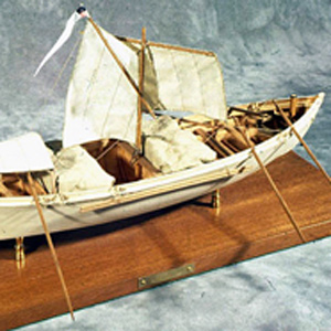
Charbonneau’s ultimate test of faith came as a boatman, on a day when he was at the helm of the white pirogue. After a sudden gust of wind, he panicked and turned the boat sideways to the wind, turning the boat over.
Thrapples
by Joseph A. MussulmanOf four Yankton Sioux, Sgt. Ordway wrote: “They had each of them a Thrapple made of a fresh buffelow hide dressed white with Some Small Shot in it and a little bunch of hair tied on it.”
Lewis’s Five Firs
by James L. Reveal, Joseph A. Mussulman
Lewis describes one of the richest resources of the Pacific northwest coast: Sitka spruce, western hemlock, grand fir, perhaps the Pacific silver fir, and Douglas-fir.
Jerusalem Artichokes
Helianthus tuberosus
by Joseph A. Mussulman, Kristopher K. Townsend
The French explorer Samuel de Champlain found the vegetable growing in Indian gardens along the Saint Lawrence seaway and carried specimens of it back to France in 1603, where its root soon became a staple food for humans.
The Bears Tooth
Key landmark on the Old North Trail
by Joseph A. Mussulman
The Bears Tooth was an important landmark on the the ancient Indian road that has come to be known as the Old North Trail. It was included on Nicholas King’s 1804 map, and the captains expected to find it.
The “Deserts of America”
by Joseph A. Mussulman
The men of the Corps of Discovery were fascinated by the varied textures, shapes and colors of the 200- to 300-foot cliffs that defined the river’s immediate borderlands. Clark judged from all he could see that “this Countrey may with propriety … be termed the Deserts of America.”
Charles B. J. F. de Saint Mémin
Early American portraitist
by Joseph A. Mussulman
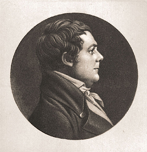
Charles Balthazar Julien Févret de Saint-Mémin (1770–1852) was a portrait artist whose works include Lewis, Clark, Chief Sheheke and his wife Yellow Corn.
Nathaniel Pryor
Sergeant
by Joseph A. Mussulman
Pryor was assigned several special missions from exploring the Sandy River to escorting Mandan Chiefs to Washington City. He would barely survive his adventures on the Yellowstone River.
The Yellowstone Badlands
by Joseph A. Mussulman
Around midday he passed the mouth of a tributary “40 yards wid Shallow and muddy,” the banks of which can be faintly discerned near the horizon in the picture, and identified it as the stream the Mandan chief Sheheke had called Oak-tar-pon-er.
Observing Bighorn Sheep
A pictorial essay
by Joseph A. Mussulman
By telling the story of how these photos and videos were created, the behaviors of the bighorn sheep are described.
Wheeler’s Railroad Promotions
The Lewis and Clark Centennial
by Barbara Fifer, Joseph A. Mussulman
The Northern Pacific Railway had identified two new attractions within its Wonderland—a centennial commemoration of the historic Lewis and Clark expedition, plus extensive segments of the original trail within sight of its rails.
Beaverhead Rock
Sacagawea's landmark?
by Joseph A. Mussulman
“The Indian woman recognized the point of a high plain to our right . . . . This hill she says her nation calls the beaver’s head from a conceived resemblance of its figure to the head of that animal.”
Snowbank Camp to Lonesome Cove
Tough going
by Joseph A. Mussulman
Although none of the journalists mentioned it, the very presence of last winter’s snow on those mountains in late September must have aroused the feeling that crossing the Rockies was going to be even tougher than they had figured.
Always the Wind
by Joseph A. Mussulman
On 4 June 1805, while they were exploring the Maria’s River, Lewis and his men camped “among the willow bushes which defended us from the wind which blew hard from the N. W.” Homesteaders on the plains planted Shelterbelts to shield from strong wind and blowing snow.
Fort Mandan by Air
"most perfect harmony"
by Joseph A. Mussulman
Lewis attested that his men were “in excellent health and sperits, zealously attached to the enterprise, and anxious to proceed; not a whisper of murmur or discontent to be heard among them, but all act in unison, and with the most perfect harmony.”
Sheheke’s Delegation
by Joseph A. Mussulman
Sheheke’s diplomatic trip to Washington City and his difficult return home brought down the careers of at least two great leaders—himself, and Meriwether Lewis.
Early American Hunting
by Joseph A. Mussulman
Governor William Bradford of the Massachusetts Bay Colony hired the local Indians to hunt for the colony. Early Americans later learned several hunting methods from Indians such as relaying, driving, and still hunting.
The Falls of the Missouri
by Joseph A. Mussulman
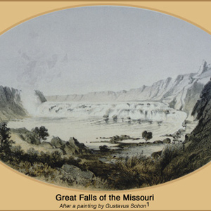
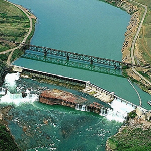
From Indian information the previous winter, the captains knew they would encounter a great falls in the Missouri River. What they found was a 14-mile-long series of waterfalls and rapids that drops 473 feet.
Meeting the Columbia
A welcoming fanfare
by Joseph A. Mussulman
In the afternoon of 16 October 1805, the expedition portaged around “the last bad rapid as the Indians Sign to us”–the last on the Snake River, that is–and soon arrived at the “Great River of the West,” the Columbia.
Cascade Mountains at Dawn
by Joseph A. Mussulman
In 1838, a patriotic citizen started a campaign to change the Cascade Mountains into the “Presidential Range.” This was to include renaming Mount Hood after John Adams.
Making Leather
by Joseph A. Mussulman
“The men of the garison are still busily employed in dessing Elk’s skins for cloathing.” Regrettably, Lewis was compelled to add that “they find great difficulty for the want of branes [brains].”
The Salmon and Snake Villages
Side trip
by Joseph A. Mussulman
When the captains saw Nez Perces with several fresh chinook salmon, “fat and fine,” which the Indians said came from “Lewis’s River,” known today as the Salmon River, they dispatched Sgt. John Ordway and two privates to buy some.
Grays Bay
Shallow bay
by Joseph A. Mussulman
On the morning of 8 November 1805, the Corps’ flotilla entered a “nitch” they called Shallow Bay and paused for their midday meal near the remains of an Indian village with “great numbers of flees which [we] treated with the greatest caution and distance.”
The Jefferson River
Third gap
by Joseph A. Mussulman
On the first of August 1805, Clark and the expedition’s flotilla of eight dugout canoes pushed up the Jefferson River through “a verrey high mountain which jutted its tremendious Clifts on either Side for 9 Miles, the rocks ragide.”
Travelers’ Rest by Air
Turning point
by Joseph A. Mussulman
For three days the Corps rested here, gathering strength for the arduous 150-mile trek across the Bitterroot Mountains. The campsite was about two-thirds down in the photo, among the cottonwoods that shelter Lolo Creek.
Camp Disappointment
The northernmost extent
by Joseph A. Mussulman
In 1806, Lewis, Drouillard, Joe Field, and Reubin Field made a second excursion up the Marias, this time on horseback. The four men reached the northernmost point of the Expedition’s exploration on 22 July 1806, camping on the south side of today’s Cut Bank Creek.
York’s Fallout over Freedom
by Joseph A. Mussulman
It is remarkable that we have no record of York’s words and thoughts. Insofar as the nineteenth century “slave narratives” were produced by Africans who had freed themselves, it may be conjectured that York did not leave a record of his thoughts and experiences because he was never freed.
The Vermillion River
The stream near Spirit Mound
by Joseph A. Mussulman
The Corps left the white pirogue at the mouth of this stream and followed it part of the way to the storied Spirit Mound. During the years between the day the Corps passed it and today, its mouth has migrated about 2.5 miles southeast.
Stolen Horses
Apsáalooke horse culture
by Joseph A. Mussulman, Robert N. Bergantino
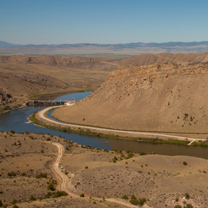
Pryor and six privates had successfully driven forty-one horses all the way to the Yellowstone Valley, apparently without any trouble. Then, smoke on the horizon. Twenty-four horses stolen on the twentieth. Seventeen taken on the twenty-fifth.
System, Model and Legacy
Nature's taxonomy
by Joseph A. Mussulman
The science of the orderly classification of all living and extinct organisms is called taxonomy. It comprised a hierarchical outline of descriptors extending between the most general and the most specific and Lewis and Clark had a role.
Experience the Lewis and Clark Trail
The Lewis and Clark Trail Experience—our sister site at lewisandclark.travel—connects the world to people and places on the Lewis and Clark Trail.
Discover More
- The Lewis and Clark Expedition: Day by Day by Gary E. Moulton (University of Nebraska Press, 2018). The story in prose, 14 May 1804–23 September 1806.
- The Lewis and Clark Journals: An American Epic of Discovery (abridged) by Gary E. Moulton (University of Nebraska Press, 2003). Selected journal excerpts, 14 May 1804–23 September 1806.
- The Lewis and Clark Journals. by Gary E. Moulton (University of Nebraska Press, 1983–2001). The complete story in 13 volumes.