At 4 p.m. on 7 April 1805, the permanent party heads their six canoes and two pirogues up the Missouri toward the Rocky Mountain barrier. At the same moment, Corp. Warfington and a small crew accompanied by Too Né’s delegation bound for a meeting with President Jefferson head downriver in the barge.
The Missouri River reaches it most northern position flowing from the Great Falls of the Missouri across present Montana and North Dakota. Moving through this stretch, the expedition passes the Yellowstone, Milk, Poplar, and Musselshell rivers. In the Upper Missouri River Breaks, the journalists describe both “scenes of barrenness and desolation” and “seens of visionary inchantment”.
At the mouth of the Marias, they come to a river they did not expect. They are unsure which fork is the true Missouri. After ten days exploring each, the captains decide to take the left fork.
Lewis scouts ahead to find the Falls of the Missouri that they are expecting. Sacagawea becomes dangerously ill and travels with Clark and the boats until they can go no farther—below present Belt Creek.
If the expedition is to be successful, Sacagawea will need gain her health, and the heavy boats will need to be carted around not one, but several waterfalls on a long and difficult portage.
The Assiniboines
by Kristopher K. Townsend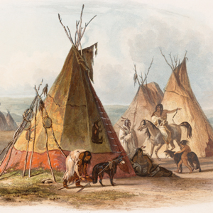
The Assiniboines were nomadic hunter-gatherers roaming primarily along the rivers in Saskatchewan and western Manitoba. They often dropped south into present-day Montana and North Dakota, especially in their role as middle-men between the English trading companies and the Hidatsas to the south.
The Atsinas
by Kristopher K. Townsend
Today, they are called the Atsina or Gros Ventre, but their names in the historical literature—Big Bellies, Gros Ventre and Minnetares—cause confusion even to this day. The expedition never met them, but their presence affected the expedition in several ways.
Synopsis Part 2
Fort Mandan to the Marias River
by Harry W. Fritz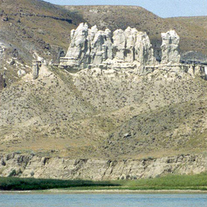
Near the mouth of the Knife, in late October 1804, the expedition settled down for the winter. After the river ice broke up, the keelboat left for St. Louis and six new dugout canoes headed the opposite direction, up the Missouri river.
The Fort Union Formation
by Robert N. Bergantino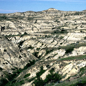
Today it is a high and dry plain, but sixty million years ago it was a shallow saucer in the earth’s crust, filled with warm, steamy tropical jungles. That rich, dense vegetation would, over some millions of years, become a huge, complex deposit of lignite.
Mouth of the Yellowstone
When Captain Lewis arrived at the mouth of the great river in late April 1805, he saw a “rich, delightful land, broken into valleys and meadows, and well supplied with wood and water.”
Fort Union
Upper Missouri developers
by Joseph A. Mussulman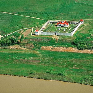
This is where, in 1828, John Jacob Astor’s American Fur Company built Fort Union, which remained the axis of Indian-American commerce on the Upper Missouri until the late 1860s.
Culbertson, Montana
Abundance
by Joseph A. Mussulman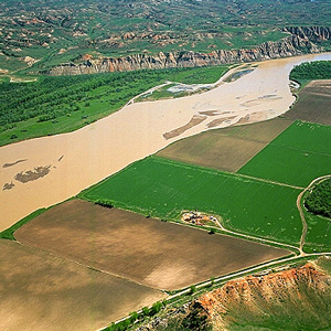
Somewhere in this vicinity, on 29 April 1805, Lewis shot his first grizzly bear and promptly began his detailed study of the fascinating species. Other game was astonishingly abundant, too.
The Milk River
The river which scolds all others?
by Joseph A. Mussulman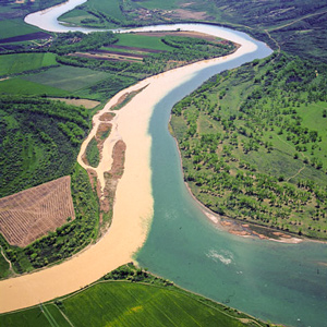
Creeping down the nearly imperceptible slope of the northern high plains, this is the stream Lewis and Clark described as possessing a peculiar whiteness, being about the colour of a cup of tea with the admixture of a tablespoonfull of milk.
Fort Peck Dam
Varied landscape
by Joseph A. Mussulman
“The countrey on the North Side of the Missouri is one of the handsomest plains we have yet Seen on the river,” Clark declared. Lewis described the ragged badlands on the south side as “high broken hills….”
Charbonneau’s Prayer
Accident in the white pirogue
by Joseph A. Mussulman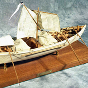
Charbonneau’s ultimate test of faith came as a boatman, on a day when he was at the helm of the white pirogue. After a sudden gust of wind, he panicked and turned the boat sideways to the wind, turning the boat over.
Fort Peck Lake
Close calls
by Joseph A. Mussulman
The fourteenth of May was a day of close calls. With no time to reload their weapons, the grizzly bear hunters flung them aside and leaped over a twenty-foot-high bank into the river.
The Musselshell River
Sharp curve
by Joseph A. Mussulman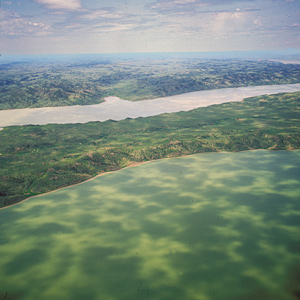
On 19 May 1805, the expedition camped on the east side of the neck, or “gouge,” in the Missouri River where the Musselshell River joins it. It had been an exhausting day.
Charles M. Russell NWR
Missouri Breaks
by Joseph A. Mussulman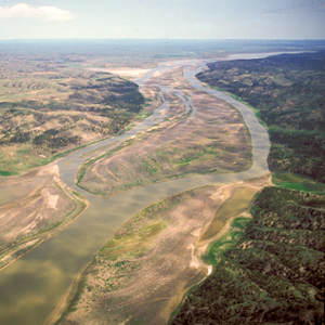
The wind against them again on 25 May 1805, the Corps had to tow their boats with ropes. Lewis observed, “the water run with great violence, and compelled us in some instances to double our force in order to get a perorogue or canoe by them.”
Into the Breaks
Fred Robinson Bridge to Judith Landing
by Joseph A. Mussulman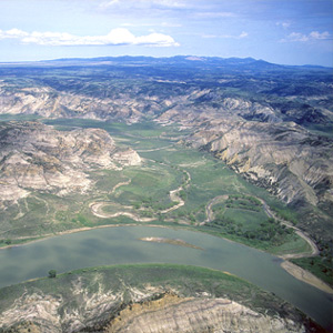
In 1804-5-6 Lewis and Clark called all rough or relatively precipitous elevations, wherever they saw them, “broken” lands; the topography along this 149-mile stretch of the Wild and Scenic Missouri River was clearly the worst they had ever seen.
Geology of the Breaks
The geologic entries
by John W. Jengo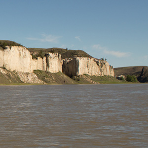
As a professional geologist and a Lewis and Clark enthusiast I’m impressed by what the captains had to say about the geology of the Upper Missouri River Breaks, as suggested by the following journal excerpts and commentary.
The Judith River
by Joseph A. Mussulman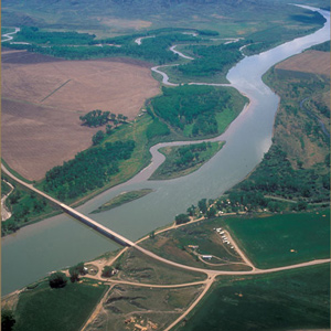
“at the distance of 2½ miles passed a handsome river which discharged itself on the Lard. side, I walked on shore and acended this river about a mile and a half in order to examine it”
The Grand Natural Wall
"walls of tolerable workmanship"
by Joseph A. Mussulman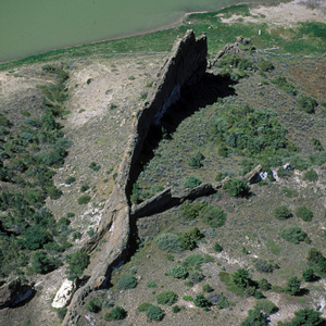
“As we passed on it seemed as if those seens of visionary inchantment would never have an end; for here it is too that nature presents to the view of the traveler vast ranges of walls of tolerable workmanship.”
The White Cliffs
by Joseph A. Mussulman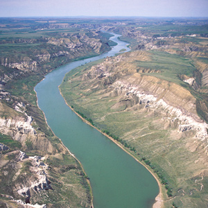
Under cloudy skies on the morning of 31 May 1805, the expedition “proceeded at an early hour,” and roped their flotilla of six cottonwood dugout canoes and two big pirogues into one of the most famous riverscapes on the Missouri.
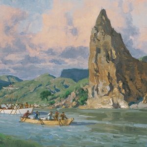
Citadel Rock
"Steep black rock"
by Joseph A. Mussulman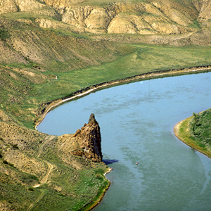
Clark remarked on this “high Steep black rock riseing from the waters edge” as they passed it on 31 May 1805, but he did not give it a name. Citadel Rock, so called during the steamboat era for its fortress-like presence, was an igneous intrusion into a layer of sandstone.
The Teton River
Clark's "Tanzy" and Lewis's "Rose"
by Joseph A. Mussulman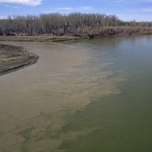
Clark first called it the “Tanzey.” Apparently Lewis dubbed it Rose River, for he noted that “the wild rose which grows here in great abundance in the bottoms of all these rivers is now in full bloom, and adds not a little to the beauty of the cenery.”
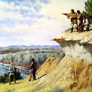
Decision Point
Marias River decision
by Joseph A. Mussulman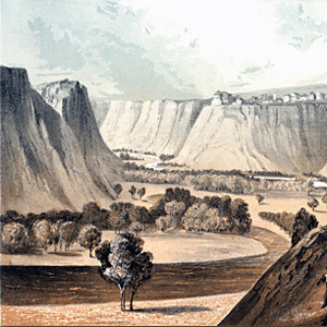
The two captains “strolled out to the top of the hights in the fork of these rivers,” from which they had “an extensive and most inchanting view.”
The Marias River Observations
2–10 June 1805
by Robert N. Bergantino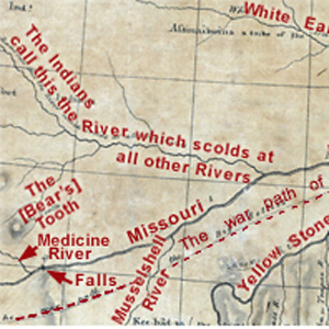
It was a clear night. The moon, just two days short of its first quarter, was 23° above the horizon bearing S78° W when the captains began their observations about 9:30 p.m.
Experience the Lewis and Clark Trail
The Lewis and Clark Trail Experience—our sister site at lewisandclark.travel—connects the world to people and places on the Lewis and Clark Trail.
![]()
Discover More
- The Lewis and Clark Expedition: Day by Day by Gary E. Moulton (University of Nebraska Press, 2018). The story in prose, 14 May 1804–23 September 1806.
- The Lewis and Clark Journals: An American Epic of Discovery (abridged) by Gary E. Moulton (University of Nebraska Press, 2003). Selected journal excerpts, 14 May 1804–23 September 1806.
- The Lewis and Clark Journals. by Gary E. Moulton (University of Nebraska Press, 1983–2001). The complete story in 13 volumes.
This site is provided as a public service by the
![]()
Lewis and Clark Trail Alliance
with additional funding from the following:

