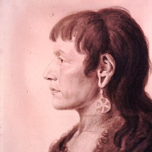
Cheyenne
Edgar S. Paxson (1852-1919)
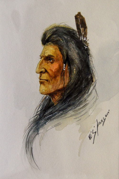
Meloy & Paxson Galleries; The University of Montana PARTV Center.
The expedition journalists spelled the people’s name Chyenne, Cheaun, Chion, and Chien. Originally, they lived along the Minnesota River. In 1680, a delegation traveled to La Salle’s Fort Crevecoeur in Illinois to invite the French to visit their lands. Later, the people migrated westward to avoid Sioux encroachment, and by the time of the Lewis and Clark Expedition, these Algonquian-speaking people lived on the Cheyenne River between the Missouri and Black Hills. The people had transitioned from gathering wild rice to horticultural and then, to a horse-based Plains culture subsisting primarily on buffalo.[1]John H. Moore, Margot P. Liberty, and A. Terry Straus, Handbook of North American Indians: Plains Vol. 15, ed. Raymond J. DeMallie (Washington, D.C.: Smithsonian Institution, 1978), 863, 880.
Many, including the expedition members, misheard the people’s name as ‘chien’—French for ‘dog’. Their name actually comes from the Sioux exonym shahíyena, perhaps meaning ‘people of alien speech’. Their language was Algonquian, very different from the Siouan languages spoken by most of their neighbors.[2]Frederick Webb Hodge, Handbook of American Indians North of Mexico, Vol. 1 (Washington: Smithsonian Institution Bureau of American Ethnology, Government Printing Office, 1912), 250–251.
On their way up the Missouri River in 1804, the expedition passed an abandoned Cheyenne village and met only a handful of Cheyenne. One was Big Man, adopted by Hidatsa chief Le Borgne. Clark recorded what he and Lewis could learn about the people. The captains’ entry for the Cheyenne in their “Estimate of the Eastern Indians” written during the winter at Fort Mandan remains accurate:
They are the remnant of a nation once respectable in point of number: formerly resided on a branch of the Red river of Lake Winnipie [Winnipeg], which still bears their name [North Dakota’s Sheyenne River]. Being oppressed by the Sioux, they removed to the west side of the Missouri, about 15 miles below the mouth of the Warricunne creek, where they built and fortified a village, but being pursued by their ancient enemies the Sioux, they fled to the Black hills, about the head of the Chyenne river, where they wander in quest of the buffaloe, having no fixed residence. They do not cultivate. They are well disposed towards the whites, and might easily be induced to settle on the Missouri, if they could be assured of being protected from the Sioux. Their number annually diminishes. Their trade may be made valuable.[3]Moulton, Journals, 3:421.
Homeward-bound, the expedition met a large Cheyenne group at an Arikara village. The captains delayed to council with Mandan Chief Sheheke and various chiefs of the Arikara and Cheyenne. All but Sheheke declined the captains’ invitation to travel to Washington City, but one Cheyenne did ask the United States to establish trade with his people.
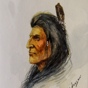
Cheyenne Dog Soldier
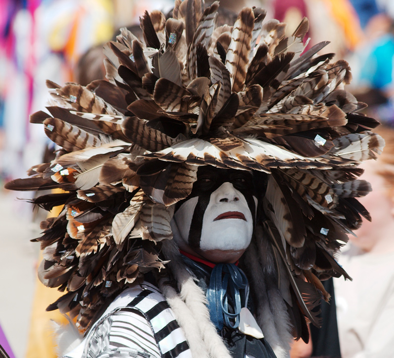
By WikiCommons user Dori. Permission via the Creative Commons Attribution-Share Alike 3.0 United States license.
To maintain their hunting grounds, the Cheyenne continually fought with the Shoshones, Pawnees, and Crows. Around 1850, disruption from emigrant travel through their lands began diminishing the tribe, and many members died from cholera. On 29 November 1864, a peaceful tribe was massacred at Sand Creek, Colorado—the infamous Sand Creek Massacre.[4]Moore, et al., 863,865. Today, the Southern Cheyenne of Oklahoma and Northern Cheyenne of Montana constitute two federally recognized nations within the United States.[5]“Cheyenne,” Wikipedia accessed on 21 December 2020, https://en.wikipedia.org/wiki/Cheyenne.
The Dog Soldiers are one of six Cheyenne military societies that formed in the mid-1800s. The Cheyenne fought may battles with the U.S. Army to preserve the Cheyenne way of life, and the Dog Soldiers remain especially popular in literature and film.
Selected Pages and Encounters
Montana’s Indian Country
Changes after the expedition
by Rick Newby
Beginning with the Fort Laramie Treaty of 1851, the U.S. government set the vast area north of the Missouri (approximately 20 million acres) aside as the “Blackfeet Hunting Ground” for the Blackfeet and other tribes—Cree, Assiniboine, Gros Ventre, and Sioux.
October 1, 1804
The Cheyenne River
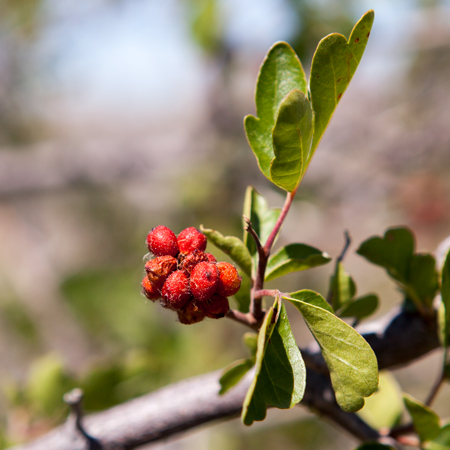
At the Cheyenne River, the captains meet trader Jean Vallé who tells them about that river. Clark finds that buffaberries make a delightful tart, and Lewis adds three specimens to his plant collection.
October 12, 1804
Trading with the Arikara
At an Arikara village, the morning is spent parleying and trading. At 1 pm, the expedition heads up the Missouri River and encamps near present Shaw Creek Recreation Area in South Dakota.
October 16, 1804
"Goat" hunting
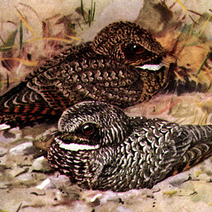
The expedition struggles 14 river miles between present Fort Yates and Beaver Creek in North Dakota. Some Arikaras hunt pronghorn, and Lewis adds common poorwill and creeping juniper to his collection.
October 30, 1804
Sheheke's introduction
Sheheke and one other come to the expedition’s camp at the Knife River Villages having missed yesterday’s council. Clark and eight men head up the river in search of a place to spend the winter.
December 1, 1804
Hudson's Bay Company visitor
![]()
Trader George Henderson of the Hudson’s Bay Company visits Fort Mandan, and Sgt. Ordway describes their business at the Knife River villages. A delegation of Cheyennes and Arikaras arouse Mandan suspicion.
December 2, 1804
A Cheyenne delegation
When four Cheyennes arrive at Fort Mandan, the captains give them a speech, tobacco, a flag, and demonstrations of many ‘curiosities’. They also give them a letter of warning for the Sioux and Arikaras.
August 21, 1806
At the Arikara villages
At the Arikara villages above present Mobridge, South Dakota, several councils are conducted between various Mandans, Arikaras, and Cheyennes. One of their 1804 engagés shares ominous news.
August 22, 1806
An engagé re-joins
Arikara and Cheyenne chiefs decline Clark’s invitation to travel to Washington City. With an engagé hired in 1804, they travel down the river and camp below present Mobridge, South Dakota.
Notes
| ↑1 | John H. Moore, Margot P. Liberty, and A. Terry Straus, Handbook of North American Indians: Plains Vol. 15, ed. Raymond J. DeMallie (Washington, D.C.: Smithsonian Institution, 1978), 863, 880. |
|---|---|
| ↑2 | Frederick Webb Hodge, Handbook of American Indians North of Mexico, Vol. 1 (Washington: Smithsonian Institution Bureau of American Ethnology, Government Printing Office, 1912), 250–251. |
| ↑3 | Moulton, Journals, 3:421. |
| ↑4 | Moore, et al., 863,865. |
| ↑5 | “Cheyenne,” Wikipedia accessed on 21 December 2020, https://en.wikipedia.org/wiki/Cheyenne. |
Experience the Lewis and Clark Trail
The Lewis and Clark Trail Experience—our sister site at lewisandclark.travel—connects the world to people and places on the Lewis and Clark Trail.
![]()
Discover More
- The Lewis and Clark Expedition: Day by Day by Gary E. Moulton (University of Nebraska Press, 2018). The story in prose, 14 May 1804–23 September 1806.
- The Lewis and Clark Journals: An American Epic of Discovery (abridged) by Gary E. Moulton (University of Nebraska Press, 2003). Selected journal excerpts, 14 May 1804–23 September 1806.
- The Lewis and Clark Journals. by Gary E. Moulton (University of Nebraska Press, 1983–2001). The complete story in 13 volumes.
This site is provided as a public service by the
![]()
Lewis and Clark Trail Alliance
with additional funding from the following:

