Joseph Mussulman
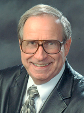
Marc A. Hefty photo.
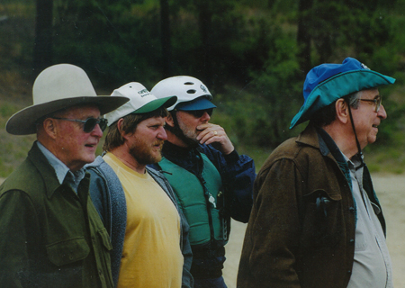
Photo by Bill Bevis.
Left to right: Two concerned dugout canoe owners, one concerned expert paddler, and Joe grinning with delight
Joseph A. Mussulman (1928–2017) was the founding producer, editor and writer for Discovering Lewis & Clark. After five years of preparation and experimentation the website went online in 1998, under the auspices of a non-profit entity called VIAs Inc., and funded by grants from various sources, especially–throughout the bicentennial observance from 2003 to 2006–the Challenge Cost Share Program of the National Park Service. In 2009 the site was taken over by the Lewis & Clark Fort Mandan Foundation of Washburn, North Dakota.
Dr. Mussulman earned his bachelor’s and master’s degrees in music history and literature at Northwestern University in 1950 and 1951. As a Danforth Scholar he earned a doctorate in humanities from Syracuse University in 1967.
He has written and produced a number of interpretive programs in collaboration with audio specialist Richard H. Kuschel, also of Missoula Montana. In 1986, he wrote, narrated, and co-produced a multimedia presentation for the Blaine County Museum (MT) titled Forty Miles from Freedom, about the Non-Treaty Nez Perce Indians’ final battle with the U.S. Army, at the Bear Paw Mountains in 1877. In 2012-13 Mussulman and Kuschel revised the 20-minute onsite production and updated it in High Definition video. In 1994 their interactive self-guided audio-CD tour of Yellowstone National Park, a five-hour program produced for Tour Technologies, Inc., received first prize in the category of media productions from the National Association for Interpretation. Their Two Days to Destiny, an audio interpretive tour of the Little Bighorn Battlefield, won first place from the NAI in 1995.
Mussulman is the author of five articles on Lewis and Clark that appeared in We Proceeded On, the official journal of the Lewis and Clark Trail Heritage Foundation, Inc.: “My Boy Pomp’: About That Name,” Vol. 21, No. 2 (May 1995); “Soundscapes: The Sonic Dimensions of the Lewis and Clark Expedition,” Vol. 21, No. 4 (November 1995); “Men in High Spirits: Humor on the Lewis and Clark Trail,” Vol.22, No. 2 (May 1996); “‘In Greatest Harmoney’: ‘Meddicine Songs’ on the Lewis and Clark Trail,” Vol. 23, No. 4 (November 1997); and “Pomp’s bier was a bar,” Vol. 27, No. 1 (February 2001).
Dr. Mussulman has designed and produced maps for various books, brochures and study guides about Lewis and Clark, including 58 full-color maps illustrating the expedition’s entire route from coast to coast for the travelers’ guide, Along the Trail with Lewis and Clark, by Barbara Fifer and Vicky Soderberg (2nd ed., Helena: Montana Magazine, 2001). Those maps also appeared in the same publisher’s annual Lewis and Clark Travel Planner and Guide. They may be seen in Discovering Lewis & Clark at Discovering Lewis & Clark from the Air. In 1998, he created a poster illustrating the trail from Washington, D.C. to the Pacific, for Farcountry Press.
His other publications include a biography, Dear People . . . Robert Shaw (Indiana University Press,1979; reprint, Chapel Hill, NC: Hinshaw Music, 1996), and Music in the Cultured Generation (Evanston: Northwestern University Press, 1974). From 1987 through 1998 he was the interpretive writer and designer of Montana Afloat, a series of sixteen maps of Montana’s major floatable rivers.
Dr. Mussulman was a 1999 recipient of a Montana Governor’s Arts Award. Several years later he received an award of meritorious achievement from the Lewis and Clark Trail Heritage Foundation “for outstanding contributions in bring to this nation a greater awareness and appreciation of the Lewis and Clark expedition.” In 2005, he received the Montana Governor’s Humanities Award.
Contributions to this Site
Clark’s Apsáalooke (Crow) Speech
A speech never given
by Joseph A. Mussulman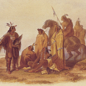
While stinging from having so many of his horses stolen, Clark wrote a speech to the Crow Indians imploring them to return the booty. After all, he needed those horses to complete the captain’s bold diplomatic plan.
Naming the Marias
"in honour of Miss Maria"
by Joseph A. Mussulman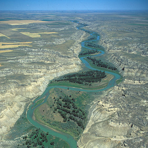
“The whole of my party to a man except myself were fully perswaided that this river was the Missouri, but being fully of opinion that it was neither . . . I determined to give it a name and in honour of Miss Maria W____d.”
Kirwan’s Elements of Mineralogy
The captain's field guide
by David D. Alt, Joseph A. Mussulman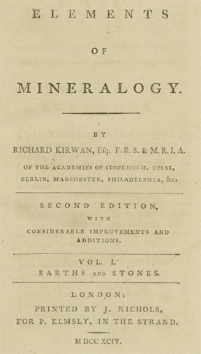
As a reference, Lewis purchased the second edition (1784) of Richard Kirwan’s Elements of Mineralogy. Although Lewis and Clark had the book at hand throughout the expedition, its usefulness as a field guide was limited.
Western Whitetail Deer
Mysterious "longtailed deer"
by Joseph A. Mussulman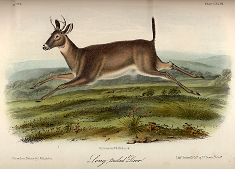
One of the most confusing terms in Lewis and Clark’s lexicon of quadrupeds was the adjective long-tailed—or longtailed. At the Three Forks on 29 July 1805, he compounded the ambiguity.
Lewis’s Five Firs
by James L. Reveal, Joseph A. Mussulman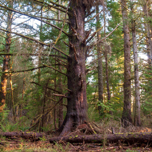
Lewis describes one of the richest resources of the Pacific northwest coast: Sitka spruce, western hemlock, grand fir, perhaps the Pacific silver fir, and Douglas-fir.
The River’s End
End of navigable water
by Joseph A. Mussulman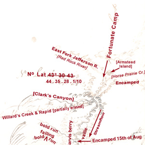
Lewis: “here I halted and examined those streams and readily discovered from their size that it would be vain to attempt the navigation of either any further.”
Big Hole to Three Forks
Sacagawea points to home
by Joseph A. Mussulman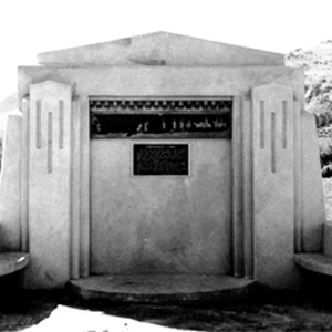
Sacagawea informed Clark that “she had been in this plain frequently and knew it well,” that the creek they were following was a branch of the Big Hole River, and that “when we assended the higher part of the plain we would discover a gap in the mountains”
Nathaniel Pryor
Sergeant
by Joseph A. Mussulman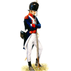
Pryor was assigned several special missions from exploring the Sandy River to escorting Mandan Chiefs to Washington City. He would barely survive his adventures on the Yellowstone River.
Air Gun Accident
A shooting on Brunot's Island
by Joseph A. Mussulman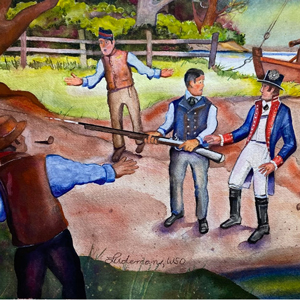
“accedentaly the ball passed through the hat of a woman about 40 yards distanc cutting her temple about the fourth of the diameter of the ball.”
Eagles
The bald and golden eagles
by Joseph A. Mussulman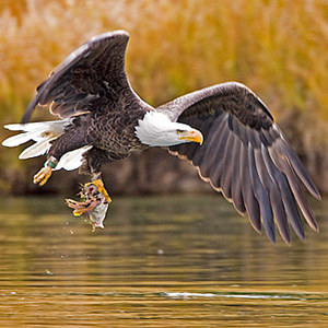
En route to the Pacific Ocean, Lewis and Clark saw both species of eagles that are native to North America: the black-and-white one called the bald eagle, and the brown-and-gold one commonly known as the golden eagle, but which the explorers knew as the grey eagle.
Peace Medals
Tools of diplomacy and trade
by Joseph A. Mussulman, Kristopher K. Townsend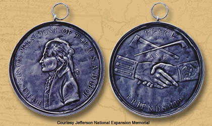
One of the tasks assigned to the expedition was to replace the French, Spanish, and English peace medals previously gifted to North American Indians with those from the United States. The gifts symbolized mutual loyalty in trade and, at least to the Indians, military protection.
Clark’s Fort Mandan Maps
by Joseph A. Mussulman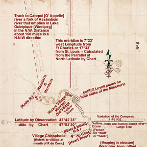
While wintering over at Fort Mandan, Clark made a series of maps based on Indian information and previous traders such as John Evans and François Larocque.
La Véndrye’s Golden Sands
His visit to Spirit Mound
by Joseph A. Mussulman, Kristopher K. Townsend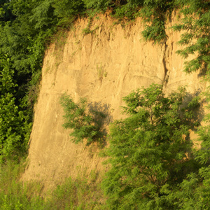
La Vérendrye’s 1728 name for Spirit Mound contains several puzzling statements. Pako’s reference to that “very fine gold-coloured sand,” suggests the “little mountain” was located in a fabulous land, an Eldorado, of precious natural riches.
Finding the Yellowstone
by Joseph A. Mussulman, Rick Newby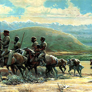
As he started over the mountains at today’s Bozeman they observed several Indian and buffalo roads heading northeast across the mountains. Clark reported, “the indian woman who has been of great Service to me as a pilot through this Country recommends a gap.”
Fort Clatsop
Looking for a winter camp
by Joseph A. Mussulman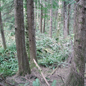
They had sketched out a plan for their fort, but it seemed that finding a level spot at least fifty feet square would be next to impossible.
Coyotes
Canis latrans
by Joseph A. Mussulman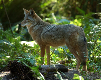
Clark shot “a Prarie Wollf, about the Size of a gray fox bushey tail head & ear like a wolf.” Lewis wrote his description of what proved to be a new species on 5 May 1805, in northeastern Montana.
Always the Wind
by Joseph A. Mussulman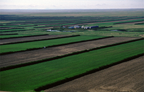
On 4 June 1805, while they were exploring the Maria’s River, Lewis and his men camped “among the willow bushes which defended us from the wind which blew hard from the N. W.” Homesteaders on the plains planted Shelterbelts to shield from strong wind and blowing snow.
The Headwaters by Air
Essential point
by Joseph A. Mussulman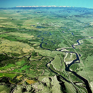
Upon the Corps’s arrival at this confluence on 25 July 1805, Lewis quickly recognized it as “an essential point in the geography of this western part of the Continent.”
Pompeys Pillar
Pompy's Tower
by Joseph A. Mussulman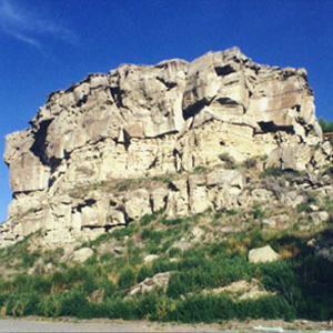
On 25 July 1806, Clark and his contingent of nine men, plus York, Toussaint Charbonneau, Sacagawea, and little Jean Baptiste, arrived at “a remarkable rock Situated in an extensive bottom, on the Star[boar]d. [south] Side of the river.”
The Shoshones’ Three Roots
Examining Shoshone foods
by Joseph A. Mussulman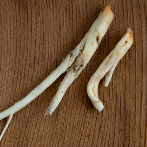
Lewis learned about three unfamiliar species of edible roots–a bushel of them altogether. The Shoshones who were encamped nearby helped him sort them out, and told him how they were customarily prepared.
A ‘Sinque’ Hole
Below the Smoking Place
by Joseph A. Mussulman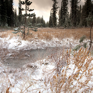
Private Whitehouse reported: “Camped at a Small branch on the mountain near a round deep Sinque hole full of water.”
Fiddle Music
Fiddle music on the trail
by Joseph A. Mussulman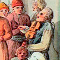
The principal catalyst for their musical diversions was undoubtedly Private Pierre Cruzatte, whose official duty was as a boatman, but who also played the fiddle.
Mosquito Netting
Pomp's 'bier' was a 'bar'
by Joseph A. Mussulman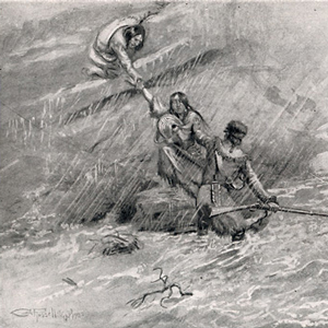
Lewis writes: “the bier in which the woman carrys her child and all it’s cloaths wer swept away as they lay at her feet she having time only to grasp her child.” This bier, then, is a bar or net serving to keep mosquitos from one’s personal blood supply.
Little Gate of the Mountain
Lewis's "second grand chain"
by Joseph A. Mussulman, Robert N. Bergantino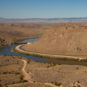
Before arriving at the three forks of the Missouri, Whitehouse wrote that they “passed some rough rockey hills, which we expect from the account we have from the Indian Woman that is with us, to be the commencement of the Second chain of the Rockey Mountains.
Spirit Mound by Air
"Unusual spirits"
by Joseph A. Mussulman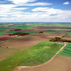
On 25 August 1804, obedient to Jefferson’s instruction to observe Indians traditions, monuments and landmarks, Lewis and Clark went inland to visit a “conic form” rising from the plain.
Oregon Grapes
Berberis aquifolium
by Joseph A. Mussulman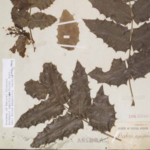
In his journal for 12 February 1806, Lewis described the plant that now goes by the name Berberis aquifolium, which he had first noticed in the vicinity of the Cascades of the Columbia River, about 145 miles from the ocean.
Dugout Canoes
by Joseph A. Mussulman
Altogether, the men carved 15 dugout canoes. At Fort Mandan they hewed 6 from cottonwood logs. West of the Rockies they used ponderosa pine logs to craft five new canoes. On the Yellowstone, Clark made two small dugouts a few miles above today’s Billings.
Fort Rock
Refuge at The Dalles
by Joseph A. Mussulman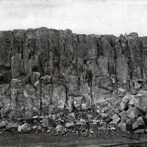
The party “Came too, under a high point of rocks on the Lard. Side below a creek”—Quenett (“salmon”), now Mill Creek—a “Situation well Calculated to defend our Selves,” and duly named their bivouac “Fort Rock Camp.”
Seaman’s Creek
Clues to his name
by Joseph A. Mussulman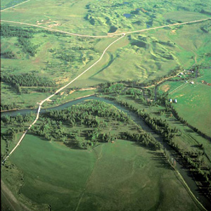
Twenty-eight and one-half miles upriver from their camp of 4 July 1806 the Indian road crossed a stream Lewis named after William Werner. At mile 31, they camped near the mouth of a stream the captain named after his dog, Seaman.
Clarkia
Clarkia pulchella
by James L. Reveal, Joseph A. Mussulman, Kristopher K. Townsend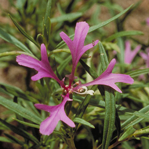
The plant’s common names include elkhorn, ragged robin, pink fairy, and deerhorn. In the spring of 1807 Lewis turned over his plant specimens to Frederick Pursh, who gave this flower the scientific name Clarkia pulchella
Floyd’s Monument by Air
"Much Lamented"
by Joseph A. Mussulman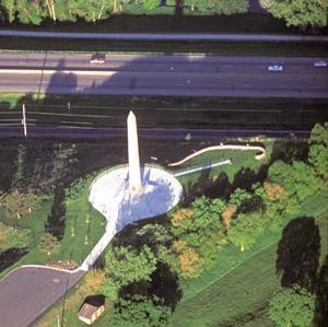
On 20 August 1804, the Corps proceeded thirteen miles, while young Floyd quickly grew worse. A little past noon they landed, and presently Floyd said, “I am going away.”
Grouse
by Joseph A. Mussulman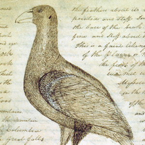
Why did Lewis call the spruce grouse, blue grouse, and Oregon ruffed grouse “Three species of Pheasants?” What species did he actually see?
The Two Medicine Formation
Dinosaur country
by Joseph A. Mussulman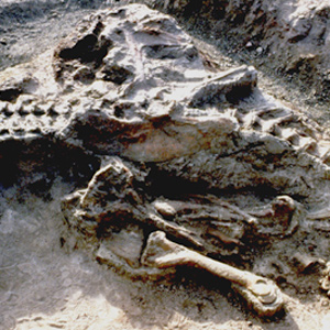
During his trips on the Marias in June 1805 and 1806, had he not been continually on the lookout for signs of those hostile Blackfeet Indians, Lewis just might have seen some fossils of marine shellfish.
Domestic Dogs
What Lewis was describing
by Joseph A. Mussulman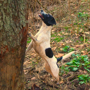
The Corps’ journalists, in their accounts of new species of mammals they encountered on the expedition, would occasionally call to mind comparable features of domestic canids whenever it was appropriate—in terms of their sizes, morphology, and “notes” or barks.
Jefferson’s Monticello
Source and paradigm
by Joseph A. Mussulman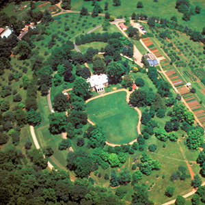
After some eight months of planning and discussion, President Thomas Jefferson handed his twenty-eight-year-old secretary, Captain Meriwether Lewis, a letter containing instructions for the conduct of one of the most significant undertakings in American history.
Pryor Mountains
Local lore and myths
by Joseph A. Mussulman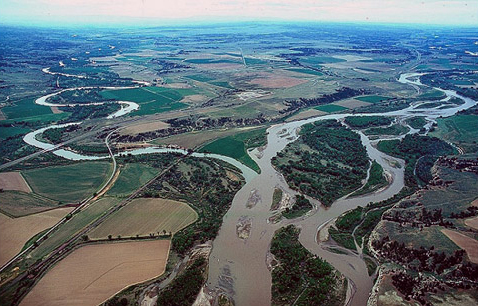
Pryor Creek begins in the Pryor Mountains 50 miles from its mouth, but coils into nearly 100 miles of creek bottom by the time it empties into the Yellowstone. Local lore maintains that Pryor traveled up this creek to those mountains.
St. Louis by Air
The western gate
by Joseph A. Mussulman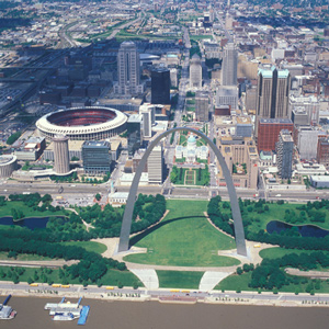
The expedition arrived on 7 December 1803, witnessed the transfer of Louisiana from Spain to the United States, and metaphorically passed through its western gate on 14 May 1804. They would not return until 23 September 1806.
Climbing Wendover Ridge
Leaving the Lochsa
by Joseph A. Mussulman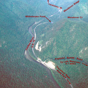
“Several horses Sliped and roled down Steep hills which hurt them verry much The one which Carried my desk & Small trunk Turned over & roled down a mountain for 40 yards & lodged against a tree, broke the Desk…”
Mountain Beavers
Aplodontia rufa (Sewelel)
by Joseph A. Mussulman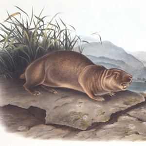
This secretive, primitive little rodent, which somewhat resembles the woodchuck and the muskrat, belongs to the same mammalian order, Rodentia, as the beaver, Castor canadensis, but otherwise they have nothing in common.
Spirit Mound
An elevation of devilish spirits
by Joseph A. Mussulman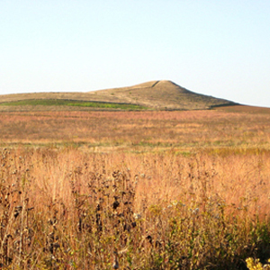
The visit to this prairie hill was among the more bizarre sidelights of the whole expedition, but evidently it was not entirely unexpected. Seventy-six years earlier, explorer Pierre La Véndrye called the place the “Dwelling of the Spirits.”
The Clearwater Canoe Camp
by Joseph A. Mussulman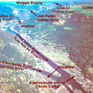
Still sick and exhausted from their recent crossing of the Bitterroot Mountains, Lewis, Clark, and their crew arrived on 26 September 1805, at what they called Canoe Camp, on the Clearwater River.
The Bears Paw Mountains
And the Sweet Grass Hills
by Joseph A. Mussulman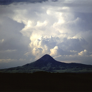
By his 5 June 1805 estimate, Meriwether Lewis was 38 miles up the Marias River from the expedition’s camp on the Missouri. To the northeast, he identified the Bears Paw Mountains and Sweet Grass Hills.
Pierre by Air
Standoff
by Joseph A. Mussulman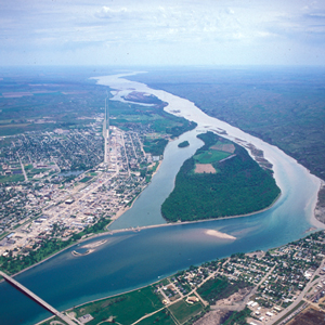
Lewis and Clark first met the Teton Sioux on 25 September 1804. One of Jefferson’s primary political objectives for the expedition was to create a peace treaty and trade agreement them, the most potent military and economic force on the lower Missouri.
End of the Enlightenment
Anti calomel and the "genteel tradition"
by Joseph A. Mussulman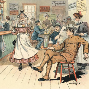
No more calomel! Not just an anthem, a reflection on the transition from the “Age of Enlightenment” to the “genteel tradition.”
Lower Portage Camp
Good news, bad news
by Joseph A. Mussulman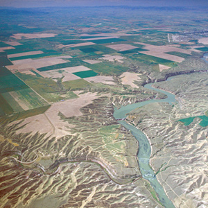
By the evening of 15 June 1805, Clark had gotten the canoes and the white perogue as close to the Great Falls as possible, and the next afternoon Lewis joined him at the “lower portage camp,” a mile below the mouth of Belt Creek.
Mapping the Lolo Trail
by Joseph A. Mussulman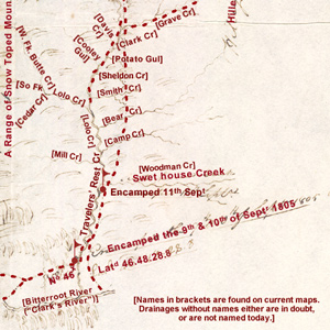
Clark did not randomly insert wiggly lines merely to hint at the topography around K’useyneiskit. By comparing his sketches with a modern USGS map we can make reasonably good guesses as to what drainages he actually saw.
Moose
Alces alces
by Joseph A. Mussulman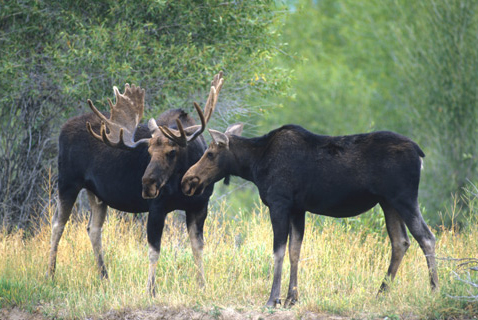
“Reubin Field wounded a moos deer this morning near our camp,” Lewis wrote on 7 July 1806, adding, “my dog much worried.”
Early American Flags
by Joseph A. Mussulman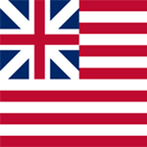
Lewis’s long list of needs for the journey would have been a large supply of American flags, to be flown on their boats, over their camps, and at their council sites. Leading up to the Lewis and Clark expedition, what did the young country’s flags look like?
Travelers’ Rest by Air
Turning point
by Joseph A. Mussulman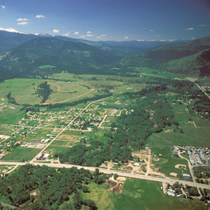
For three days the Corps rested here, gathering strength for the arduous 150-mile trek across the Bitterroot Mountains. The campsite was about two-thirds down in the photo, among the cottonwoods that shelter Lolo Creek.
The Osages
by Joseph A. Mussulman, Kristopher K. Townsend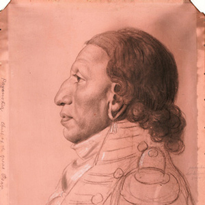
The Osage were experienced traders, exchanging horses and Indian slaves for French guns, knives, axes, kettles, and other metal objects. After the 1760s, the Osage adopted a new economic system of planting gardens in permanent villages, summer hunts in the plains, and fur-trapping in the winter.
Experience the Lewis and Clark Trail
The Lewis and Clark Trail Experience—our sister site at lewisandclark.travel—connects the world to people and places on the Lewis and Clark Trail.
Discover More
- The Lewis and Clark Expedition: Day by Day by Gary E. Moulton (University of Nebraska Press, 2018). The story in prose, 14 May 1804–23 September 1806.
- The Lewis and Clark Journals: An American Epic of Discovery (abridged) by Gary E. Moulton (University of Nebraska Press, 2003). Selected journal excerpts, 14 May 1804–23 September 1806.
- The Lewis and Clark Journals. by Gary E. Moulton (University of Nebraska Press, 1983–2001). The complete story in 13 volumes.
This site is provided as a public service by the
Lewis and Clark Trail Alliance
with additional funding from the following: