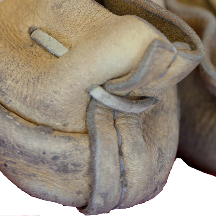
Kainai (Blood) Travois (1910)
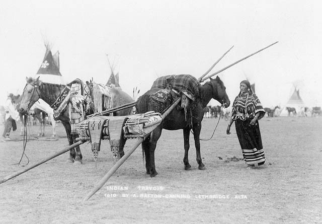
Photo by Arthur Rafton-Canning. Courtesy Library and Archives Canada PA-029769.
The horse dramatically increased travel distance. The travois above carries a tepee.
They commonly called themselves saokí•tap•ksi meaning ‘prairie people.’ The meaning ‘people with black feet’ comes from exonymns—the names given by other, external tribes. Historically, several related groups comprise the Blackfoot or Blackfeet people:
- Siksika (Blackfoot)
- Kainai or Kainah (Blood)
- Piikani (Piegan Blackfeet)
While Blackfoot is typically applied north of the 49th parallel and Blackfeet to those from the United States, linguistically they are all members of the Western division of the Algonquian language family. They also are members of the Blackfeet Confederacy which includes Atsinas, Arapahos, and Cheyennes.[1]Frederick Webb Hodge, Handbook of American Indians North of Mexico, Vol. 1 (Washington: Smithsonian Institution Bureau of American Ethnology, Government Printing Office, 1912), 138,570.
Prior to European contact, the Blackfeet had traded for horses via the Eastern Shoshone to the south and weapons and tools via the Cree to the East.[2]See on this site Indian Horses in the PNW. Thus armed and mounted, they dominated their neighbors, and after the first traders arrived, they sought to maintain that dominance.[3]Loretta Fowler and Regina Flannery, Handbook of North American Indians: Plains Vol. 15, ed. Raymond J. DeMallie (Washington, D.C.: Smithsonian Institution, 1978), 608, 623.
At the time of the Lewis and Clark Expedition, the captains avoided encounters with Blackfeet people as the Americans’ presence would be seen as a serious threat to their dominance over other tribes in the region. Despite that, Lewis risked a trip to locate the source of the Marias River. On his way back to the Great Falls of the Missouri, he did meet a group of young Blackfeet men. For more on that encounter, see The Marias River Risk and Fight on the Two Medicine.
For many years after the expedition, traveling, trapping, and trading in Blackfeet country was unusually risky. In 1810, near the Three Forks of the Missouri, expedition members George Drouillard and John Potts were killed by Blackfeet, and John Colter made his famous run to escape death at their hands.[4]For more on this period, see Blackfeet Confederacy and American Trappers, 1806–1840 by Jay H. Buckley.
Today, there are three First Nations governments in Canada, and in the United States, the Blackfeet Nation is a federally recognized tribe residing in Northern Montana.[5]“Blackfoot Confederacy,” Wikipedia, accessed on 25 November 2020, https://en.wikipedia.org/wiki/Blackfoot_Confederacy.
Selected Pages and Encounters
The Blackfeet Confederacy
Short tempers and long knives
by Jay H. Buckley
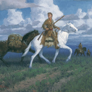
Next to grizzly bears and Mother Nature, the most feared enemy of American fur trappers traveling along the upper Missouri River were the Niitsítapi or Blackfeet, the “Original People” or “Prairie People.” Was that Lewis’s fault?
Montana’s Indian Country
Changes after the expedition
by Rick Newby
Beginning with the Fort Laramie Treaty of 1851, the U.S. government set the vast area north of the Missouri (approximately 20 million acres) aside as the “Blackfeet Hunting Ground” for the Blackfeet and other tribes—Cree, Assiniboine, Gros Ventre, and Sioux.
The Marias River Risk
"Of highest national importance"
by Joseph A. Mussulman
Why was it so important that Meriwether Lewis was willing to risk his life in a region occupied by the “Pahkees” or Minnetares, the Assiniboines, and other people whom he had been led—by their enemies, of course—to believe were “vicious and illy disposed”?
Blackfeet Songs
An interview with an elder
These songs are used in honorings, giveaways, recognition of society members, and respect for veterans. Blackfeet reporter Pelah Hoyt talked with Professor of Music Joseph Mussulman about the expedition and its music.
The Marias Massacre
My Lai on the Marias
by Joseph A. Mussulman
Some blame the ruin of the Blackfeet people on the Lewis and Clark Expedition. The story is far too complicated to be told fully in a few hundred words. Many foul deeds on both sides led up to the “the greatest slaughter of Indians ever made by U.S. troops.”
July 4, 1806
Dangerous roads
The expedition is divided into two groups, and today, both are on dangerous roads.
On the Blackfoot River, Lewis’s Nez Perce guides warn him about dangerous Indians, and they decline to continue. He travels east on “Cokahlahishkit”—the Road to the Buffalo—for eight miles. He also collects a specimen of mock orange, a species named in his honor.
On the Bitterroot River, Clark’s group must cross several creeks swollen from snows melting in the nearby Bitterroot Mountains. Despite there being no buffalo, whiskey, or tobacco, they celebrate the Fourth of July with a “Sumptious Dinner”.
July 17, 1806
Signs of danger
The expedition is split into four detachments separated by over 200 miles. On the plains north of the Great Falls of the Missouri, Lewis and his small group see a wounded bison, a sign that Indian hunters may be near.
On the Yellowstone River, Clark and his group scout for timber to make dugouts and see an “Indian fort” used by traveling war parties. He camps near present Reed Point, Montana.
Sgt. Ordway leads the paddlers down the Missouri navigating Pine Tree Rapids and passing Tower Rock. At the White Bear Islands, Sgt. Gass and his detail wait for the arrival of Ordway and the canoes.
July 23, 1806
Blackfeet and Apsáalooke near
The expedition travels in three groups separated by 200 miles. Due to clouds at Camp Disappointment, Lewis cannot make celestial observations. He is surprised to see Columbian ground squirrels east of the Continental Divide, and Drouillard sees signs that the Blackfeet are near.
On the Yellowstone, Clark’s group finishes two dugout canoes and begins making paddles and poles. They find signs that Apsáalooke (Crows) are trying to steal their remaining horses, and Sgt. Pryor is given his orders to take them to the Knife River Villages.
Sgts. Gass and Ordway lead the portage of the canoes around the Great Falls of the Missouri. After multiple breakdowns, they get two across Box Elder Creek and camp. Pvt. Weiser suffers a bad cut on his leg.
July 25, 1806
Pompy's Tower (Pompeys Pillar)
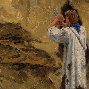
On this day, the expedition is split into four detachments spread out over 200 miles. On the Yellowstone River below present Billings, Montana, Clark names a rock Pompy’s Tower after Jean Baptiste Charbonneau—now known as Pompeys Pillar—and then, he carves his name and date into the rock. He also excavates a dinosaur fossil.
At Camp Disappointment on Cut Bank Creek, Lewis waits for the weather to clear so that he can take celestial observations. With signs of Blackfeet nearby, he decides that should tomorrow also be cloudy, he will leave for Decision Point at the mouth of the Marias.
At the Great Falls of the Missouri, another dugout is carted along the muddy portage to the Lower Portage Camp. During an outburst, they seek shelter under their canoes, but the rainwater runs under.
South of the Yellowstone, Sgt. Pryor and three others take the horses along a road that leads to the Knife River Villages. On or near this date, they pass present Pryor’s River.
July 26, 1806
A Blackfeet interview
The risk of splitting into four groups becomes overly apparent on this day. Lewis and his small group leave Camp Disappointment and head south. At the Two Medicine River, they are joined by a group of young Blackfeet and an uncomfortable and wary night ensues.
On their way to the Knife River Villages, Sgt. Pryor and his small group wake to find that all their horses have been stolen. They pursue the culprits’ tracks for ten miles before giving up. Later during the night, a wolf bites Pryor’s hand.
At the Great Falls of the Missouri, the men move the last dugout canoe along the muddy portage. All the dugouts are then taken to Lower Portage Camp.
Clark and his group paddle quickly down the Yellowstone River. Clark and Pvt. Labiche explore seven miles up the Bighorn River.
July 27, 1806
Fight with the Blackfeet
Today, the expedition travels in five separate groups along four different rivers. On the Two Medicine River, the young Blackfeet camping with Lewis and his small party attempt to steal rifles and horses. A fatal encounter ensues, and everyone takes flight.
Clark and his group paddle down the Yellowstone passing large herds of bison and elk and camping near present Forsyth, Montana.
South of Pompeys Pillar, Sgt. Pryor and three others are stranded without horses. They decide to haul their gear to the Yellowstone River and make bull boats.
Below the Great Falls of the Missouri, Sgt. Gass and Pvt. Willard swim the horses across the river and head towards the mouth of the Marias River. They camp on the Teton River.
At Lower Portage Camp, Sgt. Ordway and his group load the dugouts and white pirogue and paddle down the Missouri River intending to re-join Ordway tomorrow.
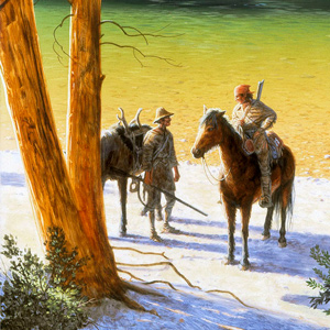
Fight on the Two Medicine
An "accedental interview"
by Joseph A. Mussulman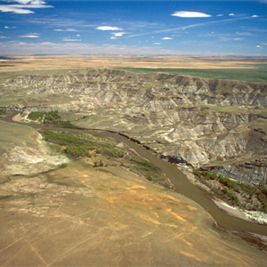
The Indians invited the Americans to share a campsite that night. At daybreak, despite the soldiers’ watchfulness, the Indians tried to steal the Americans’ guns and horses. That immediately erupted into a skirmish.
August 3, 1806
Clark reaches the Missouri
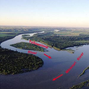
Reaching the mouth of the Yellowstone, Clark and his group stop to dry everything at their old camp of 26 April 1805. The mosquitoes are so thick that Clark cannot shoot accurately, yet he recommends the site for a fur trade post.
Many miles up the Missouri, Lewis and his group paddle seventy miles. To devote more time to paddling, he orders each mess to cook all they need for the next day. The hunting is good with 29 deer killed since yesterday morning.
Still on the Yellowstone, Sgt. Pryor and his group of three must navigate their small bull boats around the many bison crossing the river.
Notes
| ↑1 | Frederick Webb Hodge, Handbook of American Indians North of Mexico, Vol. 1 (Washington: Smithsonian Institution Bureau of American Ethnology, Government Printing Office, 1912), 138,570. |
|---|---|
| ↑2 | See on this site Indian Horses in the PNW. |
| ↑3 | Loretta Fowler and Regina Flannery, Handbook of North American Indians: Plains Vol. 15, ed. Raymond J. DeMallie (Washington, D.C.: Smithsonian Institution, 1978), 608, 623. |
| ↑4 | For more on this period, see Blackfeet Confederacy and American Trappers, 1806–1840 by Jay H. Buckley. |
| ↑5 | “Blackfoot Confederacy,” Wikipedia, accessed on 25 November 2020, https://en.wikipedia.org/wiki/Blackfoot_Confederacy. |
Experience the Lewis and Clark Trail
The Lewis and Clark Trail Experience—our sister site at lewisandclark.travel—connects the world to people and places on the Lewis and Clark Trail.
![]()
Discover More
- The Lewis and Clark Expedition: Day by Day by Gary E. Moulton (University of Nebraska Press, 2018). The story in prose, 14 May 1804–23 September 1806.
- The Lewis and Clark Journals: An American Epic of Discovery (abridged) by Gary E. Moulton (University of Nebraska Press, 2003). Selected journal excerpts, 14 May 1804–23 September 1806.
- The Lewis and Clark Journals. by Gary E. Moulton (University of Nebraska Press, 1983–2001). The complete story in 13 volumes.
This site is provided as a public service by the
![]()
Lewis and Clark Trail Alliance
with additional funding from the following:

