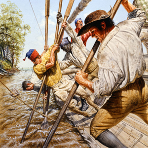
© Michael Haynes, https://www.mhaynesart.com. Used with permission.
On 14 May 1804—after more than a year of preparation and travel—the boats leave Camp River Dubois and head up the Missouri River. At St. Charles, the two captains, Clark’s slave York, interpreter George Drouillard, eight or nine French engagés, 34 enlisted men, and Lewis’s dog Seaman depart in three boats: the barge and two large pirogues.
Everyone quickly learns of the struggles and hazards of moving up the Missouri with its many sawyers and sandbars. Despite the overloaded boats and several close calls, they safely pass many landmarks made familiar by earlier traders from St. Louis.
Crossing the present state of Missouri and then heading north along the Kansas-Missouri border, they pass the homelands of the Omaha, Kansa, Otoe, and Pawnee. On 21 July, they reach the mouth of the Platte where only a handful of traders had ever continued north towards the Knife River Villages.
The Osages
by Joseph A. Mussulman, Kristopher K. Townsend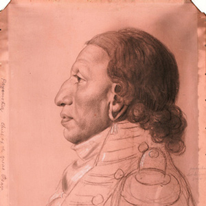
The Osage were experienced traders, exchanging horses and Indian slaves for French guns, knives, axes, kettles, and other metal objects. After the 1760s, the Osage adopted a new economic system of planting gardens in permanent villages, summer hunts in the plains, and fur-trapping in the winter.
The Kickapoos
Always on the move
by Kristopher K. Townsend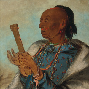
Perhaps more than any North American people, the Kickapoo exemplify the transitory nature of the native nations encountered during the Lewis and Clark Expedition. In 1803, there was at least one village near Ste. Genevieve on the Mississippi River.
The Otoes and Missourias
by Kristopher K. Townsend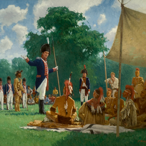
At the time of the expedition, the nation from which the Missouri River derived its name were so reduced by smallpox and attacks that they had abandoned their villages and merged with other tribes—Kansas, Osages, but primarily, the Otoes.
The Sauks and Foxes
by Kristopher K. Townsend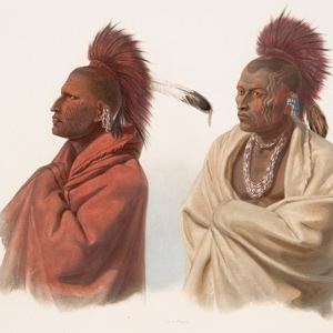
To outsiders in 1803, the Sauk and Fox people living on the Mississippi River in Illinois, Iowa, and Wisconsin were seen as one people. Both peoples spoke the Sauk-Fox-Kickapoo dialect of Algonquian and had similar cultures and economies.
The Pawnees
by Kristopher K. Townsend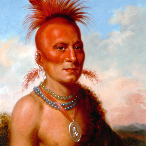
Although Clark referred to the Pawnee often and included them in the Estimate of the Eastern Indians, the journals do not document any face-to-face encounters.
The Omahas
by Kristopher K. Townsend
The captains appeared eager to meet with the Omaha. They tried to find them at their two biggest villages and planted a flag at the gravesite of the chief who for many years had controlled trade in the region, the infamous Blackbird.
The Kansas
by Kristopher K. Townsend
Known in the journals as Kanzas, Kansas, Kansias, Kansies, Kar sea, and Kah they are popularly called the ‘People of the South Wind’. At the mouth of the Kansas River, the captains ordered a defensive wall built, but no Kansa warriors appeared.
Searching for Lead
by John W. Jengo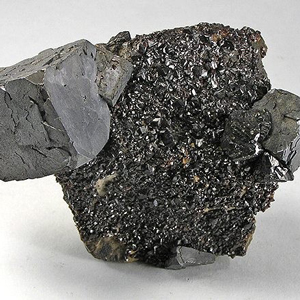
In the afternoon of 4 June 1804, William Clark decided to investigate the purported occurrence of lead in the vicinity of a rather unique prominence he named “Mine Hill,” but which is known today as Sugar Loaf Rock. The search was unsuccessful, but Lewis’s previous inquiries while in St. Louis resulted in 11 specimens sent to Thomas Jefferson.
Missouri River Hazards
The travails of river travel
by Joseph A. Mussulman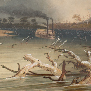
“So far, we have experienced more difficulty from the navigation of the Missouri, than danger from the Savages. The difficulties which oppose themselves to the navigation of this immence river, arise from the rapidity of it’s current, it’s falling banks, sandbars, and timber”
Synopsis Part 1
Washington City to Fort Mandan
by Harry W. Fritz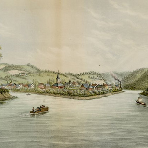
The Corps of Discovery, as it would be called, or the “corps of volunteers for North Western Discovery,” as Lewis put it, epitomized the rising glory of the United States—its sense of limitless possibilities and unparalleled opportunities.
The Barge
Barge, keelboat, or just 'the boat'?
by Joseph A. Mussulman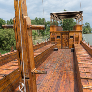
Meriwether Lewis listed a “Keeled Boat” in his pre-expedition shopping list, but after he finally got it, he and the other journalists of the Corps of Discovery simply called it “the boat” (190 times) or, less often, “the barge” (32 times).
St. Louis
Gateway to the west
by Frances H. Stadler![]()
In 1804 and in the presence of the Lewis and Clark expedition the little village, built and designed to be an outpost of the fur trade, shed its ambiguous Spanish-French parentage and took on full American citizenship.
The Mouth of the Missouri
by Joseph A. Mussulman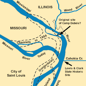
The Missouri River still contributes its tint a few miles north of St. Louis. It is difficult to determine exactly how much, and how often, the confluence of the Missouri and the Mississippi Rivers changed during the nine decades after the Lewis and Clark Expedition.
St. Charles
Petites Côtes
by Joseph A. Mussulman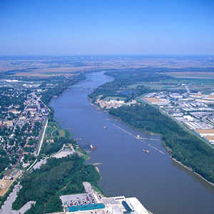
With Captain Clark in sole command, the Corps of Volunteers for North Western Discovery left the mouth of Wood River on 14 May 1804. The flotilla was comprised of the barge and two pirogues. Clark and the men “proceeded on under a jentle brease,” bound for St. Charles.
Church in St. Charles
by Joseph A. Mussulman
On the first Sunday after leaving Camp River Dubois, Joseph Whitehouse wrote that some of the party “went to church, which the french call Mass, and Saw their way of performing &c.”
La Charrette
Outpost
by Joseph A. Mussulman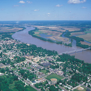
On 25 May 1804, about forty river-miles above St. Charles, the expedition camped near a small village at the mouth of a creek called Charrette. Its seven French families had arrived only a few years before. The family of Daniel Boone moved there sometime after 1804.
The Osage River
"a delightfull prospect"
by Joseph A. Mussulman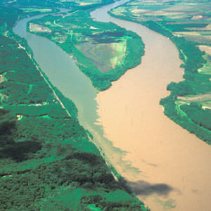
On 1 June 1804, the expedition arrived at the mouth of the Osage River, one of the major Indian trail intersections on the lower Missouri. From the height on the point, Clark wrote: “I had a delightfull prospect of the Missouries up & down, also the Osage R. up.”
Jefferson City
"Nightengale" song
by Joseph A. Mussulman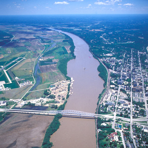
On Sunday, 3 June 1804, the expedition left its camp at the mouth of the Osage River and proceeded five miles upstream to the mouth of the Moreau River. There, Clark wrote, he and George Drouillard, “Saw much sign of war parties of Inds. having Crossed from the mouth of this Creek.”
Arrow Rock
Handsome spot
by Joseph A. Mussulman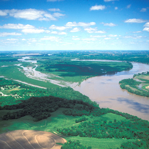
It was a hard and dangerous day’s work getting past the wooded bluff called Arrow Rock on 9 June 1804. It was a “disagreeable and Dangerous situation,” wrote Clark.
Driftwood Danger
An embarras (obstacle)
by Joseph A. Mussulman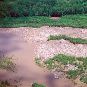
The Missouri spawned countless hazards such as a drift or raft of logs—an embarras, or “obstacle,” as the French engagés called it.
Malta Bend
"butifull prarie"
by Joseph A. Mussulman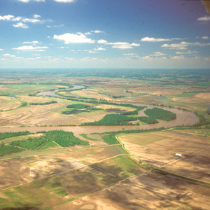
On 16 June 1804, Clark took a long walk through a “butifull extensive Prarie” to look for an old fort on Evans’s map, built by the French thereabouts more than eighty years earlier. The party spent three days here making new oars and ropes, and hunting.
The Kansas River
by Joseph A. Mussulman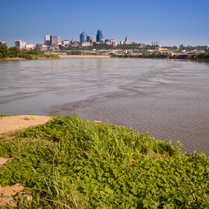
Clark was informed by one of the engagés who had traded along the Kansas that the river took its name from the Indians known as the Kanzes, or Kaw, nation which at that time dwelt on its banks.
The Kansas River Observations
27–29 June 1804
by Robert N. Bergantino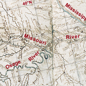
Celestial observations at the Kansas and Missouri river confluence began shortly after 8 a.m. on 27 June 1804. The first observation would provide the data necessary to calculate the magnetic declination.
St. Joseph by Air
Bad medicine
by Joseph A. Mussulman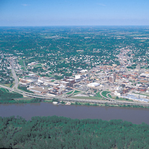
Pvt. Robert Frazer came close to being the expedition’s first fatality, for he was “verry Sick, struck with the Sun.” Probably his affliction would be diagnosed today as either heat exhaustion or sunstroke.
Experience the Lewis and Clark Trail
The Lewis and Clark Trail Experience—our sister site at lewisandclark.travel—connects the world to people and places on the Lewis and Clark Trail.
![]()
Discover More
- The Lewis and Clark Expedition: Day by Day by Gary E. Moulton (University of Nebraska Press, 2018). The story in prose, 14 May 1804–23 September 1806.
- The Lewis and Clark Journals: An American Epic of Discovery (abridged) by Gary E. Moulton (University of Nebraska Press, 2003). Selected journal excerpts, 14 May 1804–23 September 1806.
- The Lewis and Clark Journals. by Gary E. Moulton (University of Nebraska Press, 1983–2001). The complete story in 13 volumes.
This site is provided as a public service by the
![]()
Lewis and Clark Trail Alliance
with additional funding from the following:

