Peter Weiser
(1781–unknown), Private
by Barbara Fifer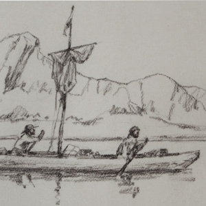
Weiser was a member of Sgt. John Ordway’s detachment that paddled the canoes back to the Great Falls. During the 1806 portage around the Falls of the Missouri, he suffered a disabling accident.
(1781–unknown), Private
by Barbara Fifer
Weiser was a member of Sgt. John Ordway’s detachment that paddled the canoes back to the Great Falls. During the 1806 portage around the Falls of the Missouri, he suffered a disabling accident.
Lewis's great medicine
by Joseph A. Mussulman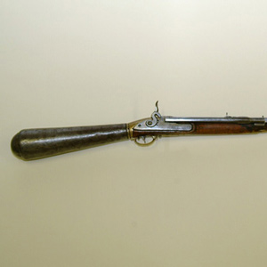
Thomas Rodney stated: “It is a curious piece of workmanship not easily described and therefore I omit attempting it.” Of the Indians, Lewis wrote that it “astonishes them very much, they cannot comprehend it’s shooting so often and without powder.”
Upper Missouri developers
by Joseph A. Mussulman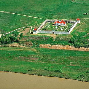
This is where, in 1828, John Jacob Astor’s American Fur Company built Fort Union, which remained the axis of Indian-American commerce on the Upper Missouri until the late 1860s.
22 December 1804–3 April 1805
by Robert N. Bergantino
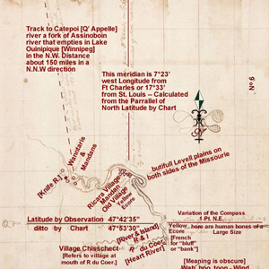
In January 1798, Thompson took celestial observations at the villages and determined them to be at a latitude of 47°17’22″N and a longitude of 101°14’24″W. Why then did Lewis and Clark think it necessary to take twenty-six observations?
Expedition souvenirs and specimens
by Elizabeth Chew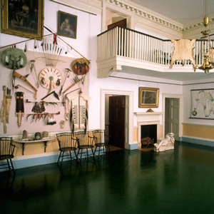
Bostonian George Ticknor catalogued the “strange furniture” of the four walls of the room after his visit in 1815, listing heads and horns, “curiosities which Lewis and Clark found on their wild and perilous expedition,” mastodon bones, and the two Native American painted hides.
Filling in the blank
by Joseph A. Mussulman
Islands had hidden it from view on the westbound trip, but early on 2 April 1806 some Indians visiting their camp happened to mention it. Clark picked six of his soldiers, hired an Indian guide, and went back to see it.
While wintering over at Fort Mandan, Clark made a series of maps based on Indian information and previous traders such as John Evans and François Larocque.
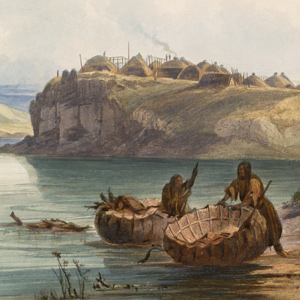
After the 1781 smallpox epidemic, the Mandan had moved into to a more defensible position in two villages immediately south of the Hidatsa at the Knife River. The Mandan-Hidatsa alliance had developed many years prior, and the two tribes previously shared their large hunting territory to the west.
Meriwether Lewis met Nicholas Jarrot in Cahokia on 7 December 1803. The next day, he and Cahokia postmaster John Hay served as translators when Lewis met the Spanish Governor of Upper Louisiana, Carlos Dehault Delassus.
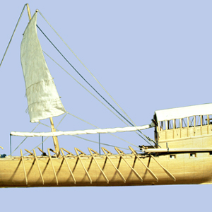
Starting at Pittsburgh, traveling to the Pacific Ocean, and then returning to St. Louis, the Lewis and Clark Expedition traveled approximately 10,600 miles. Of that, 85%—over 9,000 miles—was by boat. To understand travel in the early 1800 American West is to understand the boats and challenges of river navigation.
Arikara guide and diplomat
by Clay S. Jenkinson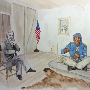
This Arikara leader rode upriver with the expedition in the weeks that followed to negotiate a peace settlement with the Mandan. In the spring of 1805 he went down river with the barge to St. Louis. After a series of delays, he went to Washington, DC, to meet with President Jefferson.
Going large and strong
by Arlen J. Large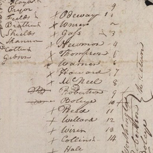
On 22 December 1803, Drouillard arrived at Clark’s Camp Dubois with the eight lost soldiers from South West Point. They were a disappointing lot, except for Corporal Richard Warfington.
The northernmost extent
by Joseph A. Mussulman
In 1806, Lewis, Drouillard, Joe Field, and Reubin Field made a second excursion up the Marias, this time on horseback. The four men reached the northernmost point of the Expedition’s exploration on 22 July 1806, camping on the south side of today’s Cut Bank Creek.
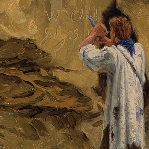
Members of the Lewis and Clark expedition carved, burned, or painted their names or initials and the dates when they did so, more than fourteen times according to the journals. They were practicing what had long been European explorers’ legitimate means for claiming dominion over other people’s land.
Three Forks after the expedition
by Joseph A. Mussulman, Robert N. Bergantino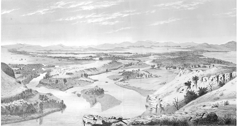
After the expedition, the Three Forks area would see the death of Potts and Drouillard, the start of Colter’s famous run, and an emerging frontier lifestyle in Gallatin City, later to be known as Three Forks, Montana.
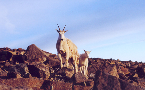
We confront the paradox that Elliott Coues pointed out in 1893—that Lewis and Clark had mistaken goats with wool … for sheep, and sheep without wool . . . for ibexes. Succeeding naturalists heightened the misunderstanding with invidious comparisons.
Cataloger of expedition plants
by James L. Reveal
During the winter of 1807-1808, Pursh lived at the home of Bernard McMahon in Philadelphia. Here he worked on the drawings and descriptions of Lewis’s western plants.
Incompleat Anglers
by Robert R. Hunt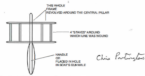
Lewis knew before embarking on his mission that there would be a pack of fish in his future. In Philadelphia in the summer of 1803, preparing for the expedition, he visited the “Old Experienced Tackle Shop” kept by George R. Lawton, a dealer in “all kinds of Fishing Tackle for the use of either Sea or River.”
(possibly 1778–unknown), Private
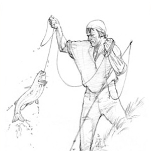
Silas Goodrich was the expedition’s principal fisherman. He also did well when trading for food with Indians from time to time.
Key landmark on the Old North Trail
by Joseph A. Mussulman
The Bears Tooth was an important landmark on the the ancient Indian road that has come to be known as the Old North Trail. It was included on Nicholas King’s 1804 map, and the captains expected to find it.
This page was funded in part by a grant from the National Park Service's Challenge Cost Share Program.
This site is provided as a public service by the![]()
Lewis and Clark Trail Alliance
with cooperation and funding from the following organizations:
Unless otherwise noted, journal excerpts are from The Journals of the Lewis and Clark Expedition, edited by Gary E. Moulton, 13 vols. (Lincoln: University of Nebraska Press, 1983-2001).