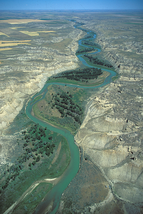
Not knowing which river is the Missouri, the captains take small groups on scouting trips. Lewis heads up the northerly fork—the Marias—where he finds prickly pears troublesome. Clark finds the other fork—the Missouri—rapid and crowded with islands and gravel bars. At the Decision Point base camp Joseph Field barely escapes an attacking grizzly bear.
Missouri and Teton Rivers
© 29 June 2013 by Kristopher K. Townsend. Permission to use granted under the Creative Commons Attribution-Share Alike 4.0 International license.
This view looks up the Missouri River from Rowe Bench. The Teton River valley is beyond the thin ridge in the middle of the photo.
Scouting Trips
Capt. Lewis and 6 men Set out to go up the right hand fork. Capt Clark & 5 more Set out at the Same time to go up the left hand fork in order to go one day & a halfs march up the River and see if they can find out which will be our best River to proceed on.
—John Ordway
Rapid Missouri River
The river is rapid & Closely himed on one or the other Side with high bluffs, Crouded with Islands & graveley bars Containing but a Small quantity of timber on its bottoms & none on the high land.
—William Clark
Grizzly Escape
In the evening we went towards the river to encamp, where one of the men [Joseph Field] having got down to a small point of woods on the bank, before the rest of the party, was attacked by a huge he-bear, and his gun missed fire. We were about 200 yards from him, but the bank there was so steep we could not get down to his assistance: we, however, fired at the animal from the place where we stood and he went off without injuring the man.
—Patrick Gass
Plains above the Marias
© 28 June 2013 by Kristopher K. Townsend. Permission to use granted under the Creative Commons Attribution-Share Alike 4.0 International license.
One Continued Plain
the whole country in fact appears to be one continued plain to the foot of the mountains or as far as the eye can reach; the soil appears dark rich and fertile yet the grass is by no means as high nor dose it look so luxurient as I should have expected, it is short just sufficient to conceal the ground.
—Meriwether Lewis
Prickly Pears
great abundance of prickly pears which are extreemly troublesome; as the thorns very readily perce the foot through the Mockerson; they are so numerous that it requires one half of the traveler’s attention to avoid them
—Meriwether Lewis
Other Sightings
Weather Diary
State of the thermometer at rise
Weather Wind at rise
State of the thermometer at 4 OC. P.M. Weather Wind at 4 OC. P. M. State of river 48 [above 0] fair after cloudy N E 61 [above 0] fair S W fall ¾ in. —Meriwether Lewis[1]To assist the reader, the editor of this web page has omitted the date column, merged the “State of the river” columns, and spelled out some abbreviations.
Experience the Lewis and Clark Trail
The Lewis and Clark Trail Experience—our sister site at lewisandclark.travel—connects the world to people and places on the Lewis and Clark Trail.
Plan a trip related to June 4, 1805:

Decision Point is a High Potential Historic Site along the Lewis and Clark National Historic Trail managed by the U.S. National Park Service. The site is open to the public and managed by the Bureau of Land Management.
Notes
| ↑1 | To assist the reader, the editor of this web page has omitted the date column, merged the “State of the river” columns, and spelled out some abbreviations. |
|---|


