On the Yellowstone River below present Billings, Montana, Clark names a rock Pompy’s Tower after Jean Baptiste Charbonneau—now known as Pompeys Pillar—and then, he carves his name and date into the rock. He also excavates a dinosaur fossil.
At Camp Disappointment on Cut Bank Creek, Lewis waits for the weather to clear so that he can take celestial observations. With signs of Indians nearby, he decides to leave tomorrow if the skies are still cloudy.
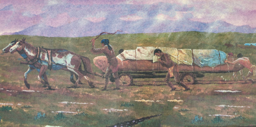
At the Great Falls of the Missouri, another dugout is carted along the muddy portage route to reach Lower Portage Camp. They seek shelter under their canoes, but the rainwater runs under them.
Sgt. Pryor and three others are taking horses along a road that leads to the Knife River Villages. On or near this date, they pass present Pryor’s River.[1]For more on the captains’ strategy and various groups after leaving Travelers’ Rest, see Dividing Forces at Travelers’ Rest.
Pompeys Pillar
by Yellowstone Public Radio[2]Originally aired weekdays by Yellowstone Public Radio during the Bicentennial observance of 2003-2006. Narrated by Hal Hansen. Scripts by Whit Hansen and Ed Jacobson. Produced by Leni Holliman. © … Continue reading
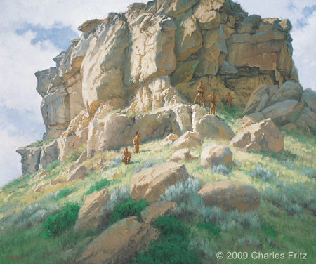
Pompy’s Tower—July 25, 1806
30″ x 36″ oil on canvas
© 2009 by Charles Fritz. Used by permission.
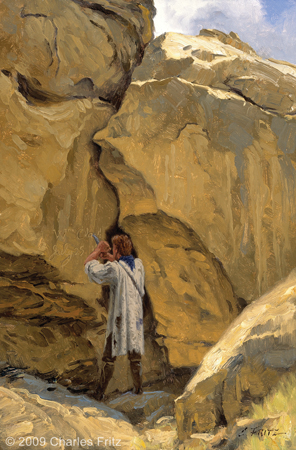
Wm. Clark—July 25, 1806
15″ x 10″ oil on board
© 2009 by Charles Fritz. Used by permission.
Clark at Pompeys Pillar
Pompy’s Tower
at 4 P M arived at a remarkable rock Situated in an extensive bottom on the Stard. Side of the river & 250 paces from it . . . . this rock I ascended and from it’s top had a most extensive view in every direction.
—William Clark
Yellowstone River Graffiti
The nativs have ingraved on the face of this rock the figures of animals &c. near which I marked my name and the day of the month & year.
—William Clark
Dinosaur Bone
I employed my Self in getting pieces of the rib of a fish which was Semented within the face of the rock this rib is inchs in Secumpherance about the middle it is 3 feet in length tho a part of the end appears to have been broken off I have Several peces of this rib
—William Clark
Lewis Increasingly Worries
Indian Signs
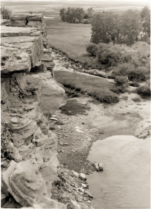
they informed me that it was about 10 miles to the main branch of Maria’s River . . . . here they found some wintering camps of the natives and a great number of others of a more recent date or that had from appearance been evacuated about 6 weeks; we consider ourselves extreemly fortunate in not having met with these people.
—Meriwether Lewis
Lewis’s Reluctance
I determined that if tomorrow continued cloudy to set out as I now begin to be apprehensive that I shall not reach the United States within this season unless I make every exertion in my power which I shall certainly not omit when once I leave this place which I shall do with much reluctance without having obtained the necessary data to establish it’s longitude
—Meriwether Lewis
Disappointing Fate
as if the fates were against me my chronometer from some unknown cause stoped today, when I set her to going she went as usual.
—Meriwether Lewis
Gass and Ordway are Wet and Muddy
halted as much as we were able to help the horses as the place So amazeing muddy & bad. in the evening we got to portage Creek and Camped. rained verry hard and we having no Shelter Some of the men and myself turned over a canoe & lay under it others Set up by the fires. the water run under us and the ground was covred with water.
—John Ordway
Pryor’s Broken Country
The Country through which St. Pryor Passed after he parted with me is a broken open Country. he passed one Small river which I have Called Pryors river which [Nicholas Biddle: rises] in a Mtn. to the South of Pompys tower.
—William Clark (recorded 8 August 1806)
Weather Diaries
State of the weather at rise
Wind at rise
State of the weather at 4 P. M. Wind at 4 P. M. cloudy after rain N W cloudy after rain N W rained and wind violent all day and night.
—Meriwether Lewis
State of the weather at Sun rise Wind at Sun rise State of the weather at 4 P. M Wind at 4 P M. cloudy E cloudy after rain S W rained from 3 to 4 P M yesterday but Slight. rained Several Showers Several Showers of rain with hard winds from the S and S W the fore part of the day. the brooks on each Side are high and water muddye
—William Clark[3]To assist the reader of this web page, the date column is omitted and some abbreviations have been spelled out.
Experience the Lewis and Clark Trail
The Lewis and Clark Trail Experience—our sister site at lewisandclark.travel—connects the world to people and places on the Lewis and Clark Trail.
Plan a trip related to July 25, 1806:
- Cut Bank Creek Coulee Trail (Lewis)
- Pompeys Pillar National Monument (Clark)
- Knife River Indian Villages (Pryor)
- Lower Portage Staging Area (Gass and Ordway)

Camp Disappointment is a High Potential Historic Site along the Lewis and Clark National Historic Trail managed by the U.S. National Park Service. The site is on private property within the Blackfeet Indian Reservation.
Pompeys Pillar is a High Potential Historic Site along the Lewis and Clark National Historic Trail managed by the U.S. National Park Service. The site and interpretive center is managed by the U.S. Bureau of Land Management.
The Great Falls Portage is a High Potential Historic Site along the Lewis and Clark National Historic Trail managed by the U.S. National Park Service. It includes Sulphur Springs (open to the public) and Lower Portage camp site (private land), and the Upper Portage Camp Overlook.
Notes
| ↑1 | For more on the captains’ strategy and various groups after leaving Travelers’ Rest, see Dividing Forces at Travelers’ Rest. |
|---|---|
| ↑2 | Originally aired weekdays by Yellowstone Public Radio during the Bicentennial observance of 2003-2006. Narrated by Hal Hansen. Scripts by Whit Hansen and Ed Jacobson. Produced by Leni Holliman. © 2003 by Yellowstone Public Radio. |
| ↑3 | To assist the reader of this web page, the date column is omitted and some abbreviations have been spelled out. |


