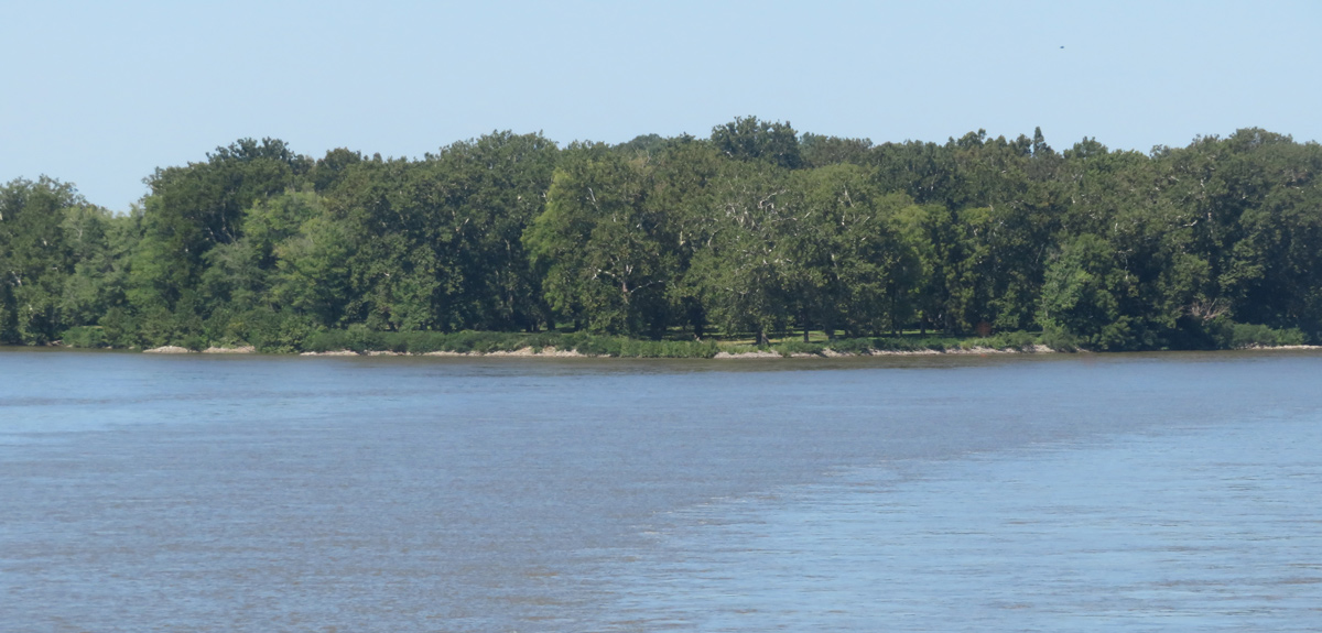
With a dry night and no morning fog, the expedition moves down the Ohio River before sunrise. They safely pass a rapid near the present community of Letart Falls, and Lewis writes his last known journal entry until 11 November 1803.
Lewis Passes Letart’s Falls
we set out before sunrise and at nine in the morning passed Letart’s falls . . . . this rappid is the most considerable in the whole course of the Ohio, except the rappids as they ar called opposite to Louisville in Kentuckey— the descent at Letart’s falls is a little more than 4 four feet in two hundred fifty yards.
—Meriwether Lewis
Cramer’s Description, 1802
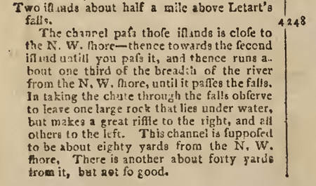
Figure 2
Zadok Cramer, The Navigator, 1802, from archive.org, accessed on 24 December 2018.
Transcription:
Two islands about half a mile above Letart’s falls. 248 [miles]
The channel pass those islands is close to the N. W. shore—thence towards the second island untill you pass it, and thence runs about one third of the breadth of the river from the N. W. shore, until it passes the falls. In taking the chute through the falls observe to leave one large rock that lies under water, but makes a great riffle to the right, and all others to the left. This channel is supposed to be about eighty yards from the N. W. shore. There is another about forty yards from it, but not so good.[1]Zadok Cramer, The Navigator: Containing Directions for Navigating the Monongahela, Allegheny, Ohio and Mississippi Rivers… (Pittsburgh: Zadok Cramer, Bookseller & Stationer, 1802), 28.
Descriptions of Letart’s Falls
On 27 September 1803, nine days after Lewis, Thomas Rodney navigated the rapid at Letart Falls. He found the passage easy and regretted having hired a local river pilot:
[T]he torrent and the white caps over the falls was a sufficient direction. There was no danger but one large rock in the midst of the falls, which was easily seen; and the Ohio Pilot directed us close on the left of it, which road our pilot kept, and we were over them in an instant; and when safe we set the pilot ashore, and gave him 3/9 for his trouble.
—Thomas Rodney[2]Dwight L. Smith and Ray Swick, ed., A Journey Through the West: Thomas Rodney’s 1803 Journal from Delaware to the Mississippi Territory (Athens: Ohio University Press, 1997), 78.
Rodney’s “Ohio Pilot” is a reference to the description in Cramer’s Navigator shown and transcribed in the figure. In normal water conditions, the large rock was underwater creating a potential unseen water hazard. Here, Lewis and Rodney benefited from the low water conditions by exposing this hidden hazard. The rocks creating the rapids were later removed, and in Cramer’s 1814 description, there is no mention of it.[3]Zadok Cramer, The Navigator: Containing Directions for Navigating the Monongahela, Allegheny, Ohio and Mississippi Rivers . . . (Pittsburgh: Cramer, Spear and Eichbaum, 1814), 91.
Experience the Lewis and Clark Trail
The Lewis and Clark Trail Experience—our sister site at lewisandclark.travel—connects the world to people and places on the Lewis and Clark Trail.
Plan a trip related to September 18, 1803:

Notes
| ↑1 | Zadok Cramer, The Navigator: Containing Directions for Navigating the Monongahela, Allegheny, Ohio and Mississippi Rivers… (Pittsburgh: Zadok Cramer, Bookseller & Stationer, 1802), 28. |
|---|---|
| ↑2 | Dwight L. Smith and Ray Swick, ed., A Journey Through the West: Thomas Rodney’s 1803 Journal from Delaware to the Mississippi Territory (Athens: Ohio University Press, 1997), 78. |
| ↑3 | Zadok Cramer, The Navigator: Containing Directions for Navigating the Monongahela, Allegheny, Ohio and Mississippi Rivers . . . (Pittsburgh: Cramer, Spear and Eichbaum, 1814), 91. |


