Among the Blackfoot
Philip Turnor (center) and Peter Fidler (left)
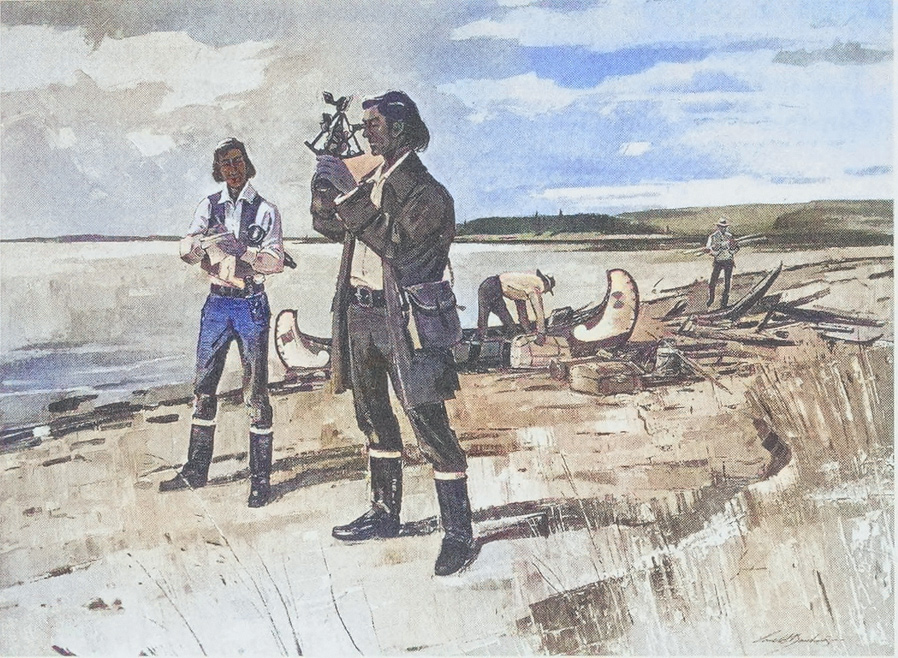
Derived from an oil painting by Lorne Bouchard, Hudson’s Bay Company Archives, Provincial Archives of Manitoba.
Peter Fidler (1769–1822) was a trader, surveyor, and ethnographer who played a pivotal role in mapping the Canadian Rockies and the Missouri River watershed. Employed by the Hudson’s Bay Company from 1791 to 1822, Fidler ventured into remote regions of North America and was the first to survey and map the courses of the North and South Saskatchewan rivers.[1]J. G. MacGregor, Peter Fidler: Canada’s Forgotten Explorer 1769–1822 (Calgary, Alberta: Fifth House Publishers, 1998), XVI, archive.org/details/peterfidlercanad0000macg. His efforts contributed significantly to the understanding of the continent’s vast and largely uncharted landscapes prior to the Lewis and Clark Expedition.
During the winter of 1801–1802, Fidler solicited five maps from three “Blackfoot chiefs”—Ackomokki, Kioocus, Ackoweeak—and an unnamed “Fall Indian” (Atsina). Fidler’s “Maps & Papers” arrived in London in late October 1802 and Alexander Lean, the HBC Governor, forwarded them to Aaron Arrowsmith who updated his own map. On 17 June 1803, Thomas Jefferson ordered a copy from James Cheetham and Fidler’s new geographical information made its way into the maps carried by captains Clark and Lewis. (See figures below.)[2]Belyea, Barbara. “Mapping the Marias: The Interface of Native and Scientific Cartographies.” Great Plains Quarterly 17, no. 3/4 (1997): 165–84, www.jstor.org/stable/23533206 accessed 17 … Continue reading
Unquestionable Veracity
When attempting to ascertain the true Missouri River at Decision Point, the captains scrutinized Fidler’s geographical information as placed on Arrowsmith’s map. On 8 June 1805, Meriwether Lewis took a break, downed some “grog” from a nearby spring, and pondered:
I now began more than ever to suspect the varacity of Mr. Fidler or the correctness of his instruments. for I see that Arrasmith in his late map of N. America has laid down a remarkable mountain in the chain of the Rocky mountains called the tooth nearly as far South as Latitude 45°, and this is said to be from the discoveries of Mr. Fidler.[3]The Definitive Journals of Lewis & Clark, Gary Moulton, ed. (Lincoln: University of Nebraska Press, 2002), 4:266–67.
On Ackomokki’s map, the Missouri River is a straight line terminating at the Rocky Mountains. The previous winter, the captains were told the Missouri would bend far to the south. According to their map, the Bears Tooth should be a notable landmark near the Missouri’s source. The Bears Tooth would not be seen until mid-July—neither recognized by the captains nor near the river’s end. When transferring Fidler’s Native information into a European-style map, Arrowsmith removed Fidler’s ethnographic annotations including the title: “An Indian map of the Different Tribes . . .” (emphasis added). In the context of Arrowsmith’s maps, the captains naturally assumed that Fidler had traveled to these locations and laid down the landmarks based on compass and sextant observations. Had they seen Ackomokki’s map, the captains would have likely reconciled the information they had learned at the Knife River villages with Fidler’s additions. Fidler’s veracity can not be questioned. His report provided a far richer and more valuable geographic report than any of the maps carried by the captains.
Arrowsmith’s Map (Detail)
The Captains’ Reference

Courtesy U.S. Library of Congress.[4]Arrowsmith, Aaron, and J Puke. A map exhibiting all the new discoveries in the interior parts of North America (London: A. Arrowsmith, 1802) Map, www.loc.gov/item/2001620920/.
For purposes of Fidler’s contributions, the 1803 map drawn by Nicholas King at the request of Albert Gallatin for the use of the Lewis and Clark Expedition is nearly identical to Arrowsmith’s for the area shown above. We don’t know why the captains never mention King’s map. Since they knew King derived much of his map from Arrowsmith, they may have considered King’s version a copy of “Arrowsmith’s Map”. Or they may simply have preferred Arrowsmith’s map over King’s.
Ackomokki’s 1801 Map (Detail)
What Fidler Reported
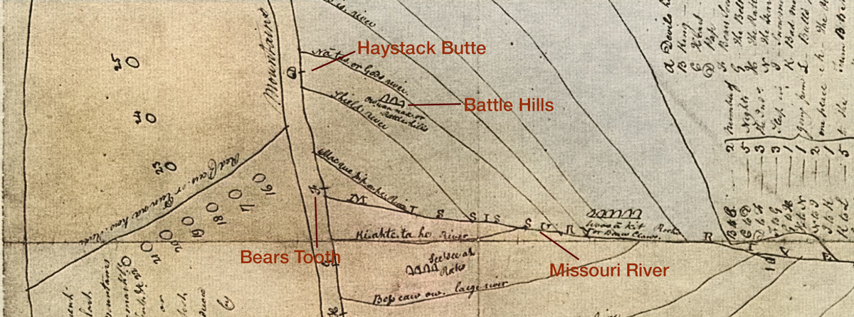
Courtesy of Hudson’s Bay Company Archives, Provincial Archives of Manitoba.[5]“An Indian map of the Different Tribes that inhabit the East & West Side of the Rocky Mountains with all the rivers & other remarkbl. places, also the number of Tents etc. Drawn by the … Continue reading
That the Missouri River runs in a nearly straight line instead of bending to the south is consistent with virtually all Native American maps that emphasized relationships over distance and proportion.
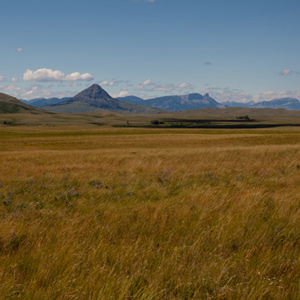
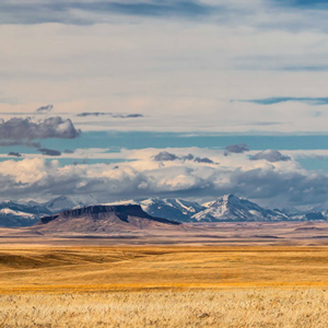
Battle Hills
What the Captains Eventually Saw
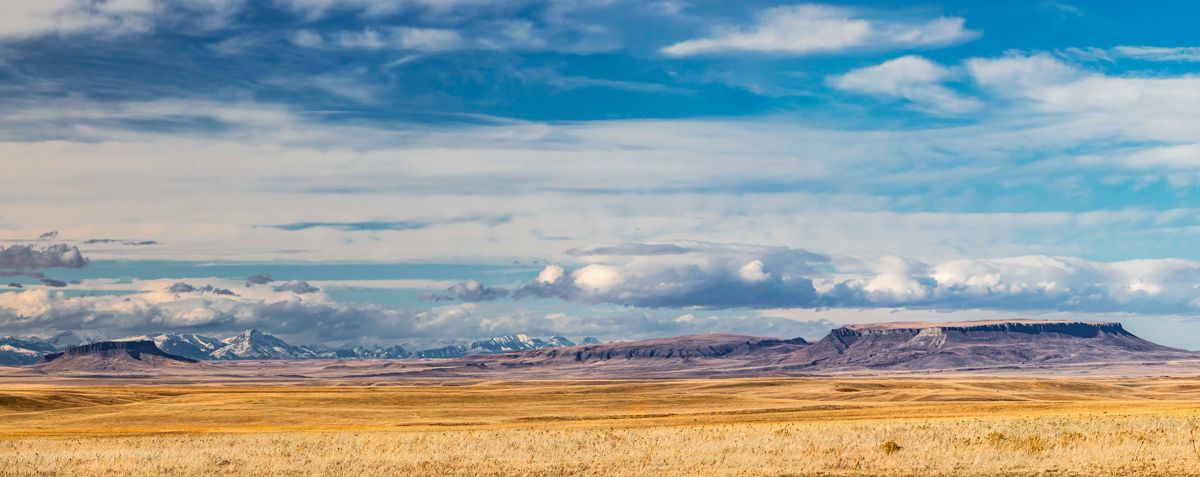
© Norman Anderson, 2026. Used by permission.
In 1805, Lewis viewed the Rocky Mountain Front from a vantage point similar to that in the above photo, but he did not appear to recognize the buttes as Fidler’s Battle Hills. From left to right is Crown Butte, Shaw Butte, and Square Butte. Square Butte—Lewis’s “Fort Mountain”—is nearly 1,000 feet above the surrounding prairie, and is about 1,100 acres on top.
Fidler’s Legacy
During his long career, Fidler endured harsh conditions and relied on indigenous knowledge to navigate difficult terrain. In return, he enriched the historical record of Native Americans. He documented their customs, languages, and knowledge of the land, fostering a deeper appreciation for their expertise among European settlers and explorers. This exchange of information proved essential for survival and success in unfamiliar territory, and Fidler’s approach set a precedent for future explorers.
Peter Fidler died December 1822 in relative obscurity and for years, his contributions were eclipsed by David Thompson. Today, he is recognized as one of the key figures in the exploration and mapping of western Canada and the Northern United States. His legacy remains an invaluable link between indigenous wisdom and European scientific inquiry. His many descendants carry on that tradition as a leading Métis family in Western Canada.[6]Barbara Belyea, Encyclopedia of the Great Plains (Lincoln, Nebraska: University of Nebraska Plains, 2004), s.v. “Fidler, Peter”.
Related Pages
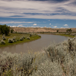
Down the Sun River
Through the "Battle Hills"
Meriwether Lewis has tempted fate and his “chapter of accidents” again by re-entering the domain of the people he had repeatedly been advised to steer clear of—the Blackfeet, Siksikas, Atsinas, and Assiniboines.
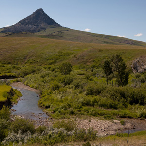
Haystack Butte
Known as Shishequaw Mountain
Today’s iconic Haystack Butte was a landmark already known to Lewis and Clark as Shishequaw Mountain. Seeing it from Lewis and Clark Pass, 7 July 1806, provided Lewis with a reference point on Nicholas King’s 1803 map.
Across the Great Divide
Over Lemhi Pass
by Joseph A. Mussulman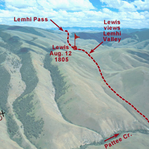
Below the summit of today’s Lemhi Pass, Lewis said that he had reached “the most distant fountain of the waters of the mighty Missouri in surch of which we have spent so many toilsome days and wristless nights.”
The Kansas River Observations
27–29 June 1804
by Robert N. Bergantino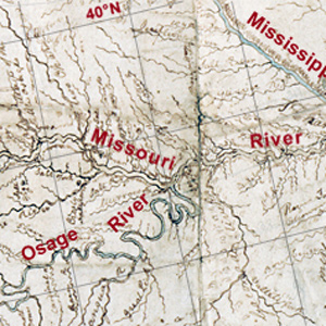
Celestial observations at the Kansas and Missouri river confluence began shortly after 8 a.m. on 27 June 1804. The first observation would provide the data necessary to calculate the magnetic declination.
David Thompson
A convergence with Lewis, Clark, and Jefferson
by Jack Nisbet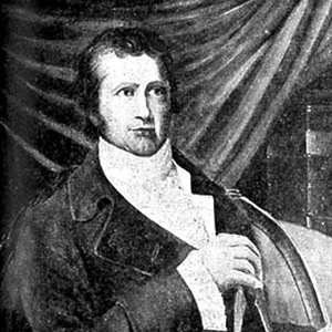
The life and times of these three explorers intertwined in a number of odd and interesting ways, often brought together by far-reaching hand of Thomas Jefferson. Tracing these connections opens a window onto every conceivable aspect of the period.
The Bears Tooth
Key landmark on the Old North Trail
by Joseph A. Mussulman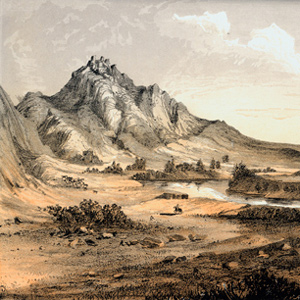
The Bears Tooth was an important landmark on the the ancient Indian road that has come to be known as the Old North Trail. It was included on Nicholas King’s 1804 map, and the captains expected to find it.
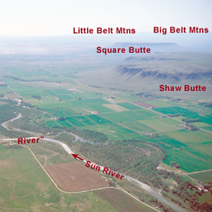
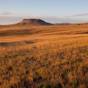
Square Butte
Lewis's Fort Mountain
by Joseph A. Mussulman
“This mountain has a singular appearance. it is situated in a level plain, it’s sides stand nearly at right angles with each other and are each about a mile in extent … from it’s figure we gave it the name of fort mountain.”
July 11, 1806
10,000 buffalo
Returning home, the expedition takes two different routes. Lewis arrives at the mouth of the Sun River above the Great Falls of the Missouri where he sees 10,000 bison. They commence hunting and from the hides, begin building two bull boats.
Clark paddles down the Beaverhead River, passes Beaverhead Rock, and stops at the mouth of the Big Hole. There, they recover a dugout canoe and bayonet left last fall. Traveling by land, Sgt. Pryor herds the horses.
July 8, 1806
Happy returns
On this day, the expedition travels in three separate groups. Lewis and his group cross the Dearborn River, pass Haystack Butte—a landmark on the Old North Trail—and once again find themselves “in the plains of the Missouri which abound with game.”
Clark and his group return to Fortunate Camp where provisions and several dugouts are cached. The enlisted men immediately dig up the tobacco.
Sgt. Ordway and three others return stray horses 40 miles across the Big Hole Valley. They find a pronghorn head dropped previously by Clark’s party, and the tired men make a dinner of it.
July 14, 1805
Launching the new canoes
Near their canoe camp at present Ulm, Montana, Lewis remarks on the view of “Fort Mountain”—known today as Square Butte. Sgt. John Ordway’s detachment arrives with the remaining dugouts and baggage, two new canoes are launched, and all is made ready for departure.
In Washington City, Lewis’s letters and Clark’s journals—sent from Fort Mandan on 6 April 1805—reach President Jefferson.
June 8, 1805
Return to Decision Point
Lewis names the river that he has been exploring “Maria’s River” [Marias] and speculates on its political and commercial value. After his party returns to Decision Point, the captains attempt to reconcile their maps with what they have learned from their recent scouting trips of the Missouri and Marias branches.
June 19, 1804
Clearing a channel
The expedition sails several miles up the Missouri River, but later in the day the enlisted men and engagés must clear the channel of driftwood and tow the boats. At camp near the mouth of present the Crooked River in Missouri, Lewis issues mosquito netting.
In Philadelphia, German polymath Alexander von Humboldt—returning from his Mexican and Cuban expedition—writes to Secretary of State James Madison seeking funding for another expedition.
July 14, 1803
On the Monongahela
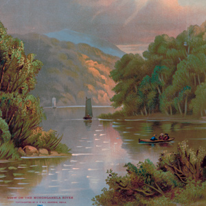
On his way to Pittsburgh, Lewis is likely traveling along the Monongahela River, between Brownsville and Elizabethtown, Pennsylvania. If he hired a flatboat, he would travel about 32 river miles. Continuing by horse would be a shorter distance, but a more difficult day.
In Washington City, President Jefferson receives information about Mt. Hood from French naturalist Bernard Lacépède.
June 17, 1803
Critical books and maps
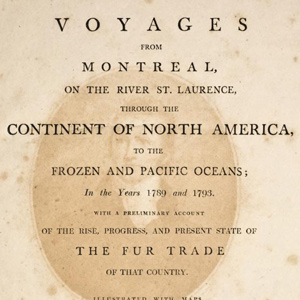
In Washington City, President Thomas Jefferson orders a copy of Alexander Mackenzie’s Voyages from Montreal and Aaron Arrowsmith’s map of North America recently updated with information from Hudson’s Bay explorer Peter Fidler. Both would be carried west with the expedition.
Jefferson also offers Federal appointments to Thomas Rodney who would document his 1803 trip down the Ohio and his encounters there with Meriwether Lewis and William Clark.
May 13, 1803
Louisiana Treaty details
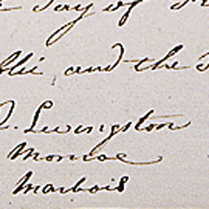
In Paris, France, Robert Livingston and James Monroe record the details of the Louisiana Purchase for James Madison. Also in Paris, fellow scientist B. G. É. L. Lacepède provides Thomas Jefferson information about the Columbia River. The letters must then cross the Atlantic.
Notes
| ↑1 | J. G. MacGregor, Peter Fidler: Canada’s Forgotten Explorer 1769–1822 (Calgary, Alberta: Fifth House Publishers, 1998), XVI, archive.org/details/peterfidlercanad0000macg. |
|---|---|
| ↑2 | Belyea, Barbara. “Mapping the Marias: The Interface of Native and Scientific Cartographies.” Great Plains Quarterly 17, no. 3/4 (1997): 165–84, www.jstor.org/stable/23533206 accessed 17 Jan 2026; Thomas Jefferson to James Cheetham, Founders Online, National Archives, founders.archives.gov/documents/Jefferson/01-40-02-0413 accessed 13 May 1803. [Original source: The Papers of Thomas Jefferson, vol. 40, 4 March–10 July 1803, ed. Barbara B. Oberg. Princeton: Princeton University Press, 2013, p. 549.]. |
| ↑3 | The Definitive Journals of Lewis & Clark, Gary Moulton, ed. (Lincoln: University of Nebraska Press, 2002), 4:266–67. |
| ↑4 | Arrowsmith, Aaron, and J Puke. A map exhibiting all the new discoveries in the interior parts of North America (London: A. Arrowsmith, 1802) Map, www.loc.gov/item/2001620920/. |
| ↑5 | “An Indian map of the Different Tribes that inhabit the East & West Side of the Rocky Mountains with all the rivers & other remarkbl. places, also the number of Tents etc. Drawn by the Feathers or Ac ko mok ki—a Black foot chief—7th Feby. 1801—reduced 1/4 from the Original Size—by Peter Fidler.” HBCA G. 1/12 (N4157). |
| ↑6 | Barbara Belyea, Encyclopedia of the Great Plains (Lincoln, Nebraska: University of Nebraska Plains, 2004), s.v. “Fidler, Peter”. |
Experience the Lewis and Clark Trail
The Lewis and Clark Trail Experience—our sister site at lewisandclark.travel—connects the world to people and places on the Lewis and Clark Trail.
![]()
Discover More
- The Lewis and Clark Expedition: Day by Day by Gary E. Moulton (University of Nebraska Press, 2018). The story in prose, 14 May 1804–23 September 1806.
- The Lewis and Clark Journals: An American Epic of Discovery (abridged) by Gary E. Moulton (University of Nebraska Press, 2003). Selected journal excerpts, 14 May 1804–23 September 1806.
- The Lewis and Clark Journals. by Gary E. Moulton (University of Nebraska Press, 1983–2001). The complete story in 13 volumes.
This site is provided as a public service by the
![]()
Lewis and Clark Trail Alliance
with additional funding from the following:

