In 1902, Wheeler followed the Northern Pacific’s course on the Yellowstone River promoting the railroad and the Lewis and Clark Centennial.
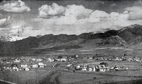
Bozeman, Montana
Final Mountain Barrier
F. M. Ingalls (1902), for Olin D. Wheeler, The Trail of Lewis and Clark. See also Wheeler’s “Trail of Lewis and Clark”.
Here, near the headwaters of the river the captains had named for Jefferson’s secretary of the treasury, Albert Gallatin, William Clark and his party faced the last of the mountain ranges they would have to cross. There were several Indian roads to choose from, but Sacagawea pointed out the best one—one of the very few times she actually functioned as a guide.
The town of Bozeman, founded in 1864, benefitted greatly from the coming of the Northern Pacific Railroad in 1883, and by 1900 had a population of approximately 3,500. Olin Wheeler drew the arrow on the picture, indicating Sacagawea Peak, at 9,665 feet (ca. 2,946 m) the highest in the Bridger Range.
Turning to Clark’s return party, Wheeler followed it south from Traveler’s Rest through the Bitterroot Valley, and then east toward the Three Forks of the Missouri and on to the Yellowstone River. In describing Clark’s crossing of southeastern Montana’s Big Hole valley, Wheeler stated that “Sacagawea again resume[d] the role of guide” in this area she had traveled through as a child. She pointed the way out of the valley via Big Hole Pass, on a shortcut to Camp Fortunate (at today’s Clark Canyon Reservoir). After Ordway’s canoe party left Clark’s at the Three Forks to paddle to the Great Falls, Sacagawea led Clark to an Indian trail north of what is now called Bozeman Pass. It was the most direct route from the Gallatin Valley to the Yellowstone at present Livingston, Montana.
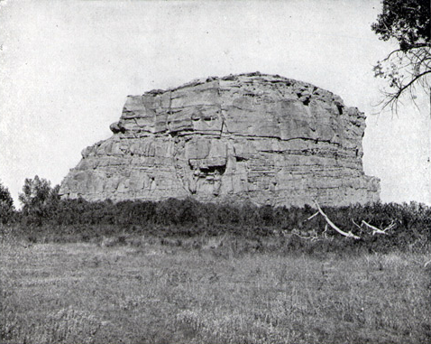
In 1902, ninety-three years after Clark paused at the place he dubbed “Pompy’s Tower,” Wheeler and photographer L. A. Huffman climbed to its top for a panoramic view; no wolves, buffalo, nor elk were in sight. Wheeler noted that at the direction of the Northern Pacific Railroad’s president, Henry Villard, a heavy iron screen had been installed over Clark’s name in 1882 to protect it from further defacement. Over the years, “the irrepressible fool has been there,” wrote Wheeler, “and has scratched and cut his various names all around it, and even over some of the letters and between the lines.”
Wheeler and his photographer examined and photographed the landmark thoroughly. It was virtually covered with graffiti, the earliest dated 1843. See Pompeys Pillar and Trail Graffiti.
After recounting the story of the expedition’s return to the Knife River villages, where the Corps bade farewell to the Charbonneau family, Wheeler wrote that:
The absence of a brave and modest woman, even though she were an Indian woman, after her presence during so long a period, could not have been unfelt. And then the little Chaboneau! Mite of dusky humanity that he was, what a void he would leave behind!
Wheeler believed that Clark must have been instrumental in the Charbonneaus’ later visit to St. Louis, but he did not learn of Clark’s offer to educate young Jean Baptiste Charbonneau in St. Louis. (See An Offer to Raise Jean Baptiste)
Experience the Lewis and Clark Trail
The Lewis and Clark Trail Experience—our sister site at lewisandclark.travel—connects the world to people and places on the Lewis and Clark Trail.
Discover More
- The Lewis and Clark Expedition: Day by Day by Gary E. Moulton (University of Nebraska Press, 2018). The story in prose, 14 May 1804–23 September 1806.
- The Lewis and Clark Journals: An American Epic of Discovery (abridged) by Gary E. Moulton (University of Nebraska Press, 2003). Selected journal excerpts, 14 May 1804–23 September 1806.
- The Lewis and Clark Journals. by Gary E. Moulton (University of Nebraska Press, 1983–2001). The complete story in 13 volumes.


