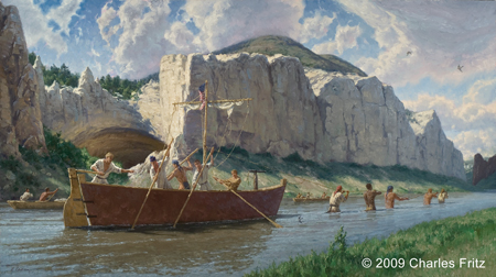
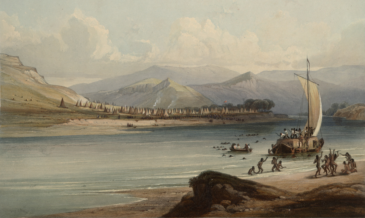
Due to slippery and narrow banks, the men find that towing the boats among the white cliffs of the Upper Missouri River Breaks is harder than usual. Meriwether Lewis tests the humidity by measuring the rate of evaporation, and Pvt. Joseph Whitehouse describes an empty Atsina camp.
Recent Indian Encampments
by Yellowstone Public Radio[1]Originally aired weekdays by Yellowstone Public Radio during the Bicentennial observance of 2003-2006. Narrated by Hal Hansen. Scripts by Whit Hansen and Ed Jacobson. Produced by Leni Holliman. © … Continue reading
Cordelling the White Pirogue, White Cliffs of the Missouri
36″ x 64″ oil on canvas
© 2009 by Charles Fritz. Used by permission.
Towing Past White Cliffs
We delayed setting off till 10 oClock A. M. the weather still being very disagreeable, & bad to Tow the Crafts; we then proceeded on our Voyage, and passed a white strait range of Clifts, lying on the South side of the River
—Joseph Whitehouse
Difficult Day
this day we proceded with more labour and difficulty than we have yet experienced; in addition to the imbarrasments of the rappid courant, riffles, & rockey point which were as bad if not worse than yesterday
—Meriwether Lewis
Slippery Banks
the banks and sides of the bluff were more steep than usual and were now rendered so slippery by the late rain that the men could scarcely walk.
—Meriwether Lewis
Evaporation Experiment
I found by several experiments that a table spoon full of water exposed to the air in a saucer would avaporate in 36 hours when the murcury did not stand higher than the temperate point at the greatest heat of the day; my inkstand so frequently becoming dry put me on this experiment.
—Meriwether Lewis
“Camp of the Gros Ventres of the prairies on the upper Missouri” c. 1840 (cropped)
Karl Bodmer (1809–1893)
Rare Book and Special Collections Division, U.S. Library of Congress.
Empty Atsina Camp
Camped at a handsom narrow bottom covered with thin c. wood timber, where 50 or 60 lodges of Indians had lately been Camped. they were gone as we expect up the river. they left Several lodge poles & considerable of fire wood gathered.
—Joseph Whitehouse
Weather Diary
State of thermometer at rise
Weather Wind at rise
State of thermometer at 4 P. M. Weather Wind at 4 P. M. State of the river 56 [above 0] cloudy after rain S W. 50 [above 0] rain S W raised 5 in. the rain commenced about 4 Oclock in the evening, and continued moderately through the course of the night; more rain has now fallen than we have experienced since the 15th of September last.
—Meriwether Lewis[2]To assist the reader, the editor of this web page has omitted the date column, merged the “State of the river” columns, and spelled out some abbreviations.
Experience the Lewis and Clark Trail
The Lewis and Clark Trail Experience—our sister site at lewisandclark.travel—connects the world to people and places on the Lewis and Clark Trail.
Plan a trip related to May 30, 1805:

The White Cliffs is a High Potential Historic Site along the Lewis and Clark National Historic Trail managed by the U.S. National Park Service. It is part of the Upper Missouri River Breaks National Monument managed by the Bureau of Land Management.—ed.
Notes
| ↑1 | Originally aired weekdays by Yellowstone Public Radio during the Bicentennial observance of 2003-2006. Narrated by Hal Hansen. Scripts by Whit Hansen and Ed Jacobson. Produced by Leni Holliman. © 2003 by Yellowstone Public Radio. |
|---|---|
| ↑2 | To assist the reader, the editor of this web page has omitted the date column, merged the “State of the river” columns, and spelled out some abbreviations. |


