The expedition’s most valuable cargo is carried around the Long Narrows of the Columbia, and then the best paddlers run the rapid in nearly empty canoes. Now out of the Sahaptian-speaking region, the two Nez Perce guides head back home. A camp is established on a high basalt outcrop—in present The Dalles, Oregon—which they would later call Fort Rock Camp.
Rumours
by Yellowstone Public Radio[1]Originally aired weekdays by Yellowstone Public Radio during the Bicentennial observance of 2003-2006. Narrated by Hal Hansen. Scripts by Whit Hansen and Ed Jacobson. Produced by Leni Holliman. © … Continue reading
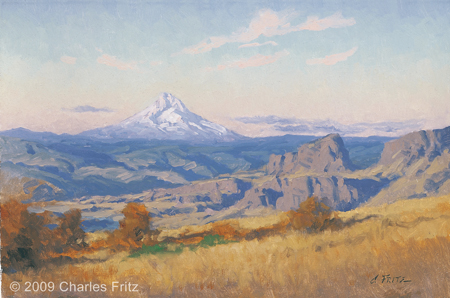
The Wishram Land at Sunset
10″ x 15″ oil on board
© 2009 by Charles Fritz. Used by permission.
Nez Perce Chiefs Depart
our 2 chiefs came to us and told us that their was a nation below that which had a design to kill them and us So they left us in order to return to their own village again.—
—Joseph Whitehouse
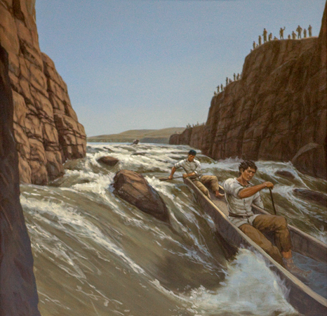
Portaging the Long Narrows
we Concluded to Make a portage of our most valuable articles and run the canoes thro accordingly on our return divided the party Some to take over the Canoes, and others to take our Stores across a portage of a mile to a place on the Chanel below this bad whorl & Suck
—William Clark
Running the Long Narrows
I had fixed on the Chanel with roapes to throw out to any who Should unfortunately meet with difficuelty in passing through; great number of Indians viewing us from the high rocks under which we had to pass, the 3 first Canoes passed thro very well, the 4th nearly filled with water, the last passed through by takeing in a little water
—William Clark
Fort Rock Camp
we formed our Camp on the top of a high point of rocks, which forms a kind of fortification in the Point between the river & Creek, with a boat guard, this Situation we Concieve well Calculated for defence, and Conveniant to hunt under the foots of the mountain to the West, & S.W.
—William Clark
Mt. Hood
The Pinical of the round toped mountain which we Saw a Short distance below the forks of this river is S. 43° W. of us and abt 37 miles, it is at this time toped with Snow
—William Clark
Crowded River
this Creek [Mill Creek] is 20 yards wide and has Some beaver Signs at its mouth river about ½ a mile wide and Crouded with Sea otters, & drum was Seen this evening
—William Clark
Weather Diary
Day of the month Wind State of the Weather 25th W fair Note from the 22d to the 29th about the Great Falls [Celilo Falls] of the Columbia river.
—William Clark[2]Some abbreviations have been spelled out.
Experience the Lewis and Clark Trail
The Lewis and Clark Trail Experience—our sister site at lewisandclark.travel—connects the world to people and places on the Lewis and Clark Trail.
Plan a trip related to October 25, 1805:

Rock Fort Campsite is a High Potential Historic Site along the Lewis and Clark National Historic Trail managed by the U.S. National Park Service. The site owned by Wasco County, Oregon, and is open to the public.
Notes
| ↑1 | Originally aired weekdays by Yellowstone Public Radio during the Bicentennial observance of 2003-2006. Narrated by Hal Hansen. Scripts by Whit Hansen and Ed Jacobson. Produced by Leni Holliman. © 2003 by Yellowstone Public Radio. |
|---|---|
| ↑2 | Some abbreviations have been spelled out. |


