The expedition arrives at Wishram, a village on the north side of the Falls of the Columbia. With the help of the villagers, they portage their baggage along the shore. Others cross the river to scout the channel that the canoes will navigate.
In Philadelphia, museum curator Charles Willson Peale cares for the live prairie dog sent from Fort Mandan last April.
In St. Louis, an Indian delegation organized by the captains leaves with Amos Stoddard for Washington City.
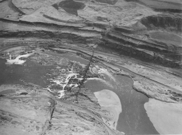
The Falls of the Columbia
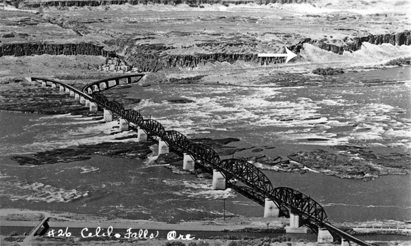
Celilo Falls, First Cataract (view south)
Detail
To see labels, point to the image
By Alfred A. Monner, c. 1935.
Above: The Lewis and Clark camp was at the end of the portage and likely on the sandbar downriver from the present-day railroad bridge. The canoe channel, Horseshoe Bend began on the white water middle-left.
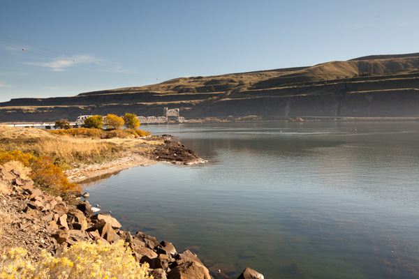
Celilo Falls, First Cataract Today (view southeast)
© 19 October 2013 by Kristopher K. Townsend. Permission to use granted under the Creative Commons Attribution-Share Alike 4.0 International license.
The position of the railroad bridge has never changed and thereby provides a reference point for the orientation of all historic and present-day photographs of Celilo Falls.
6 miles below the upper mouth of Towarnehiooks River the comencement of the pitch of the Great falls [Celilo Falls], opposit on the Stard. Side is 17 Lodges of the nativs we landed and walked down accompanied by an old man to view the falls
—William Clark
Wishram Portage
took every article except the Canoes across the portag where I had formed a camp on ellegable Situation for the protection of our Stores from Thieft, which we were more fearfull of, than their arrows . . . . Indians assisted us over the portage with our heavy articles on their horses
—William Clark
At Portage Camp
we got all except the canoes below the falls and camped close under a high range of clifts of rocks, where the body of the River beat against it and formed a verry large eddy. we Saw a number of large Sea otter below the falls in the whorl pools and eddys the natives are verry troublesome about our Camp—
—John Ordway
Scouting the Canoe Route
we despatched two men to examine the river on the opposit Side, and reported that the Canoes could be taken down a narrow Chanel on the opposit Side after a Short portage at the head of the falls, at which place the Indians take over their Canoes.
—William Clark
Islands of Rocks
the waters is divided into Several narrow chanels which pass through a hard black rock forming Islands of rocks at this Stage of the water
—William Clark
The Deschutes River
this River haveing no Indian name that we could find out, except “the River on which the Snake Indians live,” we think it best to leave the nameing of it untill our return.
—William Clark
Neatly Preserved Salmon
on those Islands of rocks as well as at and about their Lodges I observe great numbers of Stacks of pounded Salmon neetly preserved
—William Clark
Weather Diary
Day of the month Wind State of the Weather 22nd S W fair Note from the 18th to the 22d of octr. descending the Great Columbia to the falls.
Note from the 22d to the 29th about the Great Falls of the Columbia river.
—William Clark[1]Some abbreviations have been spelled out.
The Live Prairie Dog
Museum Octr. 22d 1805.
Dear Sir
[The prairie dog] is a handsome little Animal, smaller and much more gentle than our Monax [marmot] & I expect like it will not eat during the Winter, for this eats but little at present. It shall be keept in a Warm Room for tryal.
. . . . .
I am very thankful for these additions to the Museum every thing that comes from Louisiana must be interresting to the Public.
. . . . .
C. W. Peale[2]Peale to Jefferson in Letters of the Lewis and Clark Expedition with Related Documents: 1783-1854, 2nd ed., ed. Donald Jackson (Urbana: University of Illinois Press, 1978), 267.
Stoddard’s Delegation
St. Louis October 22nd 1805
Sir
The Deputation destined to visit the President, will commence their journey this day under the conduct of Captn. Stoddard, and will consist of twenty six persons from eleven Nations, (to wit) The Ottoe Missouri [Otoe and Missouria], Panis [Pawnee], Canzès [Kansa], Osage [Osage], Sacque, Reynard [Sauk and Fox], Ayoua [Iowa], Kickapoo, Pottawattomee [Potawatomi], and Miamis . . . .
Ja: Wilkinson
Experience the Lewis and Clark Trail
The Lewis and Clark Trail Experience—our sister site at lewisandclark.travel—connects the world to people and places on the Lewis and Clark Trail.
Plan a trip related to October 22, 1805:

Celilo Falls Portage is a High Potential Historic Site along the Lewis and Clark National Historic Trail managed by the U.S. National Park Service. On-site access is restricted, but nearby Celilo Park provides public viewing and interpretation of the area from the Oregon side of the river.


