Lewis, Drouillard, and Joseph and Reubin Field head for the Marias River. They lunch at Rainbow Falls and encamp at the Grand Fall.
Sgt. Gass and his group remain at the Great Falls of the Missouri repairing the wagon trucks that will haul the canoes around the falls.
Clark and his group move down the Yellowstone River looking for trees large enough to make dugouts. Moccasins are made for the lame horses, and Clark describes area geology and mountain sucker—a fish new to science. He camps near present Big Timber, Montana.
Sgt. Ordway and his group take last year’s dugouts through the Gates of the Mountains, around Oxbow Bend, and past The Bears Tooth.[1]For more on the captains’ strategy and various groups after leaving Travelers’ Rest, see Dividing Forces at Travelers’ Rest.
Off to the Marias (Lewis)
Leaving for the Marias
sent Drewyer and R. Fields with the horses to the lower side of Medecine [Sun] river, and proceeded myself with all our baggage and J. Fields down the missouri to the mouth of Medecine river in our canoe of buffaloe skins [bull boat].
—Meriwether Lewis
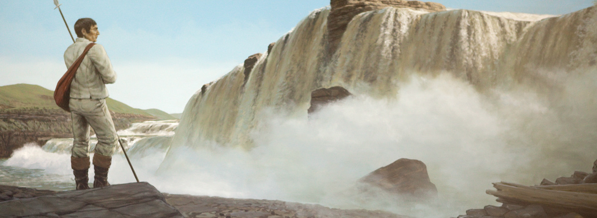
Lunch at Rainbow Falls
having arrived safely below Medicine river we immediately sadled our horses and proceeded down the river to the handsom fall [Rainbow Falls] of 47 feet where I halted about 2 hours and took a haisty sketch of these falls;
—Meriwether Lewis
Revisiting the Grand Fall
these falls have abated much of their grandure since I first arrived at them in June 1805, the water being much lower at preset than it was at that moment, however they are still a sublimely grand object . . . . we spent this evening free from the torture of the Musquetoes.
—Meriwether Lewis
Weather Diary (Lewis)
State of the weather at rise
Wind at rise
State of the weather at 4 P. M. Wind at 4 P. M. fair S W fair S W Saw the Cookkoo or rain crow and the redheaded woodpecker. the golden rye now heading. both species of the prickly pare in blume.— the sunflower in blume.
—Meriwether Lewis
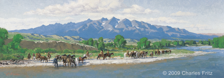
Captain Clark Descending Elk River
10″ x 28″ oil on board
© 2009 by Charles Fritz. Used by permission.
Down the Yellowstone (Clark)
Horse Moccasins
I saw a buffalow & Sent Shannon to kill it . . . . I had most of the flesh brought on an a part of the Skin to make mockersons for Some of our lame horses. proceeded on down the river without finding any trees Sufficiently large for a Canoe
—William Clark
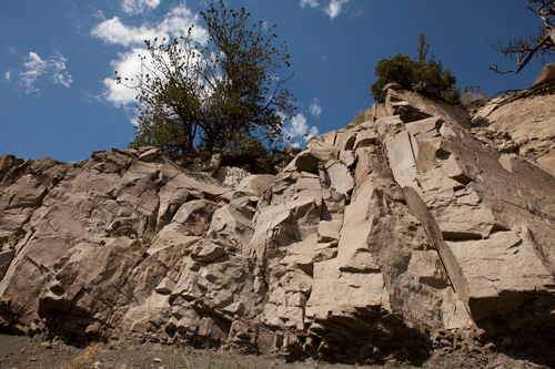
Yellowstone River Limestone
Mouth of the Shields River, 26 July 2011. © by Kristopher K. Townsend. Permission to use granted under the Creative Commons Attribution-Share Alike 4.0 International license.
Livingston Formation and Eagle Sandstone
The rocks which the high lands are faced with and which may also be seen in perpendicular Straters in the high plains, is a dark freestone. the greater part of this rock is of an excellent grit for Grindstones hard and sharp.
—William Clark
Mountain Sucker, New to Science
one of the men brought me a fish of a species I am unacquainted; it was 8 inches long formed like a trout. it’s mouth was placed like that of the Sturgeon a red streak passed down each Side from the gills to the tail.
—William Clark
Insufficient Trees
The river and Creek bottoms abound in Cotton wood trees, tho’ none of them Sufficiently large for Canoes. and the current of the Rochejhone [Yellowstone] is too rapid to depend on Skinn canoes. no other alternetive for me but to proceed on down untill I can find a tree Sufficently large &c. to make a Canoe.—
—William Clark
Weather Diary (Clark)
State of the weather at Sun rise Wind at Sun rise State of the weather at 4 P. M Wind at 4 P M. cloudy N E cloudy N. E Saw the wild indigo & common sunflower
—William Clark[2]To assist the reader of this web page, the date column is omitted and some abbreviations have been spelled out.
Wagon Work (Gass)
Working on the Wagons
We continued here to repair our waggons or truckles to transport the baggage and canoes on when the men with them should arrive.— The musquitoes are still very troublesome.
—Patrick Gass
Contingency Plan
When Capt. Lewis left us, he gave orders that we should wait at the mouth of Maria’s river to the 1st of Sept., at which time, should he not arrive, we were to proceed on and join Capt. Clarke at the mouth of the Yellow-stone river, and then to return home
—Patrick Gass
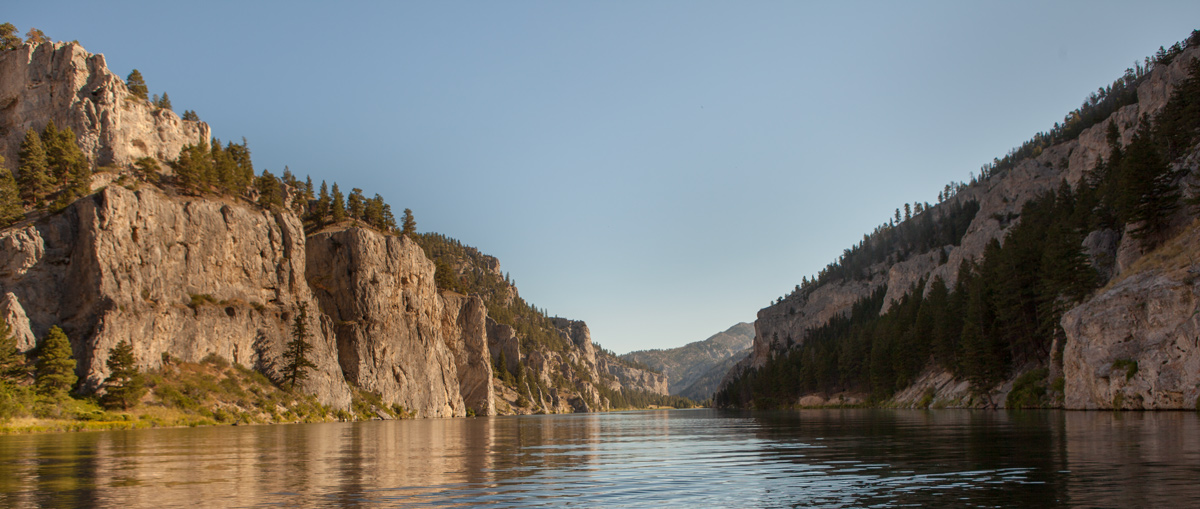
Gates of the Mountains (Ordway)
© 24 July 2013 by Kristopher K. Townsend. Permission to use granted under the Creative Commons Attribution-Share Alike 4.0 International license.
about 3 P. M. the wind abated a little and we proced. on thro the gates of the mn Saw large gangs of Mountain Sheep and Elk Collins killed a faun Elk and two Mountain Sheep. we proceeded on below ordways river and Camped on a Sand beach.
—John Ordway
Experience the Lewis and Clark Trail
The Lewis and Clark Trail Experience—our sister site at lewisandclark.travel—connects the world to people and places on the Lewis and Clark Trail.
Plan a trip related to July 16, 1806:
- Rainbow Falls (Lewis)
- Big Falls at Ryan Dam (Lewis)
- The Museum of the Rockies (Clark)
- Three Forks to Billings Driving Tour (Clark)
- Gates of the Mountains Boat Tour (Ordway)

Rainbow Falls is a High Potential Historic Site along the Lewis and Clark National Historic Trail managed by the U.S. National Park Service. An overlook of the falls is accessible by roadway or footpath, and the Lewis and Clark Interpretive Center is located about 1.5 miles to the west.
The Great Falls Portage is a High Potential Historic Site along the Lewis and Clark National Historic Trail managed by the U.S. National Park Service. It includes Sulphur Springs (open to the public) and Lower Portage Camp site (private land), and the Upper Portage Camp Overlook.
Notes
| ↑1 | For more on the captains’ strategy and various groups after leaving Travelers’ Rest, see Dividing Forces at Travelers’ Rest. |
|---|---|
| ↑2 | To assist the reader of this web page, the date column is omitted and some abbreviations have been spelled out. |


