Moving up the Northern Nez Perce Trail, the “intolerable road” clings to steep hillsides above Lolo Creek in present Montana. The travelers have difficulty finding a good campsite and must settle for a small place without grass for their horses. The Native Americans traveling this trail have peeled several pine trees to eat the inner bark.
Farewell to Travelers’ Rest
by Yellowstone Public Radio[1]Originally aired weekdays by Yellowstone Public Radio during the Bicentennial observance of 2003-2006. Narrated by Hal Hansen. Scripts by Whit Hansen and Ed Jacobson. Produced by Leni Holliman. © … Continue reading
Intolerable Road
Trail above Lolo Creek
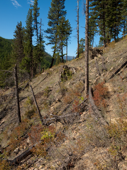
© 10 September 2009 by Kristopher K. Townsend. Permission to use granted under the Creative Commons Attribution-Share Alike 4.0 International license.
Above: A faint trail ‘sidehills’ through an old, burned area above Lolo Creek. The old trail in this area is typically well-defined, but the portions in burned areas have degraded.
The road through this hilley Countrey is verry bad passing over hills & thro’ Steep hollows, over falling timber &c. &c. continued on & passed Some most intolerable road on the Sides of the Steep Stoney mountains, which might be avoided by keeping up the Creek which is thickly covered with under groth & falling timber
—William Clark
Camp of Opportunity
we found no water nor place to Camp untill 10 oClock at night . . . . where we could not find a level place to Sleep, and Scarcely any feed for our horses
—John Ordway
Peeled Trees
the Indians have pealed a number of Pine for the under bark which they eate at certain Season of the year, I am told in the Spring they make use of his bark
—William Clark
Weather Diary
Weather at rise
Wind at Weather at 4 P.M. Wind at 4 P.M. fair N W. fair N E Mounts to our left Covered with Snow
—Meriwether Lewis[2]To assist the reader, the editor of this web page has omitted the date column and spelled out some abbreviations.
Lolo Creek and Highway 12
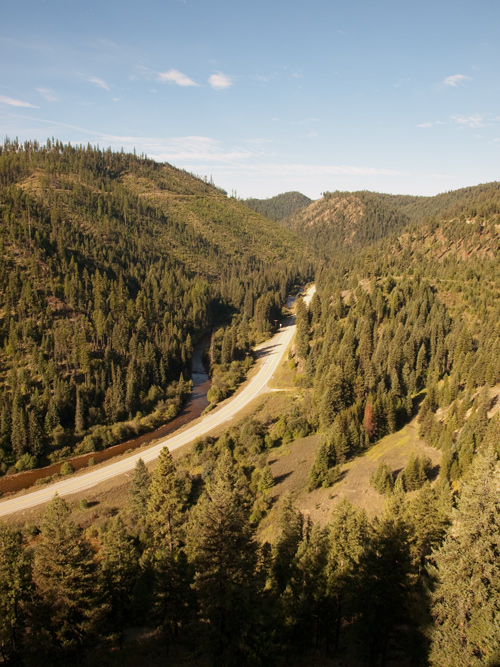
Generated from the original © 10 September 2009 by Kristopher K. Townsend. Permission to use granted under the Creative Commons Attribution-Share Alike 4.0 International license.
In the above photo, the photographer was standing on the original Northern Nez Perce Trail between Howard Creek and Lolo Hot Springs. Today, U.S. Highway 12 presents a clear path of travel along the side of Lolo Creek. In 1805, the creek bottom was full of brush, beaver ponds, and swamps. As Clark explains in his journal, the Indians preferred travel on ridges and the sides of hills rather than beating the brush along water courses.
Experience the Lewis and Clark Trail
The Lewis and Clark Trail Experience—our sister site at lewisandclark.travel—connects the world to people and places on the Lewis and Clark Trail.
Plan a trip related to September 12, 1805:
Notes
| ↑1 | Originally aired weekdays by Yellowstone Public Radio during the Bicentennial observance of 2003-2006. Narrated by Hal Hansen. Scripts by Whit Hansen and Ed Jacobson. Produced by Leni Holliman. © 2003 by Yellowstone Public Radio. |
|---|---|
| ↑2 | To assist the reader, the editor of this web page has omitted the date column and spelled out some abbreviations. |