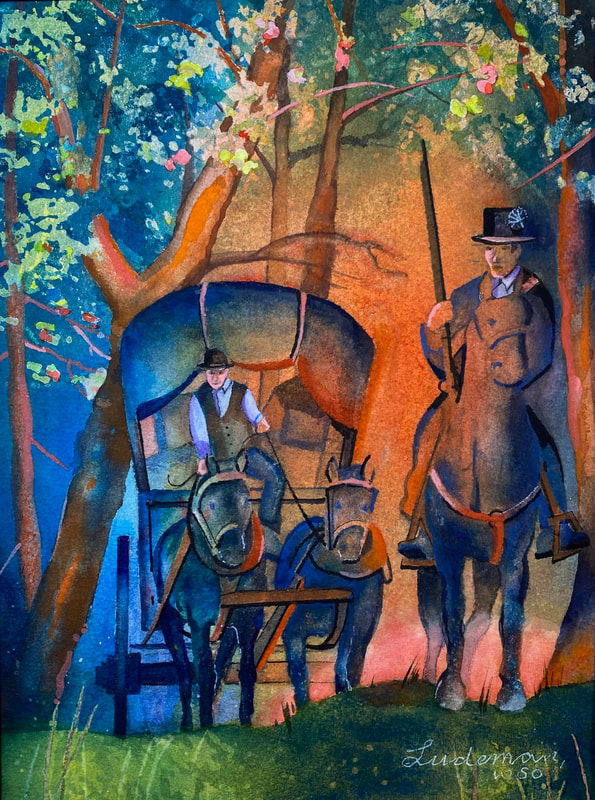
In the words of artist Steve Ludeman, “I am fascinated with the geology, archeology, natural history, and cultural history of our country.” For years, he has specialized in landscapes and seascapes of the Pacific Northwest, but he also interprets the Eastern Legacy of Lewis and Clark. This is the 1803-04 journey of the Lewis and Clark Expedition from the Eastern seaboard, down the Ohio, up the Mississippi, to their winter camp at River Dubois (Wood River) across from St. Louis. These focus areas combine his love of history and outdoor adventures with a love of painting. For him, the journey of painting is a joyful one.


Steve works primarily with watercolor, mixed media, and pen and pencil drawings. He is a signature member of the Watercolor Society of Oregon and associate member of several other art societies. His art has appeared in many shows in the Pacific Northwest and along the Lewis and Clark National Historic Trail.
Featured Works
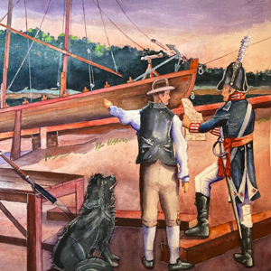
July 22, 1803
Pittsburgh update
In Pittsburgh, Lewis writes a letter to President Jefferson to update him on his progress. The wagon from Harpers Ferry arrives, but the military barge that will take him and his new recruits down the Ohio River is far from ready.
August 21, 1803
A final inspection?
Lewis anxiously awaits completion of the military barge so that he can head down the Ohio. Clark writes to tell him that the best interpreters, hunters, and boatmen can be hired at St. Louis and Cahokia.
August 31, 1803
Leaving Pittsburgh
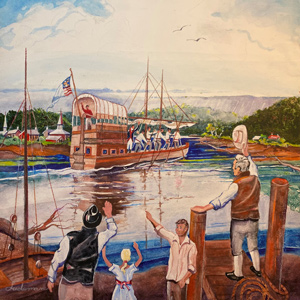
After eight months of preparation, Lewis finally leaves Pittsburgh with a crew of eleven hands. During a stop, he shows off his new air gun, and Blaze Cenas accidentally shoots a female spectator.
Leaving Pittsburgh
A late start
by James J. Holmberg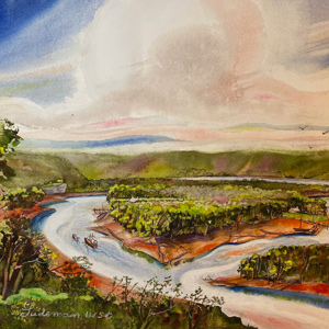
Even though Lewis himself declared the mouth of the River Dubois to be the expedition’s official point of departure, the two and one-half months spent descending the Ohio River were in fact its real beginning.
Air Gun Accident
A shooting on Brunot's Island
by Joseph A. Mussulman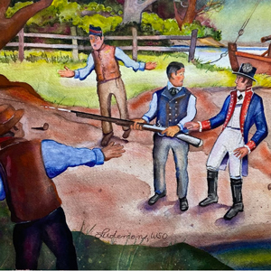
“accedentaly the ball passed through the hat of a woman about 40 yards distanc cutting her temple about the fourth of the diameter of the ball.”
September 1, 1803
Woollery's Trap
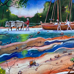
Leaving McKees Rocks below Pittsburgh, the barge has difficulty in the shallow water. At Woollery’s Trap, Lewis hires oxen to drag the emptied boat. They stop for the day near Edgeworth, Pennsylvania.
October 15, 1803
Piloting the Falls of the Ohio

Likely on this or the previous day, the expedition boats were emptied of cargo and navigated down the rapids at the Falls of the Ohio by court-appointed pilots. Also on this day, John Colter enlists.
October 21, 1803
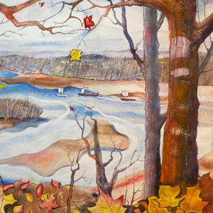
Louisville viewscape
Lewis and Clark prepare for departure from the Falls of the Ohio. Other travelers describe the area’s geography including Clarksville, the home site of Revolutionary War hero George Rogers Clark.
October 28, 1803
Winding Ohio River
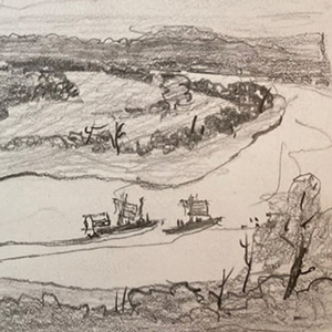
On or near this date, the expedition passes the Blue River Hills and goes around the big bend near present Leavenworth, Indiana. The bends are twenty miles long by water but only six miles by land.
November 27, 1803
A bold point of rocks
The expedition travels about thirteen miles up the Mississippi camping opposite present Chester, Illinois. Lewis describes the range of hills forming Cinque Hommes Cape and reports three grist mills and several settlers living in the area.
January 17, 1804
River thick with ice
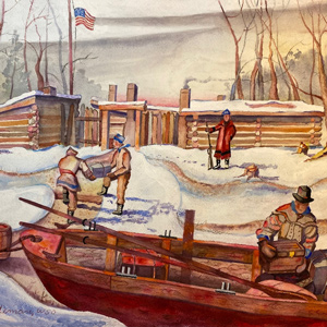
At Wood River, the thermometer drops below zero and the Missouri runs with ice. In Washington City, the Spanish Minister proposes that the Americans leave the west side of the Mississippi to the Indians.
Experience the Lewis and Clark Trail
The Lewis and Clark Trail Experience—our sister site at lewisandclark.travel—connects the world to people and places on the Lewis and Clark Trail.
![]()
Discover More
- The Lewis and Clark Expedition: Day by Day by Gary E. Moulton (University of Nebraska Press, 2018). The story in prose, 14 May 1804–23 September 1806.
- The Lewis and Clark Journals: An American Epic of Discovery (abridged) by Gary E. Moulton (University of Nebraska Press, 2003). Selected journal excerpts, 14 May 1804–23 September 1806.
- The Lewis and Clark Journals. by Gary E. Moulton (University of Nebraska Press, 1983–2001). The complete story in 13 volumes.
This site is provided as a public service by the
![]()
Lewis and Clark Trail Alliance
with additional funding from the following:

