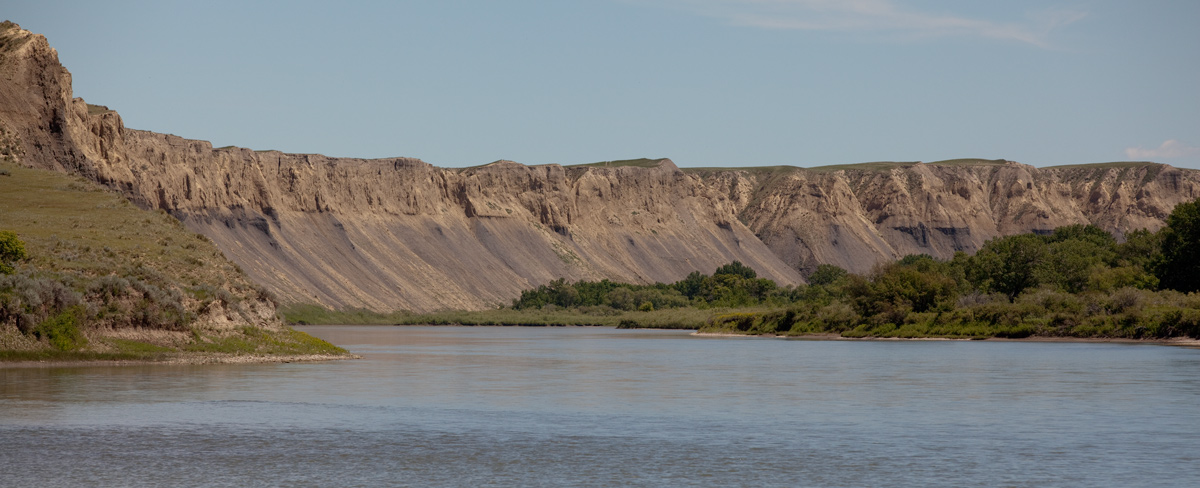
Using maps, information gathered previously from Indigenous Peoples, and their own observations during their recent excursions, the captains decide to follow the southern fork (the Missouri). The men all think the northern fork (the Marias) is the correct way to go. They dig a cache, prepare to abandon the red pirogue at Decision Point, and pass the night in song and dance.
Caching and Stashing
by Yellowstone Public Radio[1]Originally aired weekdays by Yellowstone Public Radio during the Bicentennial observance of 2003-2006. Narrated by Hal Hansen. Scripts by Whit Hansen and Ed Jacobson. Produced by Leni Holliman. © … Continue reading
Digging a Cache
7 men went out to the high land to dig a cash. a hole in the ground for to burry Some of the articles So that we may find them Safe when we return back.
—John Ordway
The Southern Fork (Missouri) Above Decision Point
© 28 June 2013 by Kristopher K. Townsend. Permission to use granted under the Creative Commons Attribution-Share Alike 4.0 International license.
Choosing the Southern Fork
today we examined our maps, and compared the information derived as well from them as from the Indians and fully settled in our minds the propryety of addopting the South fork for the Missouri, as that which it would be most expedient for us to take.
—Meriwether Lewis
Willing to Follow
the party all of whom except Capt. C. being still firm in the beleif that the N. Fork was the Missouri and that which we ought to take; they said very cheerfully that they were ready to follow us any wher we thought proper to direct but that they still thought that the other was the river and that they were affraid that the South fork would soon termineate in the mountains and leave us at a great distance from the Columbia.
—Meriwether Lewis
Singing and Dancing
In the evening Cruzatte gave us some music on the violin and the men passed the evening in dancing singing &c and were extreemly cheerfull.—
—Meriwether Lewis
Celestial Observations
At our camp on the point of land formed by the junction of the Missouri and Maria’s rivers made the following observations . . . .
—Meriwether Lewis
Weather Diary
State of the thermometer at rise
Weather Wind at rise
State of the thermometer at 4 OC. P.M. Weather Wind at 4 OC. P. M. State of river 50 [above 0] fair S W. 62 [above 0][Clark has 52.] fair S W fallen 1 in. —Meriwether Lewis[2]To assist the reader, the editor of this web page has omitted the date column, merged the “State of the river” columns, and spelled out some abbreviations.
Experience the Lewis and Clark Trail
The Lewis and Clark Trail Experience—our sister site at lewisandclark.travel—connects the world to people and places on the Lewis and Clark Trail.
Plan a trip related to June 9, 1805:

Decision Point is a High Potential Historic Site along the Lewis and Clark National Historic Trail managed by the U.S. National Park Service. The site is open to the public and managed by the Bureau of Land Management.
Notes
| ↑1 | Originally aired weekdays by Yellowstone Public Radio during the Bicentennial observance of 2003-2006. Narrated by Hal Hansen. Scripts by Whit Hansen and Ed Jacobson. Produced by Leni Holliman. © 2003 by Yellowstone Public Radio. |
|---|---|
| ↑2 | To assist the reader, the editor of this web page has omitted the date column, merged the “State of the river” columns, and spelled out some abbreviations. |


