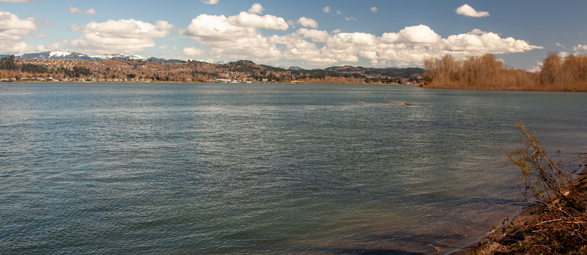
Just above the Washougal River in present Washington, a multi-day base camp is established to find the rumored “Waters of California” and to gather provisions. They learn from the locals that it is not the Sandy River and that it could be the present Willamette River. The first mosquitoes of the season appear.
A Missing River
by Yellowstone Public Radio[1]Originally aired weekdays by Yellowstone Public Radio during the Bicentennial observance of 2003-2006. Narrated by Hal Hansen. Scripts by Whit Hansen and Ed Jacobson. Produced by Leni Holliman. © … Continue reading
Sandy and Columbia Confluence
© 26 March 2012 by Kristopher K. Townsend. Permission to use granted under the Creative Commons Attribution-Share Alike 4.0 International license.
Since 1806, the mouth of the Sandy River has shifted further down the Columbia River. This view is northeast with the Sandy coming in from the right. Across the river is Camas, Washington. The Washougal River—their Seal River—come in below the hills in the distance.
Early Start
We set out early this morning and proceeded until 8 A. M. when we Landed on the N. side opposite one large wooden house of the Shâh-ha-la [Watlala] nation and took breakfast.
—Meriwether Lewis
A Missing River
The three Indians encamped near us and visited our fire we entered into a kind of a Conversation by signs, of the Country and Situation of the rivers. they informed us that Seal river headed in the mountains at no great distance. quick Sand river was Short only headed in Mt. Hood which is in view and to which he pointed. this is a circumstance we did not expect as we had heretofore deemed a comsiderable river . . . . this information if true will render it necessary to examine the river below on the South Side behind the image canoe and Wappato islands for some river which must water the Country weste of the western mountains to the Waters of California.
—Meriwether Lewis
Provision Camp
we continued our rout along the N. side of the river passed diamond Island and whitebrant island to the lower point of a handsom prarie opposite to the upper entrance of the Quicksand river; here we encamped having traveled 25 miles today. we determined to remain at our present encampment a day or two for the several purposes of examining quicksand river
—Meriwether Lewis
Seal (Washougal) River
a Small river falls in about 80 yards wide and at this time discharges a great quantity of water. the nativs inform us that this river is very Short and heads in the range of mountains to the N E of its enterance into the Columbia the nativs haveing no name which we could learn for this little river we Call it Seal river from the great number of those Animals which frequents its mouth.
—Meriwether Lewis
First Mosquitoes
This evening the Musquetors were verry troublesom this evening, it is the first time they have been so this Spring.
—Weather Diary
Weather Diary
Aspect of the weather at Rise
Wind at rise
Aspect of weather at 4 O’Ck P. M. Wind at 4 OCk. P. M. fair S. E. fair S. E. The Summer or wood duck has returned. butterflies and Several Species of insects appear. Musquitoes are troublesome this evening Encamp opposit quick Sand river The Summer Duck has returned I saw Several to day in a small pond. This evening the Musquetors were verry troublesom this evening, it is the first time they have been so this Spring. The waterfowls are much plentyer about the enterance of quick Sand river than they were below. observed a species of small wild onion growing among the moss of the rocks, they resemble the Shives of our gardins and grow remarkably close together forming a perfect tuft; they are quite as agreeably flavoured as the Shives.
—Meriwether Lewis and William Clark[2]To assist the reader, the editor of this web page has omitted the “Day of the Month” column and spelled out some abbreviations.
Experience the Lewis and Clark Trail
The Lewis and Clark Trail Experience—our sister site at lewisandclark.travel—connects the world to people and places on the Lewis and Clark Trail.
Plan a trip related to March 31, 1806:

Sandy River Delta is a High Potential Historic Site along the Lewis and Clark National Historic Trail managed by the U.S. National Park Service. The 1400-acre Sandy River Delta park, managed by the U.S. Forest Service, has an extensive trail system. Across from the delta is Captain William Clark Park, the site of Provision Camp.
Notes
| ↑1 | Originally aired weekdays by Yellowstone Public Radio during the Bicentennial observance of 2003-2006. Narrated by Hal Hansen. Scripts by Whit Hansen and Ed Jacobson. Produced by Leni Holliman. © 2003 by Yellowstone Public Radio. |
|---|---|
| ↑2 | To assist the reader, the editor of this web page has omitted the “Day of the Month” column and spelled out some abbreviations. |


