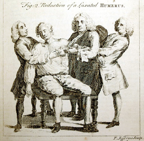
At Fort Mandan below the Knife River Villages, the river falls two feet leaving the barge on dry land. In removing its rigging, Sgt. Pryor dislocates his shoulder, and four attempts must be made to place it. The captains discuss American trade rules with North West Company clerk François-Antoine Larocque.
The Calculating Msr. Larocque
by Yellowstone Public Radio[1]Originally aired weekdays by Yellowstone Public Radio during the Bicentennial observance of 2003-2006. Narrated by Hal Hansen. Scripts by Whit Hansen and Ed Jacobson. Produced by Leni Holliman. © … Continue reading
Snow Accumulates
A verry Cold windey day wind from the N. W by W. Some Snow last night the Detpt of the Snow is various in the wood about 13 inches
—William Clark
Unrigging the Boat
the River fell abt. 2 feet last night So that our Boat lay dry on Shore. we took out the mast & every thing which was in hir & let hir lay as She appeared to be Safe.
—John Ordway
Larocque’s Promise
Mr. La Rock [Larocque] and one of his men Came to visit us we informed him what we had herd of his intentions of makeing Chiefs &c. and forbid him to give meadels or flags to the Indians, he Denied haveing any Such intention, we agreeed that one of our interpeters Should Speak for him on Conditions he did not Say any thing more than what tended to trade alone— he gave fair promises &.
—William Clark
Sgt. Pryor’s Trick Shoulder
Sergeant Pryor in takeing down the mast put his Sholder out of Place, we made four trials before we replaced it
—William Clark
Weather Diary
Ther. at rise
Weather Wind at rise
Thert. at 4 P.M. Weather Wind at 4 P.M. River 14 cloudy after snow N E 18 fair W fall 2 ft ½ in. the snow fell 8 inches deep— it drifted in heeps in the open growns— visited by Mr. La Rock, a trader.—
—Meriwether Lewis[2]To assist the reader, the editor of this web page has omitted the date column, merged the “River” columns, and spelled out some abbreviations.
Fort Mandan is a High Potential Historic Site along the Lewis and Clark National Historic Trail managed by the U.S. National Park Service. The North Dakota Department of Parks and Recreation manages a modern reconstruction and the Lewis and Clark Interpretive Center located at US Hwy 83 and ND Hwy 200A.
Knife River Indian Villages National Historic Site is a High Potential Historic Site along the Lewis and Clark National Historic Trail managed by the U.S. National Park Service. A unit of the National Park System, the site is located at 564 County Road 37, one-half mile north of Stanton, North Dakota. It has exhibits, trails, and a visitor center.
Notes
| ↑1 | Originally aired weekdays by Yellowstone Public Radio during the Bicentennial observance of 2003-2006. Narrated by Hal Hansen. Scripts by Whit Hansen and Ed Jacobson. Produced by Leni Holliman. © 2003 by Yellowstone Public Radio. |
|---|---|
| ↑2 | To assist the reader, the editor of this web page has omitted the date column, merged the “River” columns, and spelled out some abbreviations. |
Experience the Lewis and Clark Trail
The Lewis and Clark Trail Experience—our sister site at lewisandclark.travel—connects the world to people and places on the Lewis and Clark Trail.
Discover More
- The Lewis and Clark Expedition: Day by Day by Gary E. Moulton (University of Nebraska Press, 2018). The story in prose, 14 May 1804–23 September 1806.
- The Lewis and Clark Journals: An American Epic of Discovery (abridged) by Gary E. Moulton (University of Nebraska Press, 2003). Selected journal excerpts, 14 May 1804–23 September 1806.
- The Lewis and Clark Journals. by Gary E. Moulton (University of Nebraska Press, 1983–2001). The complete story in 13 volumes.


