On or near this date, Lewis and his crew pass the mouth of the Big Sandy and enter Kentucky. Just as did fellow traveler Thomas Rodney, Lewis likely noticed the many Eastern spiny soft-shelled turtles in this area.[1]Because we have no journal entry from Lewis for this day, his exact location is unknown. He was at Letart Falls on 18 September and arrived in Cincinnati on 28 September. Based on Thomas … Continue reading
Mouth of the Big Sandy, Kentucky State Border (1920)
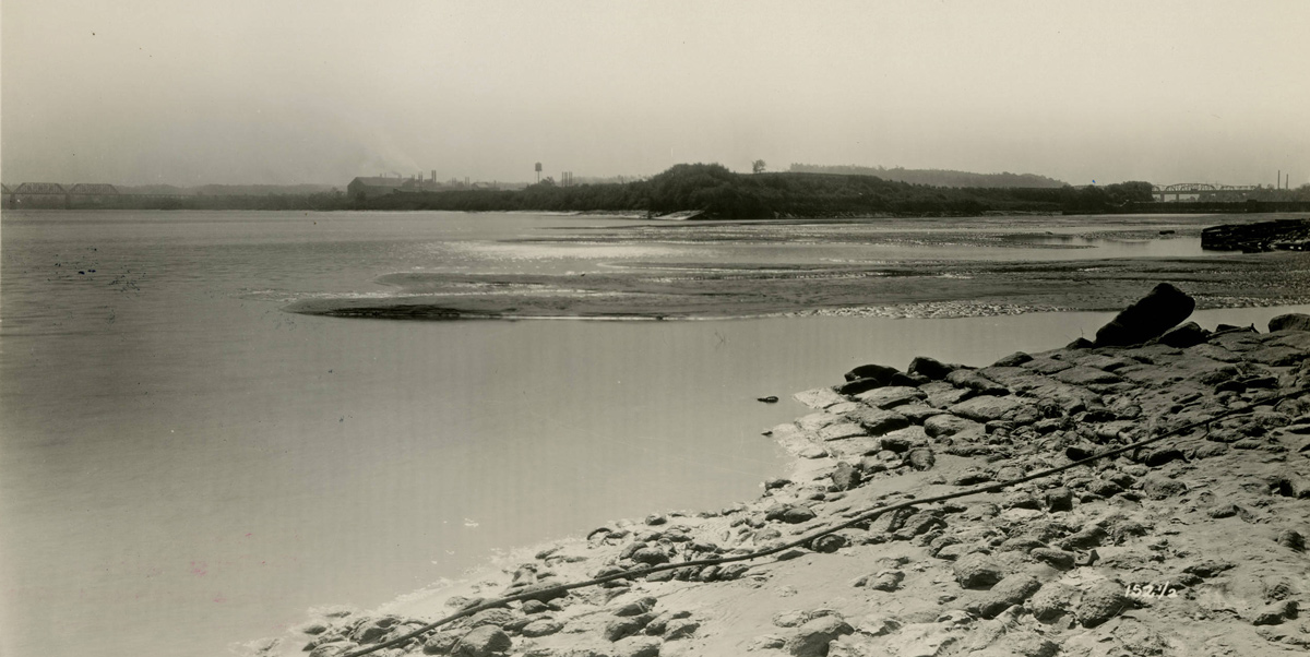
Kentucky Geological Survey Photographs, Courtesy Kentucky Historical Society, www.kyhistory.com/cdm/compoundobject/collection/PH/id/8053/rec/490.
Entering Kentucky
At seven this morning we passed the mouth of that river [Big Sandy River]. This river is the division between Virginia and Kentuky.
—Thomas Rodney (September 30, 1803)[2]Dwight L. Smith and Ray Swick, ed., A Journey Through the West: Thomas Rodney’s 1803 Journal from Delaware to the Mississippi Territory (Athens: Ohio University Press, 1997), 87.
Eastern Spiny Softshell Turtle
Apalone spinifera spinifera
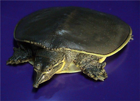
By LA Dawson. Permission via the Creative Commons Attribution-Share Alike 2.5 Generic license.
Eastern Spiny Softshell Turtle
He [Wood] had given us a soft shelled turtle in the morning which the Major had prepared for cooking. These turtles I believe are peculiar to this river and are plenty in it. They are neither like the loggerhead or sea turtle but are of a make between both; but their upper and lower shells are more like the sea turtle. Both shells are thin and no part of them so hard as that of the sea turtle, and the upper shell has a soft border all round it as soft as leather. This soft part flows round jutting out beyond the fleshy part of the turtle. The belly both shell and skin is white, a milky white, and the back is the color of the back of a flounder.
—Thomas Rodney (September 30, 1803)[3]Ibid., 87–88.
Rodney was mistaken about the turtle’s range. It lives not only along the Ohio, but in all the Central Plains states from North Dakota and Montana to Louisiana.[4]Apalone spinifera spinifera (Lesueur, 1827), U.S. Geological Survey, https://nas.er.usgs.gov/queries/factsheet.aspx?SpeciesID=1276 accessed on 30 December 2018. See on this site, Turtles.
Faster Current
There were settlements on both sides of the river most of the way we came today but some times scattering. We came 37 miles today tho we sailed but little. The current evidently increases as we proceed down this river.
—Thomas Rodney (September 30, 1803)[5]Smith and Swick, 89.
Experience the Lewis and Clark Trail
The Lewis and Clark Trail Experience—our sister site at lewisandclark.travel—connects the world to people and places on the Lewis and Clark Trail.
Plan a trip related to September 21, 1803:
Notes
| ↑1 | Because we have no journal entry from Lewis for this day, his exact location is unknown. He was at Letart Falls on 18 September and arrived in Cincinnati on 28 September. Based on Thomas Rodney’s journal of his similar trip down the Ohio and Cramer’s 1802 river guide, The Navigator, one conjecture is that Lewis stopped for the day somewhere near the Little Scioto or Big Scioto River. |
|---|---|
| ↑2 | Dwight L. Smith and Ray Swick, ed., A Journey Through the West: Thomas Rodney’s 1803 Journal from Delaware to the Mississippi Territory (Athens: Ohio University Press, 1997), 87. |
| ↑3 | Ibid., 87–88. |
| ↑4 | Apalone spinifera spinifera (Lesueur, 1827), U.S. Geological Survey, https://nas.er.usgs.gov/queries/factsheet.aspx?SpeciesID=1276 accessed on 30 December 2018. |
| ↑5 | Smith and Swick, 89. |