While Clark and Lewis prepared for departing Louisville, Lewis likely examined the unique ledges of Jefferson Limestone that create the series of dangerous rapids called the Falls of the Ohio, here described by fellow traveler Thomas Rodney.
A “Flat Pavement”
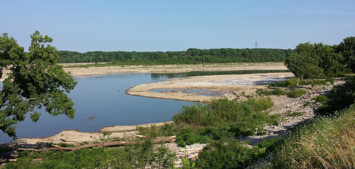
‘Indiana’ Channel
Falls of the Ohio
Permission from Censusdata via the Creative Commons Attribution-Share Alike 4.0 International license.
On the Kentucky shore quite to the middle channel the rock is all a flat pavement down to and round the island. The channel on the Kentucky shore however is now dry and the water all decends on that side of the island next the NW shore.
—Thomas Rodney (16 October 1803)[1]Dwight L. Smith and Ray Swick, ed., A Journey Through the West: Thomas Rodney’s 1803 Journal from Delaware to the Mississippi Territory (Athens: Ohio University Press, 1997), 123.
More a series of rapids than a waterfall, the navigational hazard was created by the Ohio River eroding the hard limestone rock of the 386-million-old rocks called Jeffersonville Limestone. This also created a natural crossing point for bison and Native Americans.
Experience the Lewis and Clark Trail
The Lewis and Clark Trail Experience—our sister site at lewisandclark.travel—connects the world to people and places on the Lewis and Clark Trail.
Plan a trip related to October 18, 1803:
Notes
| ↑1 | Dwight L. Smith and Ray Swick, ed., A Journey Through the West: Thomas Rodney’s 1803 Journal from Delaware to the Mississippi Territory (Athens: Ohio University Press, 1997), 123. |
|---|