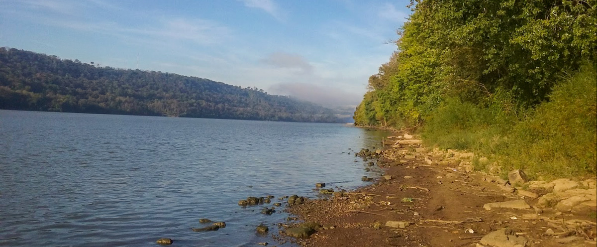
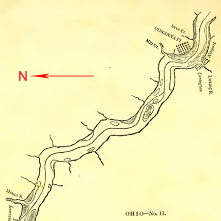
Lewis spends the day in Cincinnati and in the evening, he dispatches the boats down the Ohio to meet him below Big Bone Lick. We have no record of that journey, but Thomas Rodney encounters numerous rapids and bars in this stretch of the river.
The gravel bars and rapids encountered by the barge and its crew in this section of the Ohio River have been mitigated by dams.
Dispatching the Boats
Cincinnati, October 3rd 1803.
Dear Sir [Thomas Jefferson],
On the evening of the 1st inst. I again dispatched my boat with orders to meet me at the Big Bone lick, to which place I shall pass by land, it being distant from hence only seventeen miles while by water it is fifty three, a distance that will require my boat in the present state of the water near three days to attain.
MERIWETHER LEWIS. Capt.
1st. U.S. Regt. Infty.[1]Lewis to Jefferson. Donald Jackson, ed. Letters of the Lewis and Clark Expedition with Related Documents: 1783-1854, 2nd ed., (Urbana: University of Illinois Press, 1978), 126.
Ohio River Below Cincinnati
A week after Lewis sent the barge and pirogues down the Ohio without him, Rodney left Cincinnati in a bateau. He describes the river below town:
Just below town we passed a stoney bar on Kentucky shore and rapid. A mile below this we passed another stoney bar in the river nearest to the Kentucky shore, yet the best channel tho small is next the Kentucky shore; however we passed in the middle of the river over the rapid, but the shoal is very full of wood.
—Thomas Rodney (8 October 1803)[2]Dwight L. Smith and Ray Swick, ed., A Journey Through the West: Thomas Rodney’s 1803 Journal from Delaware to the Mississippi Territory (Athens: Ohio University Press, 1997), 107–108.
Careful Navigation
According to Cumings’ 1834 river guide, the river below Cincinnati required careful navigation:
Channel past Cincinnati, one-third from the right shore, until you pass the brewery, then steer short over towards the left, and pass pretty close to a snag or root, lying about, one-quarter from the left shore. After passing it one hundred yards, incline gradually to the right, and pass Mill creek about the middle of the river, and then incline still towards the right shore. Two miles below Mill creek, is a hard gravel bar, at the mouth of the run, on the right, above Sedam’s house. Channel in the middle of the river.[3]Samuel Cumings, The Western Pilot: Containing Charts of the Ohio River, and of the Mississippi . . . (Cincinnati: N. & G. Guilford & Co., 1834), 40–41.
Experience the Lewis and Clark Trail
The Lewis and Clark Trail Experience—our sister site at lewisandclark.travel—connects the world to people and places on the Lewis and Clark Trail.
Plan a trip related to October 1, 1803:

Notes
| ↑1 | Lewis to Jefferson. Donald Jackson, ed. Letters of the Lewis and Clark Expedition with Related Documents: 1783-1854, 2nd ed., (Urbana: University of Illinois Press, 1978), 126. |
|---|---|
| ↑2 | Dwight L. Smith and Ray Swick, ed., A Journey Through the West: Thomas Rodney’s 1803 Journal from Delaware to the Mississippi Territory (Athens: Ohio University Press, 1997), 107–108. |
| ↑3 | Samuel Cumings, The Western Pilot: Containing Charts of the Ohio River, and of the Mississippi . . . (Cincinnati: N. & G. Guilford & Co., 1834), 40–41. |


