Lewis and his scouts reach the forks of the Beaverhead River and then explore two Indian roads to determine which one will lead to the Shoshones.
Far from the river’s end, Clark and the others manage thirteen difficult river miles, but only four miles by land.
The Native American delegates sent to St. Louis on the expedition’s barge wait for permission to continue to Washington City.
Indian Roads, Impassable Steams
by Yellowstone Public Radio[1]Originally aired weekdays by Yellowstone Public Radio during the Bicentennial observance of 2003-2006. Narrated by Hal Hansen. Scripts by Whit Hansen and Ed Jacobson. Produced by Leni Holliman. © … Continue reading
Exploring Shoshone Cove (Lewis)
Shoshone Cove Sunset
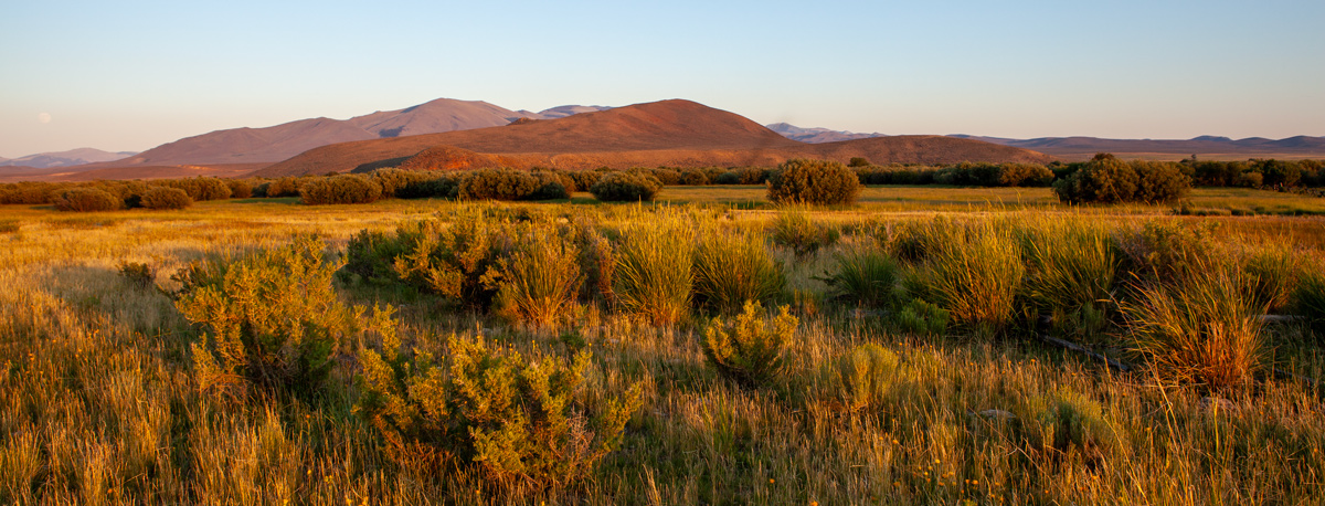
© 21 July 2013 by Kristopher K. Townsend. Permission to use granted under the Creative Commons Attribution-Share Alike 4.0 International license.
Rattlesnake Cliffs
I sent Drewyer to the wright to kill a deer which we saw feeding and halted on the river under an immencely high perpendicular clift of rocks . . . . from the number of rattle snakes about the Clifts at which we halted we called them the rattle snake clifts. this serpent is the same before discribed with oval spots of yellowish brown.
—Meriwether Lewis
Forks of the Beaverhead
fifteen Ms. from the rattle snake Clifts we arrived in a hadsome open and leavel vally where the river divided itself nearly into two equal branches; here I halted and examined those streams and readily discovered from their size that it would be vain to attempt the navigation of either any further.
—Meriwether Lewis
Shoshone Cove
this stream enters a beatifull and extensive plain about ten miles long and from 5 to six in width. this plain is surrounded on all sides by a country of roling or high wavy plains through which several little rivulets extend their wide vallies quite to the Mountains which surround the whole in an apparent Circular manner; forming one of the handsomest coves I ever saw, of about 16 or 18 miles in diameter.
—Meriwether Lewis
Columbia River Speculations
I do not beleive that the world can furnish an example of a river runing to the extent which the Missouri and Jefferson’s rivers do through such a mountainous country and at the same time so navigable as they are. if the Columbia furnishes us such another example, a communication aross the continent by water will be practicable and safe. but this I can scarcely hope from a knowledge of its having in it comparitively short course to the ocean the same number of feet to decend which the Missouri and Mississippi have from this point to the Gulph of Mexico.—
—Meriwether Lewis
Passing Beaverhead Rock (Clark)
Beaverhead River
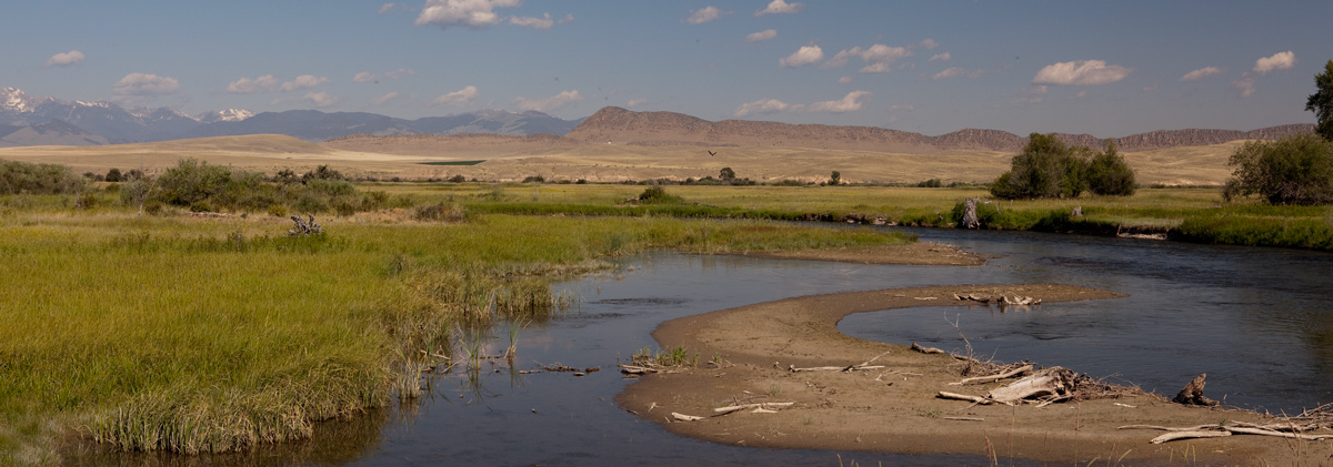
© 26 July 2011 by Kristopher K. Townsend. Permission to use granted under the Creative Commons Attribution-Share Alike 4.0 International license.
Passing Beaverhead Rock
we proceeded on passed a remarkable Clift point on the Stard. Side about 150 feet high, this Clift the [Lemhi Shoshone] Indians Call the Beavers head
—William Clark
River Bends and Sholes
it is now gitting a Small Stream verry crooked and Shole in places, So that we have to wade and hall the canoes over. about one oClock we halted to dine. a hard Thunder Show arose of rain and large hail which lasted nearly an hour.
—John Ordway
Weak Diet
we now begin to live on fresh meat & that poor venson [deer] & goat [pronghorn] meat at this time. as our fatigues hard we find that poor meat alone is not Strong diet, but we are content with what we can git.
—Joseph Whitehouse
Weather Diary
State of the Thermometer at rise
Weather at Wind at State of the Thermometer at 4 P.M. Weather at 4 P.M. Wind at 4 P.M. 60 [above 0] cloudy after rain, fair &. Lightning S W 68 [above 0] thunder, lightning, & rain S W rain Commenced at 6 P. M and continued Showery through out the night. Musqueters bad.
—Meriwether Lewis[2]To assist the reader, the editor of this web page has omitted the date column and spelled out some abbreviations.
The Delegates Wait
St. Louis August 10th 05
Sir [Henry Dearborn]
The Chiefs of three Nations sent hither by Capt. Lewis last spring, are still here waiting patiently for permission to visit the President, & I expect will set out about the 5th of October, should you not oppose it, accompanied by the Agent Chouteau—
Ja: Wilkinson[3]Clarence E. Carter, The Territorial Papers of the United States (Washington, DC: United States Government Printing Office, 1948), 13:182–84, digitized by Google books.
Notes
| ↑1 | Originally aired weekdays by Yellowstone Public Radio during the Bicentennial observance of 2003-2006. Narrated by Hal Hansen. Scripts by Whit Hansen and Ed Jacobson. Produced by Leni Holliman. © 2003 by Yellowstone Public Radio. |
|---|---|
| ↑2 | To assist the reader, the editor of this web page has omitted the date column and spelled out some abbreviations. |
| ↑3 | Clarence E. Carter, The Territorial Papers of the United States (Washington, DC: United States Government Printing Office, 1948), 13:182–84, digitized by Google books. |
Experience the Lewis and Clark Trail
The Lewis and Clark Trail Experience—our sister site at lewisandclark.travel—connects the world to people and places on the Lewis and Clark Trail.
![]()
This page was funded in part by the Lewis and Clark National Historic Trail, U.S. National Park Service.
Discover More
- The Lewis and Clark Expedition: Day by Day by Gary E. Moulton (University of Nebraska Press, 2018). The story in prose, 14 May 1804–23 September 1806.
- The Lewis and Clark Journals: An American Epic of Discovery (abridged) by Gary E. Moulton (University of Nebraska Press, 2003). Selected journal excerpts, 14 May 1804–23 September 1806.
- The Lewis and Clark Journals. by Gary E. Moulton (University of Nebraska Press, 1983–2001). The complete story in 13 volumes.
This site is provided as a public service by the
![]()
Lewis and Clark Trail Alliance
with additional funding from the following:

