In Clark’s last field note until 21 March 1805, he says the morning is fine, and that ice from the Missouri River is passing by their winter camp on the Wood River.
Missouri River Ice
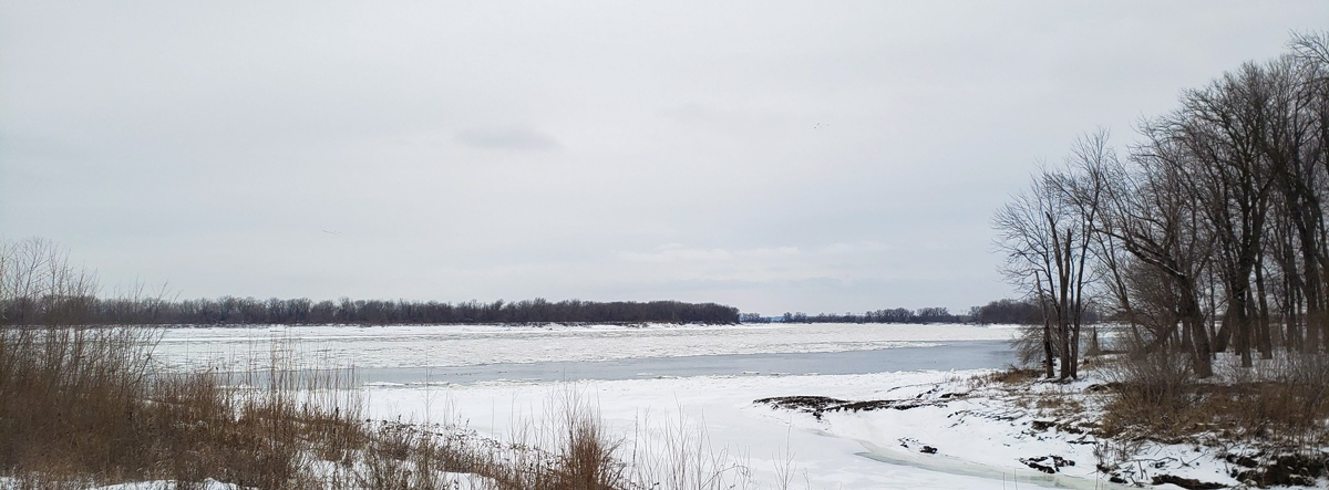
Photo provided by Lewis & Clark State Historic Site, Hartford, Illinois. Used by permission.
Above: The Missouri River enters on the far side of the Mississippi which is flowing right to left. River Dubois—present Wood River—enters from the bottom. Since 1804, all three rivers have changed course. See The Mouth of the Missouri.
Passing Ice
a fine morning river Still rise & Ice pass down the greater part out of the Missouries
—William Clark
Weather Diary
Therm at rise
weather wind Therm at 4 Oclk weather wind River 10 above 0 fair after snow N.N.E. 12 above 0 cloudy N.E. rise 2 ft. 8 in. the river raised 2 feet, large quantity of drift ice from Misso[uri]
—Meriwether Lewis[1]To assist the reader, the editor of this web page has omitted the “day of month 1804” column, merged the “River” columns, and spelled out some abbreviations.


Winter Camp at Wood River (Camp Dubois) is a High Potential Historic Site along the Lewis and Clark National Historic Trail managed by the U.S. National Park Service. The site, near Hartford, Illinois, is managed as Lewis and Clark State Historic Site and is open to the public.
Notes
| ↑1 | To assist the reader, the editor of this web page has omitted the “day of month 1804” column, merged the “River” columns, and spelled out some abbreviations. |
|---|