Lost Trail Divide, ID-MT The expedition climbs the Continental Divide near present-day Lost Trail Pass. The weather is a mix of rain, snow, and sleet, and after dark they lay down “wet hungry and cold.”
Saddle Mountain and the Lost Trail
To see labels, point to the image.
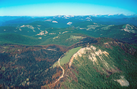
© 2002 Airphoto, Jim Wark. All rights reserved.
The Lost Trail
the high mountains closed the Creek on each Side and obliged us to take on the Steep Sides of those Mountains, So Steep that the horses Could Screcly keep from Slipping down, Several Sliped & Injured themselves verry much
—William Clark
Saddle Mountain (view east)
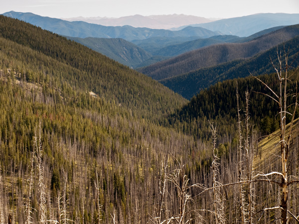
© 8 September 2009 by Kristopher K. Townsend. Permission to use granted under the Creative Commons Attribution-Share Alike 4.0 International license.
The two accompanying photos on this page show the mountainous topography of the route that the expedition has been traveling since leaving the Lemhi Shoshone. Due to stormy weather, the Corps did not witness these expansive views.
Little to Eat
but little to eate I killed 5 Pheasants & The huntes 4 with a little Corn afforded us a kind of Supper, at dusk it began to Snow
—William Clark
A Disagreeable Day
after a dissagreeable days march of only 11 miles with much fatigue and hunger as nothing has been killed this day only 2 or 3 fessents, and have no meat of any kind. Set in to raining hard at dark So we lay down and Slept, wet hungry and cold.
—Joseph Whitehouse
Angelica Specimen
Angelica within the Rocky mountains in moist places Jun: 25th 1806? The flowering one taken in Septb 3d 1805.
—Meriwether Lewis[1]Angelica sp. Moulton, ed. Herbarium, specimen 13.
Weather Diary
State of the Thermometer at rise
Weather at Wind at State of the Thermometer at 4 P.M. Weather at 4 P.M. Wind at 4 P.M. 34 [above 0] cloudy after rain N E. 52 [above 0] cloudy after rain N E Choke Cherries ripe and abundant.
—Meriwether Lewis[2]To assist the reader, the editor of this web page has omitted the date column and spelled out some abbreviations.